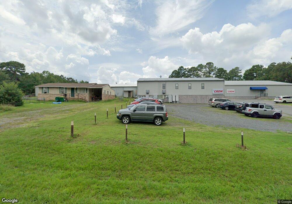
10015 Firestone Ln North Little Rock, AR 72118
Oak Grove NeighborhoodEstimated Value: $1,156,214
--
Bed
2
Baths
38,120
Sq Ft
$30/Sq Ft
Est. Value
About This Home
This home is located at 10015 Firestone Ln, North Little Rock, AR 72118 and is currently estimated at $1,156,214, approximately $30 per square foot. 10015 Firestone Ln is a home located in Pulaski County with nearby schools including Oak Grove Elementary School, Maumelle Middle School, and Maumelle High School.
Ownership History
Date
Name
Owned For
Owner Type
Purchase Details
Closed on
Oct 27, 2017
Sold by
Cac Properties Llc
Bought by
Maly Group Llc
Current Estimated Value
Home Financials for this Owner
Home Financials are based on the most recent Mortgage that was taken out on this home.
Original Mortgage
$666,859
Interest Rate
3.78%
Mortgage Type
Commercial
Purchase Details
Closed on
Jun 17, 1999
Sold by
Custom Aircraft Cabinets Inc
Bought by
Cac Properties Llc
Create a Home Valuation Report for This Property
The Home Valuation Report is an in-depth analysis detailing your home's value as well as a comparison with similar homes in the area
Home Values in the Area
Average Home Value in this Area
Purchase History
| Date | Buyer | Sale Price | Title Company |
|---|---|---|---|
| Maly Group Llc | $784,540 | Waco Title Comapny Conway | |
| Cac Properties Llc | $95,000 | Stewart Title |
Source: Public Records
Mortgage History
| Date | Status | Borrower | Loan Amount |
|---|---|---|---|
| Closed | Maly Group Llc | $666,859 |
Source: Public Records
Tax History Compared to Growth
Tax History
| Year | Tax Paid | Tax Assessment Tax Assessment Total Assessment is a certain percentage of the fair market value that is determined by local assessors to be the total taxable value of land and additions on the property. | Land | Improvement |
|---|---|---|---|---|
| 2025 | $15,393 | $303,012 | $10,740 | $292,272 |
| 2024 | $15,194 | $299,103 | $6,831 | $292,272 |
| 2023 | $15,194 | $299,103 | $6,831 | $292,272 |
| 2022 | $13,221 | $299,103 | $6,831 | $292,272 |
| 2021 | $12,046 | $231,230 | $6,830 | $224,400 |
| 2020 | $12,046 | $231,230 | $6,830 | $224,400 |
| 2019 | $11,982 | $231,230 | $6,830 | $224,400 |
| 2018 | $11,083 | $231,230 | $6,830 | $224,400 |
| 2017 | $10,185 | $231,230 | $6,830 | $224,400 |
| 2016 | $9,286 | $248,810 | $9,110 | $239,700 |
| 2015 | $8,387 | $165,097 | $9,110 | $155,987 |
| 2014 | $8,387 | $141,517 | $9,110 | $132,407 |
Source: Public Records
Map
Nearby Homes
- 0 Macarthur Unit 25004179
- 00 Interstate 40
- 10301 Short Marche Rd
- 7932 Macarthur Dr
- 8016 Highway 365
- 11806 Veronica Rd
- 62 Lucia Ln
- 00 Trapp Rd
- 71 Corniche Cove
- 123 Natural Trail
- 66 Corniche Cove
- 69 Corniche Cove
- 70 Corniche Cove
- 105 Corniche Ln
- 121 Natural Trail
- 1501 Milligan Dr
- 516 Corondelet Ln
- 520 Corondelet Ln
- 514 Corondelet Ln
- 603 Corondelet Ln
- 10007 Firestone Ln
- 10019 Firestone Ln
- Lt 65 Firestone Ln
- 10012 Firestone Ln
- 10016 Firestone Ln
- 10008 Firestone Ln
- 10000 Firestone Ln
- 10108 Firestone Ln
- 10300 Pomegranate Ave
- 10300 Pomegranate Ave
- 10304 Pomegranate Ave
- 10116 Firestone Ln
- 10201 Firestone Ln
- 10109 Pickard Rd
- 10101 Pickard Rd
- 10011 Pickard Rd
- 10214 Firestone Ln
- 9817 Firestone Ln
- 10310 Pomegranate Ave
- 10105 Pickard Rd