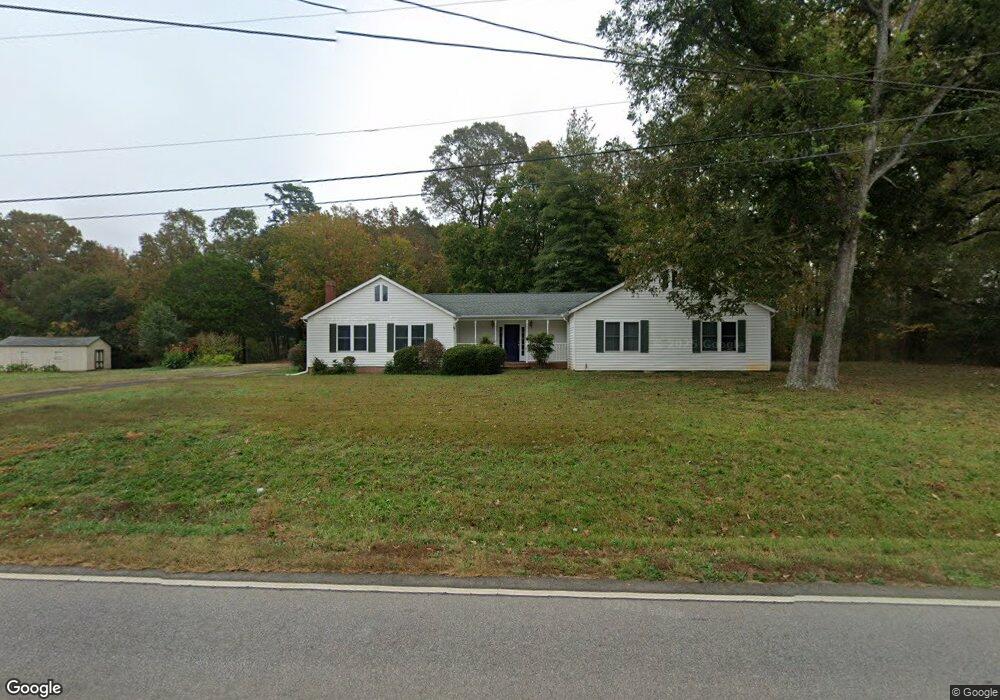
10015 Lancaster Hwy Waxhaw, NC 28173
Estimated Value: $363,000 - $522,000
3
Beds
2
Baths
1,908
Sq Ft
$221/Sq Ft
Est. Value
About This Home
This home is located at 10015 Lancaster Hwy, Waxhaw, NC 28173 and is currently estimated at $422,132, approximately $221 per square foot. 10015 Lancaster Hwy is a home located in Union County with nearby schools including Waxhaw Elementary School, Parkwood Middle School, and Parkwood High School.
Ownership History
Date
Name
Owned For
Owner Type
Purchase Details
Closed on
Jun 6, 2005
Sold by
Cook Judy S
Bought by
Cook Ronald R and Cook Judy S
Current Estimated Value
Home Financials for this Owner
Home Financials are based on the most recent Mortgage that was taken out on this home.
Original Mortgage
$100,000
Interest Rate
5.69%
Mortgage Type
New Conventional
Create a Home Valuation Report for This Property
The Home Valuation Report is an in-depth analysis detailing your home's value as well as a comparison with similar homes in the area
Home Values in the Area
Average Home Value in this Area
Purchase History
| Date | Buyer | Sale Price | Title Company |
|---|---|---|---|
| Cook Ronald R | -- | -- |
Source: Public Records
Mortgage History
| Date | Status | Borrower | Loan Amount |
|---|---|---|---|
| Closed | Cook Ronald R | $100,000 |
Source: Public Records
Tax History Compared to Growth
Tax History
| Year | Tax Paid | Tax Assessment Tax Assessment Total Assessment is a certain percentage of the fair market value that is determined by local assessors to be the total taxable value of land and additions on the property. | Land | Improvement |
|---|---|---|---|---|
| 2025 | $1,967 | $410,800 | $0 | $0 |
| 2024 | $1,678 | $263,000 | $65,600 | $197,400 |
| 2023 | $1,651 | $263,000 | $65,600 | $197,400 |
| 2022 | $1,651 | $263,000 | $65,600 | $197,400 |
| 2021 | $1,622 | $263,000 | $65,600 | $197,400 |
| 2020 | $1,029 | $133,400 | $48,300 | $85,100 |
| 2019 | $1,075 | $133,400 | $48,300 | $85,100 |
| 2018 | $1,075 | $133,400 | $48,300 | $85,100 |
| 2017 | $1,142 | $133,400 | $48,300 | $85,100 |
| 2016 | $1,084 | $133,400 | $48,300 | $85,100 |
| 2015 | $1,099 | $133,400 | $48,300 | $85,100 |
| 2014 | $1,169 | $166,400 | $95,000 | $71,400 |
Source: Public Records
Map
Nearby Homes
- 9315 Simpson Rd
- 0 Huey Rd Unit 10,11 CAR4222944
- 8824 Simpson Rd
- 1003 Cane Manor Ct Unit 5
- 1009 Cane Manor Ct Unit 3
- 1006 Cane Manor Ct Unit 7
- 1010 Cane Manor Ct Unit 8
- 1005 Cane Manor Ct Unit 4
- TBD Steele Rd Unit 5
- 8709 Providence Rd S Unit 2
- 1285 Quiet Creek Dr Unit 15
- 01 Tirzah Church Rd
- 6405 Fawn Crest Dr
- 7827 Walkup Rd
- 9404 S Providence Rd
- 8018 Fairmont Dr
- A-1 George Cook Rd
- 8001 Rillwood Dr
- 1017 S Oakshire Ln Unit 5
- 00 Craig Farm Rd
- 10018 Lancaster Hwy
- 10105 Lancaster Hwy
- 10003 Lancaster Hwy
- 10111 Lancaster Hwy
- 7105 Tirzah Church Rd
- 9926 Lancaster Hwy
- 9923 Lancaster Hwy
- 10117 Lancaster Hwy
- 9602 Simpson Rd
- 9614 Simpson Rd
- 7115 Tirzah Church Rd
- 10208 Lancaster Hwy
- - Lancaster Hwy
- 9925 Lancaster Hwy
- 9921 Lancaster Hwy Unit 2
- 9608 Simpson Rd
- 10204 Lancaster Hwy
- 9621 Simpson Rd
- 00 Tirzah Church Rd Unit 46.4 acres
- 9615 Simpson Rd