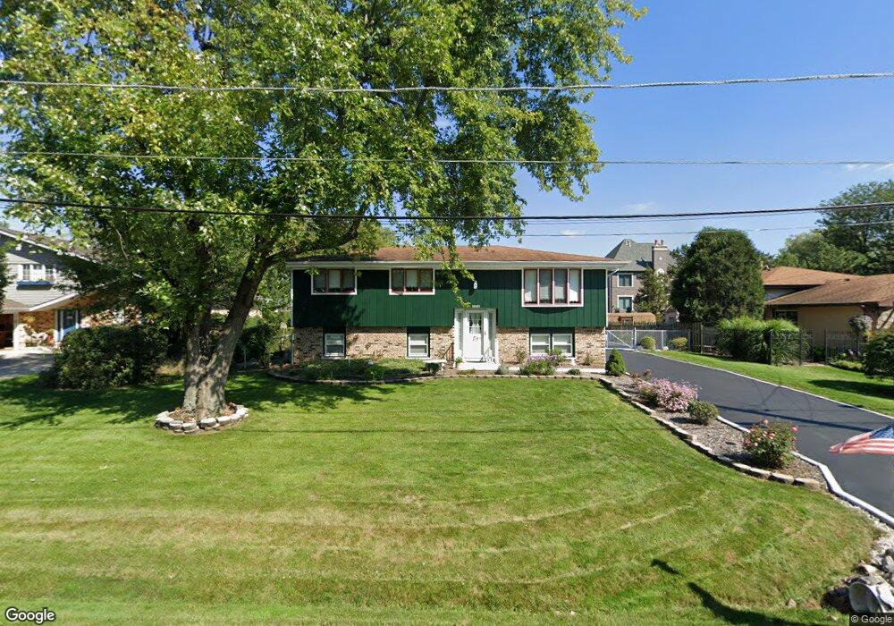
10015 S 81st Ave Palos Hills, IL 60465
Estimated Value: $302,000 - $374,000
3
Beds
1
Bath
1,240
Sq Ft
$277/Sq Ft
Est. Value
About This Home
This home is located at 10015 S 81st Ave, Palos Hills, IL 60465 and is currently estimated at $342,900, approximately $276 per square foot. 10015 S 81st Ave is a home located in Cook County with nearby schools including Sorrick Elementary School, Oak Ridge Elementary School, and H H Conrady Jr High School.
Ownership History
Date
Name
Owned For
Owner Type
Purchase Details
Closed on
Jul 24, 2001
Sold by
Buoscio Karyn M and Vanhecke Karyn M
Bought by
Karaus Allen F and Karaus Kathryn A
Current Estimated Value
Home Financials for this Owner
Home Financials are based on the most recent Mortgage that was taken out on this home.
Original Mortgage
$100,000
Interest Rate
7.16%
Purchase Details
Closed on
Apr 25, 2001
Sold by
Vanhecke Edward G
Bought by
Vanhecke Karyn M
Purchase Details
Closed on
Jul 28, 1994
Sold by
Bonick Jeffrey R and Bonick Phyllis A
Bought by
Vanhecke Edward G and Vanhecke Karyn M
Home Financials for this Owner
Home Financials are based on the most recent Mortgage that was taken out on this home.
Original Mortgage
$134,300
Interest Rate
8.59%
Create a Home Valuation Report for This Property
The Home Valuation Report is an in-depth analysis detailing your home's value as well as a comparison with similar homes in the area
Home Values in the Area
Average Home Value in this Area
Purchase History
| Date | Buyer | Sale Price | Title Company |
|---|---|---|---|
| Karaus Allen F | $212,500 | -- | |
| Vanhecke Karyn M | -- | -- | |
| Vanhecke Edward G | $168,000 | -- |
Source: Public Records
Mortgage History
| Date | Status | Borrower | Loan Amount |
|---|---|---|---|
| Previous Owner | Karaus Allen F | $100,000 | |
| Previous Owner | Vanhecke Edward G | $134,300 |
Source: Public Records
Tax History Compared to Growth
Tax History
| Year | Tax Paid | Tax Assessment Tax Assessment Total Assessment is a certain percentage of the fair market value that is determined by local assessors to be the total taxable value of land and additions on the property. | Land | Improvement |
|---|---|---|---|---|
| 2024 | $5,460 | $24,862 | $8,246 | $16,616 |
| 2023 | $5,316 | $28,000 | $8,246 | $19,754 |
| 2022 | $5,316 | $20,726 | $7,182 | $13,544 |
| 2021 | $5,209 | $20,725 | $7,182 | $13,543 |
| 2020 | $5,241 | $20,725 | $7,182 | $13,543 |
| 2019 | $4,863 | $20,278 | $6,650 | $13,628 |
| 2018 | $4,677 | $20,278 | $6,650 | $13,628 |
| 2017 | $5,229 | $22,412 | $6,650 | $15,762 |
| 2016 | $5,585 | $20,448 | $5,852 | $14,596 |
| 2015 | $5,433 | $20,448 | $5,852 | $14,596 |
| 2014 | $5,367 | $20,448 | $5,852 | $14,596 |
| 2013 | $5,506 | $22,076 | $5,852 | $16,224 |
Source: Public Records
Map
Nearby Homes
- 10125 S 81st Ct
- 10226 S 81st Ave
- 9940 S Wood Ln
- 7822 W 99th Place
- 8360 W 100th Place
- 9719 S 81st Ave
- 10221 S Eleanor Ave
- 10324 S 81st Ave
- 7810 W 102nd St
- 7826 W 98th Place
- 10230 S 83rd Ct
- 9950 S 84th Terrace Unit 215
- 9954 S 84th Terrace Unit 109
- 9645 S 78th Ct
- 8556 W 102nd Terrace Unit 5315
- 10409 Sheffield Dr Unit 13
- 10300 S Kathy Ct
- 10441 S 83rd Ave
- 10531 S Roberts Rd Unit 2D
- 10408 S Alta Dr
- 10005 S 81st Ave
- 10035 S 81st Ave
- 10020 S 80th Ct
- 10040 S 80th Ct
- 10003 S 81st Ave
- 10031 S 81st Ave
- 10032 S 80th Ct
- 10001 S 80th Ct
- 10048 S 80th Ct
- 10050 S 81st Ave
- 8035 W 100th St
- 10007 S 80th Ct
- 10001 S 81st Ave
- 10010 S 81st Ave
- 10057 S 81st Ave
- 10060 S 81st Ave
- 10006 S 81st Ave
- 8031 W 100th St
- 10054 S 80th Ct
- 10015 S 80th Ct