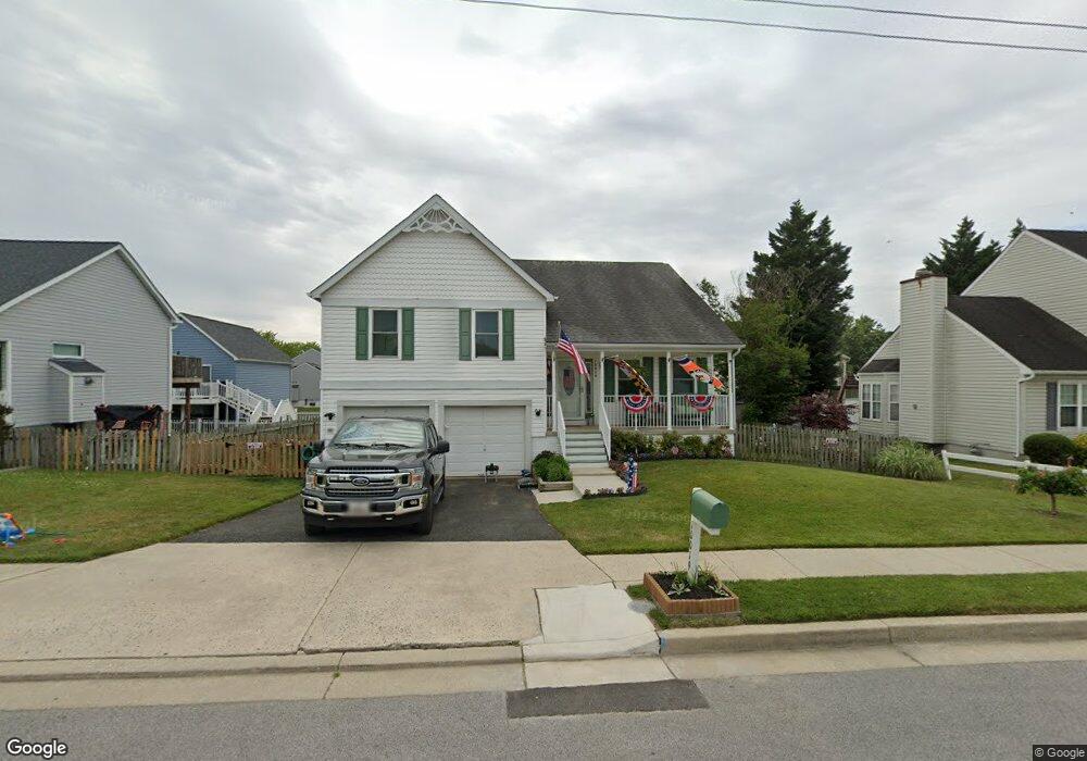
10019 Bird River Rd Middle River, MD 21220
Estimated Value: $380,000 - $450,000
--
Bed
2
Baths
2,200
Sq Ft
$188/Sq Ft
Est. Value
About This Home
This home is located at 10019 Bird River Rd, Middle River, MD 21220 and is currently estimated at $414,095, approximately $188 per square foot. 10019 Bird River Rd is a home located in Baltimore County with nearby schools including Vincent Farm Elementary, Middle River Middle School, and Kenwood High.
Ownership History
Date
Name
Owned For
Owner Type
Purchase Details
Closed on
Oct 11, 2006
Sold by
Clark Robert G
Bought by
Byer Lindsay N and Mccartney Brendan E
Current Estimated Value
Home Financials for this Owner
Home Financials are based on the most recent Mortgage that was taken out on this home.
Original Mortgage
$35,000
Interest Rate
6.47%
Mortgage Type
Stand Alone Second
Purchase Details
Closed on
Sep 28, 2006
Sold by
Clark Robert G
Bought by
Byer Lindsay N and Mccartney Brendan E
Home Financials for this Owner
Home Financials are based on the most recent Mortgage that was taken out on this home.
Original Mortgage
$35,000
Interest Rate
6.47%
Mortgage Type
Stand Alone Second
Purchase Details
Closed on
Feb 17, 1999
Sold by
Rohe Farm Lane Development Inc
Bought by
Clark Robert G and Clark Kristen M
Create a Home Valuation Report for This Property
The Home Valuation Report is an in-depth analysis detailing your home's value as well as a comparison with similar homes in the area
Home Values in the Area
Average Home Value in this Area
Purchase History
| Date | Buyer | Sale Price | Title Company |
|---|---|---|---|
| Byer Lindsay N | $350,000 | -- | |
| Byer Lindsay N | $350,000 | -- | |
| Clark Robert G | $155,237 | -- |
Source: Public Records
Mortgage History
| Date | Status | Borrower | Loan Amount |
|---|---|---|---|
| Closed | Byer Lindsay N | $35,000 | |
| Open | Byer Lindsay N | $280,000 | |
| Closed | Byer Lindsay N | $280,000 |
Source: Public Records
Tax History Compared to Growth
Tax History
| Year | Tax Paid | Tax Assessment Tax Assessment Total Assessment is a certain percentage of the fair market value that is determined by local assessors to be the total taxable value of land and additions on the property. | Land | Improvement |
|---|---|---|---|---|
| 2025 | $4,638 | $337,500 | -- | -- |
| 2024 | $4,638 | $314,700 | $0 | $0 |
| 2023 | $2,257 | $291,900 | $101,500 | $190,400 |
| 2022 | $4,275 | $272,433 | $0 | $0 |
| 2021 | $3,804 | $252,967 | $0 | $0 |
| 2020 | $3,804 | $233,500 | $101,500 | $132,000 |
| 2019 | $3,758 | $233,500 | $101,500 | $132,000 |
| 2018 | $3,658 | $233,500 | $101,500 | $132,000 |
| 2017 | $3,560 | $235,800 | $0 | $0 |
| 2016 | $4,043 | $233,333 | $0 | $0 |
| 2015 | $4,043 | $230,867 | $0 | $0 |
| 2014 | $4,043 | $228,400 | $0 | $0 |
Source: Public Records
Map
Nearby Homes
- 10002 Campbell Blvd
- 1114 Muddy Branch Ct
- 1112 Muddy Branch Ct
- 1108 Muddy Branch Ct
- 10018 Campbell Blvd
- HADLEY Plan at Creekside Estates
- JADE Plan at Creekside Estates
- ALEC Plan at Creekside Estates
- BROWLYN Plan at Creekside Estates
- Hampshire Plan at Creekside Estates
- Summit Plan at Creekside Estates
- 1113 Muddy Branch Ct
- 9900 Bird River Rd
- 0 Bird River Rd Unit MDBC2136640
- 980 Winter Run Rd
- 9864 Greenbriar Way
- 1325 Sligh Ln
- 906 Gladway Rd
- 902 White Hawk Ct
- 5711 Charlies Way
- 10021 Bird River Rd
- 10017 Bird River Rd
- 3 Old Field Ct
- 1 Old Field Ct
- 5 Old Field Ct
- 17 Shirehall Ct
- 16 Whitton Ct
- 10015 Bird River Rd
- 18 Whitton Ct
- 15 Shirehall Ct
- 7 Old Field Ct
- 1019 Rohe Farm Ln
- 1018 Meadow Glen Rd
- 17 Whitton Ct
- 16 Shirehall Ct
- 1019 Meadow Glen Rd
- 9 Oldfield Ct
- 1017 Rohe Farm Ln
- 4 Old Field Ct
- 4 Oldfield Ct