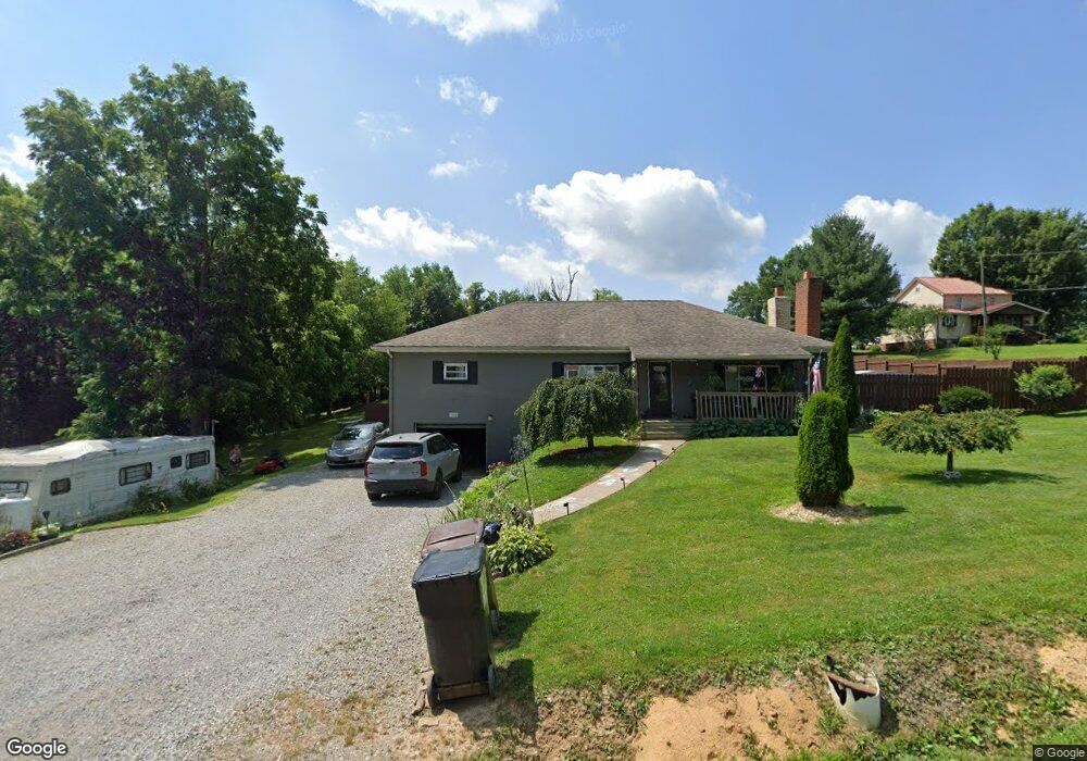
1002 Crawford Rd Wellsville, OH 43968
Estimated Value: $136,000 - $175,000
3
Beds
2
Baths
1,632
Sq Ft
$97/Sq Ft
Est. Value
About This Home
This home is located at 1002 Crawford Rd, Wellsville, OH 43968 and is currently estimated at $158,101, approximately $96 per square foot. 1002 Crawford Rd is a home located in Columbiana County with nearby schools including Garfield Elementary School, Daw Elementary School, and Wellsville Jr./Sr. High School.
Ownership History
Date
Name
Owned For
Owner Type
Purchase Details
Closed on
Jan 26, 2001
Sold by
Cataldo Patsy and Cataldo Dorothy E
Bought by
Cataldo Patsy and Cataldo Dorothy E
Current Estimated Value
Purchase Details
Closed on
Dec 7, 1995
Sold by
Cataldo Patsy
Bought by
Cataldo Danny R and Cataldo Malana R
Home Financials for this Owner
Home Financials are based on the most recent Mortgage that was taken out on this home.
Original Mortgage
$55,000
Interest Rate
7.52%
Mortgage Type
New Conventional
Create a Home Valuation Report for This Property
The Home Valuation Report is an in-depth analysis detailing your home's value as well as a comparison with similar homes in the area
Home Values in the Area
Average Home Value in this Area
Purchase History
| Date | Buyer | Sale Price | Title Company |
|---|---|---|---|
| Cataldo Patsy | -- | -- | |
| Cataldo Danny R | $36,000 | -- |
Source: Public Records
Mortgage History
| Date | Status | Borrower | Loan Amount |
|---|---|---|---|
| Previous Owner | Cataldo Danny R | $55,000 |
Source: Public Records
Tax History Compared to Growth
Tax History
| Year | Tax Paid | Tax Assessment Tax Assessment Total Assessment is a certain percentage of the fair market value that is determined by local assessors to be the total taxable value of land and additions on the property. | Land | Improvement |
|---|---|---|---|---|
| 2024 | $761 | $32,380 | $4,060 | $28,320 |
| 2023 | $756 | $32,380 | $4,060 | $28,320 |
| 2022 | $770 | $32,380 | $4,060 | $28,320 |
| 2021 | $597 | $26,120 | $3,890 | $22,230 |
| 2020 | $597 | $26,120 | $3,890 | $22,230 |
| 2019 | $619 | $26,120 | $3,890 | $22,230 |
| 2018 | $562 | $23,740 | $3,540 | $20,200 |
| 2017 | $575 | $23,740 | $3,540 | $20,200 |
| 2016 | $574 | $20,200 | $3,430 | $16,770 |
| 2015 | $445 | $20,200 | $3,430 | $16,770 |
| 2014 | $894 | $33,010 | $3,430 | $29,580 |
Source: Public Records
Map
Nearby Homes
- 1370 Hillcrest Rd
- 1087 Hillcrest Rd
- 0 Hibbetts-Mill Rd
- 1010 Hibbetts Mill Rd
- 1715 Brandon Dr
- 319 Ridge Ave
- 0 Forbes Rd
- 0 Forbes Rd Unit LotWP001
- 43184 Osbourne Rd
- 401 Broadway Ave
- 616 Washington Ave
- 405 Main St
- 43050 Osbourne Rd
- 609 Broadway Ave
- 923 Wood St
- 817 Broadway Ave
- 602 Main St
- 525 Riverside Ave
- 19498 Frischkorn Dr
- 1019 Commerce St
- 1010 Crawford Rd
- 1001 Crawford Rd
- 1001 Crawford Rd
- 1016 Crawford Rd
- 1016 Crawford Rd
- 1011 Crawford Rd
- 1099 James Dr
- 1020 Crawford Rd
- 1306 Hillcrest Rd
- 1266 Hillcrest Rd
- 1270 Hillcrest Rd
- 1262 Hillcrest Rd
- 1258 Hillcrest Rd
- 1310 Hillcrest Rd
- 1254 Hillcrest Rd
- 1314 Hillcrest Rd
- 1271 Hillcrest Rd
- 1210 Parshall Rd
- 1305 Hillcrest Rd
- 1252 Hillcrest Rd