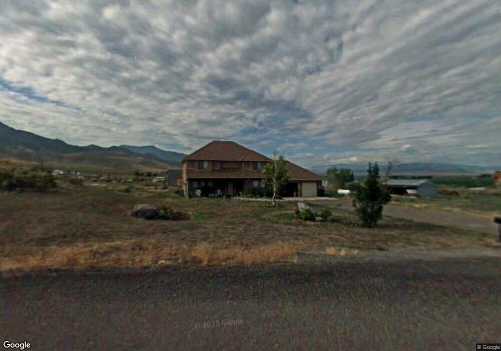
1002 E Shadow Mountain Dr Monroe, UT 84754
Estimated Value: $540,940 - $702,000
4
Beds
3
Baths
2,576
Sq Ft
$235/Sq Ft
Est. Value
About This Home
This home is located at 1002 E Shadow Mountain Dr, Monroe, UT 84754 and is currently estimated at $606,235, approximately $235 per square foot. 1002 E Shadow Mountain Dr is a home located in Sevier County with nearby schools including Monroe School, South Sevier Middle School, and South Sevier High School.
Ownership History
Date
Name
Owned For
Owner Type
Purchase Details
Closed on
Jul 26, 2022
Sold by
Lynn Wood Donna
Bought by
Wood Brian Keith
Current Estimated Value
Purchase Details
Closed on
Dec 4, 2009
Sold by
Jenkins Harriett G
Bought by
Wood Brian Keith and Wood Donna
Create a Home Valuation Report for This Property
The Home Valuation Report is an in-depth analysis detailing your home's value as well as a comparison with similar homes in the area
Purchase History
| Date | Buyer | Sale Price | Title Company |
|---|---|---|---|
| Wood Brian Keith | $145,000 | Wood Brian Keith | |
| Wood Brian Keith | $145,000 | None Listed On Document | |
| Wood Brian Keith | -- | None Available |
Source: Public Records
Tax History
| Year | Tax Paid | Tax Assessment Tax Assessment Total Assessment is a certain percentage of the fair market value that is determined by local assessors to be the total taxable value of land and additions on the property. | Land | Improvement |
|---|---|---|---|---|
| 2025 | $1,891 | $228,715 | $55,990 | $172,725 |
| 2024 | $1,891 | $228,731 | $51,850 | $176,881 |
| 2023 | $1,931 | $167,481 | $45,925 | $121,556 |
| 2022 | $1,857 | $191,111 | $34,050 | $157,061 |
| 2021 | $1,639 | $141,444 | $24,551 | $116,893 |
| 2020 | $1,580 | $128,977 | $23,435 | $105,542 |
| 2019 | $1,379 | $120,480 | $22,320 | $98,160 |
| 2018 | $1,336 | $103,460 | $22,320 | $81,140 |
| 2017 | $1,318 | $97,510 | $21,110 | $76,400 |
| 2016 | $1,016 | $97,510 | $0 | $0 |
| 2015 | $1,016 | $97,510 | $0 | $0 |
| 2014 | $1,016 | $97,510 | $0 | $0 |
Source: Public Records
Map
Nearby Homes
- 1157 E 2350 N Unit 1
- 986 E 2290 N
- 2091 N 1200 E Unit 14
- 0 E Landslide Rd Unit 1
- 190 S Main St
- 91 W 100 S
- 50 E 1570 N Unit 3
- 76 S Sr 118
- 80 N 200 W
- 272 N 350 E
- 450 W Landslide Rd
- 125 S Center St
- 1075 S 800 E
- 408 S Center St
- 851 N 280 E
- 630 N Main St
- 195 E 650 N Unit 5
- 185 E 650 N Unit 4
- 160 E 650 N Unit 3
- 155 E 650 N Unit 1
- 1002 E Shadow Mountain Dr
- 1500 E Shadow Mountain Dr
- 2572 N Washburnville Rd
- 1041 E Shadow Mountain Dr
- 1058 E Shadow Mountain Dr
- 2581 N Washburnville Rd
- 2625 N Washburnville Rd
- 2679 N Washburnville Rd
- 2512 N Washburnville Rd
- 2520 N 1040 E
- 1144 E Shadow Mountain Dr
- 1098 E 2780 N
- 1030 E 2780 N
- 1184 E Shadow Mountain Dr Unit 7
- 1161 E Shadow Mountain Dr
- 1161 E Shadow Mountain Dr
- 2779 N Washburnville Rd
- 2625 N 1250 E
- 2380 N Washburnville Rd
- 2561 N 1250 E
Your Personal Tour Guide
Ask me questions while you tour the home.