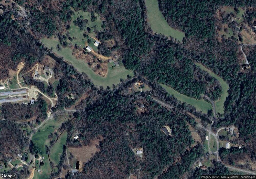
1002 Highway 2 Blue Ridge, GA 30513
Estimated Value: $252,125 - $601,000
--
Bed
2
Baths
780
Sq Ft
$478/Sq Ft
Est. Value
About This Home
This home is located at 1002 Highway 2, Blue Ridge, GA 30513 and is currently estimated at $372,531, approximately $477 per square foot. 1002 Highway 2 is a home located in Fannin County with nearby schools including Fannin County High School.
Ownership History
Date
Name
Owned For
Owner Type
Purchase Details
Closed on
Jan 12, 2021
Sold by
Sherwood Kathleen
Bought by
Sherwood Kathleen J and Kathleen J Sherwood Rev Trust
Current Estimated Value
Purchase Details
Closed on
Feb 9, 2005
Sold by
Bush Robert E
Bought by
Sherwood Kathleen and Sherwood Ronald
Home Financials for this Owner
Home Financials are based on the most recent Mortgage that was taken out on this home.
Original Mortgage
$134,250
Interest Rate
1%
Mortgage Type
New Conventional
Purchase Details
Closed on
Mar 23, 2001
Sold by
Anderson George
Bought by
Bush Robert E
Create a Home Valuation Report for This Property
The Home Valuation Report is an in-depth analysis detailing your home's value as well as a comparison with similar homes in the area
Home Values in the Area
Average Home Value in this Area
Purchase History
| Date | Buyer | Sale Price | Title Company |
|---|---|---|---|
| Sherwood Kathleen J | -- | -- | |
| Sherwood Kathleen | $179,000 | -- | |
| Bush Robert E | $115,000 | -- |
Source: Public Records
Mortgage History
| Date | Status | Borrower | Loan Amount |
|---|---|---|---|
| Previous Owner | Sherwood Kathleen | $134,250 |
Source: Public Records
Tax History Compared to Growth
Tax History
| Year | Tax Paid | Tax Assessment Tax Assessment Total Assessment is a certain percentage of the fair market value that is determined by local assessors to be the total taxable value of land and additions on the property. | Land | Improvement |
|---|---|---|---|---|
| 2024 | $825 | $89,968 | $6,502 | $83,466 |
| 2023 | $748 | $73,326 | $6,502 | $66,824 |
| 2022 | $757 | $74,240 | $6,502 | $67,738 |
| 2021 | $528 | $37,659 | $5,573 | $32,086 |
| 2020 | $537 | $37,659 | $5,573 | $32,086 |
| 2019 | $547 | $37,659 | $5,573 | $32,086 |
| 2018 | $580 | $37,659 | $5,573 | $32,086 |
| 2016 | $523 | $30,816 | $5,263 | $25,553 |
| 2015 | $478 | $26,914 | $1,034 | $25,880 |
| 2014 | $679 | $34,088 | $9,690 | $24,398 |
| 2013 | -- | $32,114 | $9,690 | $22,424 |
Source: Public Records
Map
Nearby Homes
- 201 Jaquar Ln
- 65 Black Oak Ridge Rd
- Lot 19 Black Oak Rd
- 820 Ash Loop Rd
- 115 Black Oak Ridge Rd
- 120 Sunrock Mountain Trc
- 129 Old Bend Rd
- 120 Sunrock Mountain Trace
- 1264 Sun Rock Mountain Rd
- LT 5 Sunrock Mountain Trc
- LT 4 Sunrock Mountain Trc
- 308 Hemlock Trail
- LT 5 Sunrock Mountain Trace
- LT 4 Sunrock Mountain Trace
- 0 Highway 2 Unit 10591825
- 0 Highway 2 Unit 418199
- 401 Sunrock Mountain Trc
- 68 Hibiscus Ln
- 625 Fox Run Dr
- HEMLOCK Hemlock Trail
- 998 Highway 2
- 1037 Highway 2
- 994 Highway 2
- 1204 Highway 2
- 277 Power Dam Rd
- 215 Fightingtown Dr
- 1204 Highway 2
- 263 Fightingtown Dr
- 849 Highway 2
- 1254 Highway 2
- 250 Pond Cove
- 0 Power Dam Rd Unit 6 8401451
- 0 Power Dam Rd Unit LT 1A 3028410
- 0 Power Dam Rd Unit LOT 1A 3213683
- 0 Power Dam Rd Unit Lot 103
- 0 Power Dam Rd Unit 20121083
- 0 Power Dam Rd Unit 324866
- 0 Power Dam Rd Unit 8995707
- 0 Power Dam Rd Unit LOT 103 8741139
- 0 Power Dam Rd Unit Lot 103 8159167
