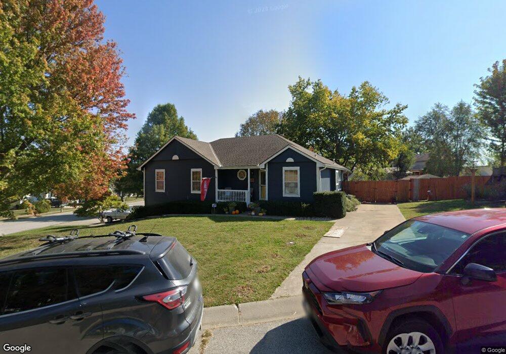
1002 Lincoln St Pleasant Hill, MO 64080
Estimated Value: $301,226 - $325,000
3
Beds
2
Baths
1,373
Sq Ft
$228/Sq Ft
Est. Value
About This Home
This home is located at 1002 Lincoln St, Pleasant Hill, MO 64080 and is currently estimated at $313,057, approximately $228 per square foot. 1002 Lincoln St is a home located in Cass County with nearby schools including Pleasant Hill Primary School, Pleasant Hill Elementary School, and Pleasant Hill Middle School.
Ownership History
Date
Name
Owned For
Owner Type
Purchase Details
Closed on
Jul 25, 2019
Sold by
Stowe Ermil F
Bought by
Vaughn Robert L and Vaughn Kelly Ann
Current Estimated Value
Home Financials for this Owner
Home Financials are based on the most recent Mortgage that was taken out on this home.
Original Mortgage
$131,200
Outstanding Balance
$114,896
Interest Rate
3.8%
Mortgage Type
New Conventional
Estimated Equity
$198,161
Create a Home Valuation Report for This Property
The Home Valuation Report is an in-depth analysis detailing your home's value as well as a comparison with similar homes in the area
Home Values in the Area
Average Home Value in this Area
Purchase History
| Date | Buyer | Sale Price | Title Company |
|---|---|---|---|
| Vaughn Robert L | -- | Crescent Land Title |
Source: Public Records
Mortgage History
| Date | Status | Borrower | Loan Amount |
|---|---|---|---|
| Open | Vaughn Robert L | $131,200 |
Source: Public Records
Tax History Compared to Growth
Tax History
| Year | Tax Paid | Tax Assessment Tax Assessment Total Assessment is a certain percentage of the fair market value that is determined by local assessors to be the total taxable value of land and additions on the property. | Land | Improvement |
|---|---|---|---|---|
| 2024 | $2,540 | $35,220 | $4,150 | $31,070 |
| 2023 | $2,522 | $35,220 | $4,150 | $31,070 |
| 2022 | $2,084 | $28,560 | $4,150 | $24,410 |
| 2021 | $2,026 | $28,560 | $4,150 | $24,410 |
| 2020 | $1,907 | $27,530 | $4,150 | $23,380 |
| 2019 | $1,882 | $27,530 | $4,150 | $23,380 |
| 2018 | $1,723 | $24,860 | $3,650 | $21,210 |
| 2017 | $1,641 | $24,860 | $3,650 | $21,210 |
| 2016 | $1,641 | $23,590 | $3,650 | $19,940 |
| 2015 | $1,662 | $23,590 | $3,650 | $19,940 |
| 2014 | $1,669 | $23,590 | $3,650 | $19,940 |
| 2013 | -- | $23,590 | $3,650 | $19,940 |
Source: Public Records
Map
Nearby Homes
- 1310 Sycamore St
- 1215 Maple Ln
- 1504 Hawthorne Cir
- 601 Hillcrest St
- 1512 Country Club Dr
- 1209 Crest Dr
- 1004 Wright St
- 902 Buckeye Ln
- 1307 Deena St
- 1200 Buckeye Ln
- 502 N Armstrong St
- 204 Lexington Rd
- 1604 Fairway Ct
- 202 Lexington Rd
- 0 Route 7
- 1528 Champion Dr Unit 1530
- 1700 Mulberry St
- 1704 Mulberry St
- 128 N McKissock St
- 1507 Trail Ridge Dr
- 1402 Red Bud Ave
- 1401 Maple Ln
- 1403 Maple Ln
- 1401 Red Bud Ave
- 1401 Redbud Ave
- 1003 Lincoln St
- 1404 Redbud Ave
- 1005 Lincoln St
- 1404 Red Bud Ave
- 1315 Maple Ln
- 1403 Red Bud Ave
- 1403 Redbud Ave
- 1405 Maple Ln
- 1313 Maple Ln
- 1406 Red Bud Ave
- 1405 Red Bud Ave
- 1308 Sycamore St
- 1320 Maple Ln
- 1318 Maple Ln
- 1407 Maple Ln