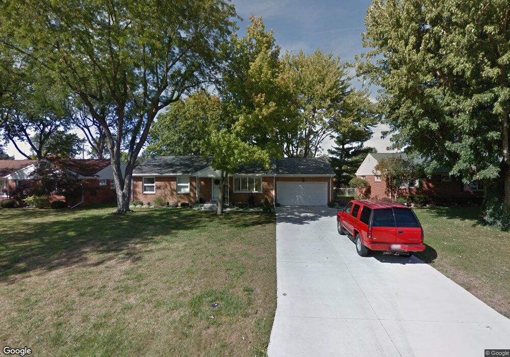
1002 Stall Dr Findlay, OH 45840
Estimated Value: $189,048 - $221,000
3
Beds
1
Bath
1,350
Sq Ft
$152/Sq Ft
Est. Value
About This Home
This home is located at 1002 Stall Dr, Findlay, OH 45840 and is currently estimated at $205,012, approximately $151 per square foot. 1002 Stall Dr is a home located in Hancock County with nearby schools including Whittier Elementary School, Wilson Vance Elementary School, and Donnell Middle School.
Ownership History
Date
Name
Owned For
Owner Type
Purchase Details
Closed on
Aug 12, 1999
Sold by
Gonzalez Jose
Bought by
Cook S Richard
Current Estimated Value
Home Financials for this Owner
Home Financials are based on the most recent Mortgage that was taken out on this home.
Original Mortgage
$93,449
Outstanding Balance
$27,106
Interest Rate
7.77%
Mortgage Type
FHA
Estimated Equity
$177,906
Purchase Details
Closed on
Oct 25, 1994
Sold by
Boltze Frances
Bought by
Gonzalez Jose and Gonzalez Maria
Home Financials for this Owner
Home Financials are based on the most recent Mortgage that was taken out on this home.
Original Mortgage
$69,600
Interest Rate
8.53%
Mortgage Type
New Conventional
Purchase Details
Closed on
Sep 23, 1988
Bought by
Krueger Lucille E
Create a Home Valuation Report for This Property
The Home Valuation Report is an in-depth analysis detailing your home's value as well as a comparison with similar homes in the area
Home Values in the Area
Average Home Value in this Area
Purchase History
| Date | Buyer | Sale Price | Title Company |
|---|---|---|---|
| Cook S Richard | $93,500 | -- | |
| Gonzalez Jose | $87,000 | -- | |
| Krueger Lucille E | -- | -- |
Source: Public Records
Mortgage History
| Date | Status | Borrower | Loan Amount |
|---|---|---|---|
| Open | Cook S Richard | $93,449 | |
| Previous Owner | Gonzalez Jose | $69,600 |
Source: Public Records
Tax History
| Year | Tax Paid | Tax Assessment Tax Assessment Total Assessment is a certain percentage of the fair market value that is determined by local assessors to be the total taxable value of land and additions on the property. | Land | Improvement |
|---|---|---|---|---|
| 2024 | $1,690 | $47,580 | $8,110 | $39,470 |
| 2023 | $1,693 | $47,580 | $8,110 | $39,470 |
| 2022 | $1,687 | $47,580 | $8,110 | $39,470 |
| 2021 | $1,575 | $38,690 | $8,110 | $30,580 |
| 2020 | $1,575 | $38,690 | $8,110 | $30,580 |
| 2019 | $1,543 | $38,690 | $8,110 | $30,580 |
| 2018 | $1,464 | $33,650 | $7,060 | $26,590 |
| 2017 | $732 | $33,650 | $7,060 | $26,590 |
| 2016 | $1,448 | $33,650 | $7,060 | $26,590 |
| 2015 | $1,505 | $34,410 | $7,060 | $27,350 |
| 2014 | $1,505 | $34,410 | $7,060 | $27,350 |
| 2012 | $1,518 | $34,410 | $7,060 | $27,350 |
Source: Public Records
Map
Nearby Homes
- 1100 Stall Dr
- 731 5th St
- 0 Blanchard Ave
- 1037 Fishlock Ave
- 1726 Eastview Dr
- 15591 Canadian Way
- 15586 Canadian Way
- 15615 Canadian Way
- 400 E Pearl St
- 206 Greenlawn Ave
- 216 1st St
- 315 Fairlawn Place
- 123 Glendale Ave
- 623 E Sandusky St
- 1421 Autumn Dr
- 829 Maple Ave
- 10692 Cherokee Dr
- 1421 E Sandusky St
- 865 S Main St
- 309 Huron Rd
- 1010 Stall Dr
- 942 Stall Dr
- 943 Breezewood Ct
- 1001 Breezewood Ct
- 1016 Stall Dr
- 1321 Brookside Dr
- 1011 Breezewood Ct
- 1301 Brookside Dr
- 1001 Stall Dr
- 943 Stall Dr
- 1011 Stall Dr
- 1022 Stall Dr
- 1019 Breezewood Ct
- 1327 Brookside Dr
- 1021 Stall Dr
- 1030 Stall Dr
- 1027 Breezewood Ct
- 1000 Breezewood Ct
- 1235 Brookside Dr
- 1000 Eastview Dr
Your Personal Tour Guide
Ask me questions while you tour the home.