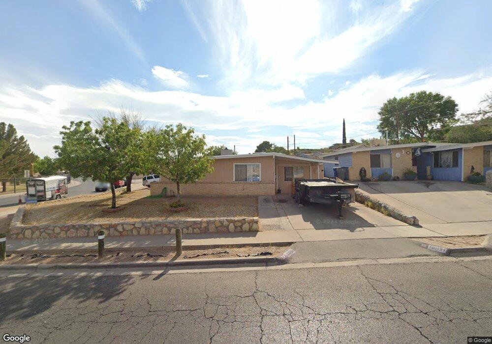
10021 Buckwood Ave El Paso, TX 79925
Travis White NeighborhoodEstimated Value: $192,261 - $234,000
--
Bed
2
Baths
1,460
Sq Ft
$144/Sq Ft
Est. Value
About This Home
This home is located at 10021 Buckwood Ave, El Paso, TX 79925 and is currently estimated at $209,815, approximately $143 per square foot. 10021 Buckwood Ave is a home located in El Paso County with nearby schools including Eastwood Knolls Elementary School, Eastwood High School, and St. Raphael School.
Ownership History
Date
Name
Owned For
Owner Type
Purchase Details
Closed on
Apr 30, 2025
Sold by
Roque Javier and Roque Maria Guadalupe
Bought by
Roque Maria Guadalupe
Current Estimated Value
Purchase Details
Closed on
Feb 19, 1998
Sold by
Jordan Sylvia G and Marcum Sylvia
Bought by
Roque Javier and Roque Maria Guadalupe
Home Financials for this Owner
Home Financials are based on the most recent Mortgage that was taken out on this home.
Original Mortgage
$50,204
Interest Rate
6.91%
Mortgage Type
FHA
Create a Home Valuation Report for This Property
The Home Valuation Report is an in-depth analysis detailing your home's value as well as a comparison with similar homes in the area
Home Values in the Area
Average Home Value in this Area
Purchase History
| Date | Buyer | Sale Price | Title Company |
|---|---|---|---|
| Roque Maria Guadalupe | -- | None Listed On Document | |
| Roque Javier | -- | -- |
Source: Public Records
Mortgage History
| Date | Status | Borrower | Loan Amount |
|---|---|---|---|
| Previous Owner | Roque Javier | $50,204 |
Source: Public Records
Tax History Compared to Growth
Tax History
| Year | Tax Paid | Tax Assessment Tax Assessment Total Assessment is a certain percentage of the fair market value that is determined by local assessors to be the total taxable value of land and additions on the property. | Land | Improvement |
|---|---|---|---|---|
| 2025 | $2,313 | $160,463 | -- | -- |
| 2024 | $2,313 | $145,875 | -- | -- |
| 2023 | $2,313 | $132,614 | $0 | $0 |
| 2022 | $3,744 | $120,558 | $0 | $0 |
| 2021 | $3,562 | $109,598 | $22,918 | $86,680 |
| 2020 | $3,183 | $100,776 | $17,629 | $83,147 |
| 2018 | $3,139 | $100,937 | $17,629 | $83,308 |
| 2017 | $3,113 | $101,857 | $17,629 | $84,228 |
| 2016 | $3,113 | $101,857 | $17,629 | $84,228 |
| 2015 | $2,359 | $101,857 | $17,629 | $84,228 |
| 2014 | $2,359 | $101,200 | $17,629 | $83,571 |
Source: Public Records
Map
Nearby Homes
- 9801 Eastridge Dr
- 10212 Garwood Ct
- 10401 Springwood Dr
- 10412 Chinaberry Dr
- 10463 Davwood Ln
- 9525 Desert Ridge Dr
- 9674 Stonehaven Dr
- 1207 Bois d Arc Dr
- 9917 Honolulu Dr
- 10145 Camwood Dr
- 7921 Candlewood Ave
- 10481 Deepwood Ct
- 7936 Dogwood St
- 10233 Byway Dr
- 2425 Fir St
- 10533 Springwood Dr
- 9605 Montwood Dr
- 10313 Byway Dr
- 10304 Woodruff Ct
- 10309 Woodruff Ct
- 1903 Wedgewood Dr
- 10017 Buckwood Ave
- 10017 Buckwood Ave
- 1905 Wedgewood Dr
- 10013 Buckwood Ave
- 10101 Buckwood Dr
- 10012 Acer Ave
- 10008 Acer Ave
- 10008 Acer Ave Unit 2
- 1909 Wedgewood Dr
- 10004 Acer Ave
- 10011 Buckwood Ave
- 10100 Buckwood Ave
- 10000 Acer Ave
- 10105 Buckwood Ave
- 10009 Buckwood Ave
- 9932 Acer Ave
- 10121 Stoneway Dr
- 10104 Buckwood Ave
- 10119 Stoneway Dr