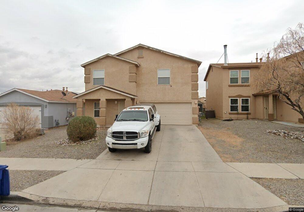
10024 Range Rd SW Albuquerque, NM 87121
Southwest Heights NeighborhoodEstimated Value: $337,000 - $378,000
About This Home
This home is located at 10024 Range Rd SW, Albuquerque, NM 87121 and is currently estimated at $353,640, approximately $137 per square foot. 10024 Range Rd SW is a home located in Bernalillo County with nearby schools including Carlos Rey Elementary School, Atrisco Heritage Academy High School, and Robert F. Kennedy Charter School.
Ownership History
We collect this data history from publicly available records. To have your information removed, we recommend requesting removal directly through your county’s website.
Purchase Details
Home Financials for this Owner
Home Financials are based on the most recent Mortgage that was taken out on this home.Purchase Details
Home Financials for this Owner
Home Financials are based on the most recent Mortgage that was taken out on this home.Purchase Details
Home Financials for this Owner
Home Financials are based on the most recent Mortgage that was taken out on this home.Purchase Details
Home Financials for this Owner
Home Financials are based on the most recent Mortgage that was taken out on this home.Purchase Details
Home Values in the Area
Average Home Value in this Area
Purchase History
We collect this data history from publicly available records. To have your information removed, we recommend requesting removal directly through your county’s website.
| Date | Buyer | Sale Price | Title Company |
|---|---|---|---|
| -- | Fidelity National Title | ||
| -- | Fidelity Natl Title Ins Co | ||
| -- | Stewart Title | ||
| -- | Commerce Title Co Of Nm Llc | ||
| -- | -- |
Mortgage History
We collect this data history from publicly available records. To have your information removed, we recommend requesting removal directly through your county’s website.
| Date | Status | Borrower | Loan Amount |
|---|---|---|---|
| Previous Owner | $155,295 | ||
| Previous Owner | $148,006 | ||
| Previous Owner | $154,400 | ||
| Previous Owner | $159,615 |
Tax History
We collect this data history from publicly available records. To have your information removed, we recommend requesting removal directly through your county’s website.
| Year | Tax Paid | Tax Assessment Tax Assessment Total Assessment is a certain percentage of the fair market value that is determined by local assessors to be the total taxable value of land and additions on the property. | Land | Improvement |
|---|---|---|---|---|
| 2025 | $2,585 | $61,184 | $11,868 | $49,316 |
| 2024 | $2,506 | $59,403 | $11,523 | $47,880 |
| 2023 | $2,465 | $57,672 | $11,187 | $46,485 |
| 2022 | $2,382 | $55,993 | $10,862 | $45,131 |
| 2021 | $2,302 | $54,362 | $10,545 | $43,817 |
| 2020 | $2,264 | $52,779 | $10,238 | $42,541 |
| 2019 | $2,197 | $51,242 | $9,940 | $41,302 |
| 2018 | $2,119 | $51,242 | $9,940 | $41,302 |
| 2017 | $2,054 | $49,750 | $9,651 | $40,099 |
| 2016 | $1,995 | $46,894 | $9,097 | $37,797 |
| 2015 | $45,528 | $45,528 | $8,832 | $36,696 |
| 2014 | $1,952 | $45,962 | $8,832 | $37,130 |
| 2013 | -- | $54,961 | $8,832 | $46,129 |
Map
- 2408 Sun Gate Trail SW
- 10135 High Range Rd SW
- 2116 Hermosa Creek Dr SW
- 2419 Meadow Gate Trail SW
- 2419 Sorral Way SW
- 9904 Morning Sun Trail SW
- 10408 Sandy Creek Rd SW
- 10436 Gila Gulch Rd SW
- 10427 Sandy Flats Ave SW
- 2708 Silver Star Dr SW
- 9827 Sun Chaser Trail SW
- 10601 Crandall Rd SW
- 10631 Big Springs St SW
- 10543 Valedon Ln SW
- 9916 Marlborough Ave SW
- 2822 Baco Noir Dr SW
- 1708 Silver Sky Dr SW Unit 1
- 9809 Marlborough Ave SW
- 10025 Melinda Ave SW
- 10687 Valedon Ln SW
- 10036 Range Rd SW
- 10032 Range Rd SW
- 10040 Range Rd SW
- 10028 Range Rd SW
- 10044 Range Rd SW
- 2115 Canter St SW
- 10048 Range Rd SW
- 2116 Canter St SW
- 2109 Canter St SW
- 10020 Range Rd SW
- 10047 Range Rd SW
- 2108 Canter St SW
- 2105 Canter St SW
- 10016 Range Rd SW
- 10051 Range Rd SW
- 10043 Corral Gate Ln SW
- 10039 Corral Gate Ln SW
- 10047 Corral Gate Ln SW
- 2100 Canter St SW
- 2105 Gait St SW Unit 10
Ask me questions while you tour the home.