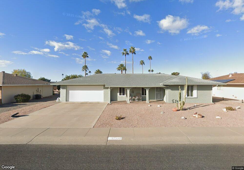
10025 W Brookside Dr Sun City, AZ 85351
Estimated Value: $261,107 - $325,000
--
Bed
2
Baths
1,466
Sq Ft
$206/Sq Ft
Est. Value
About This Home
This home is located at 10025 W Brookside Dr, Sun City, AZ 85351 and is currently estimated at $301,527, approximately $205 per square foot. 10025 W Brookside Dr is a home located in Maricopa County with nearby schools including Sonoran Science Academy-Peoria, Desert Mirage Elementary School, and Black Mountain Science Academy Montessori.
Ownership History
Date
Name
Owned For
Owner Type
Purchase Details
Closed on
Aug 1, 2022
Sold by
Dubovich Robert G
Bought by
Dubovich Robert G and King Sarah M
Current Estimated Value
Purchase Details
Closed on
Jul 29, 2022
Sold by
Dubovich Robert G and Dubovich Patricia
Bought by
Dubovich Robert G
Purchase Details
Closed on
Mar 20, 2020
Sold by
Dubovich Robert G and Dubovich Patricia S
Bought by
Dubovich Robert G and Dubovich Patricia S
Purchase Details
Closed on
Dec 5, 2014
Sold by
Ward Harold A
Bought by
Ward Lisa M and Ward Lieselotte M
Purchase Details
Closed on
Nov 21, 2014
Sold by
Ward Lieselotte M and Ward Lisa M
Bought by
Dubovich Robert G and Dubovich Patricia S
Purchase Details
Closed on
Jan 7, 2014
Sold by
Ward Harold A and Ward Lisa M
Bought by
Ward Lisa M
Create a Home Valuation Report for This Property
The Home Valuation Report is an in-depth analysis detailing your home's value as well as a comparison with similar homes in the area
Home Values in the Area
Average Home Value in this Area
Purchase History
| Date | Buyer | Sale Price | Title Company |
|---|---|---|---|
| Dubovich Robert G | -- | None Listed On Document | |
| Dubovich Robert G | -- | Ahrens Deangeli Law Group Llp | |
| Dubovich Robert G | -- | None Available | |
| Ward Lisa M | -- | First American Title Ins Co | |
| Dubovich Robert G | $124,000 | First American Title Ins Co | |
| Ward Lisa M | -- | None Available |
Source: Public Records
Tax History Compared to Growth
Tax History
| Year | Tax Paid | Tax Assessment Tax Assessment Total Assessment is a certain percentage of the fair market value that is determined by local assessors to be the total taxable value of land and additions on the property. | Land | Improvement |
|---|---|---|---|---|
| 2025 | $1,188 | $14,709 | -- | -- |
| 2024 | $1,073 | $14,009 | -- | -- |
| 2023 | $1,073 | $23,200 | $4,640 | $18,560 |
| 2022 | $1,003 | $18,170 | $3,630 | $14,540 |
| 2021 | $1,036 | $17,050 | $3,410 | $13,640 |
| 2020 | $1,009 | $15,100 | $3,020 | $12,080 |
| 2019 | $996 | $14,160 | $2,830 | $11,330 |
| 2018 | $958 | $12,970 | $2,590 | $10,380 |
| 2017 | $923 | $11,610 | $2,320 | $9,290 |
| 2016 | $867 | $10,930 | $2,180 | $8,750 |
| 2015 | $826 | $7,200 | $1,440 | $5,760 |
Source: Public Records
Map
Nearby Homes
- 10018 W Burns Dr
- 10134 W Desert Rock Dr
- 10009 W Pleasant Valley Rd
- 9921 W Hutton Dr
- 10313 W Desert Rock Dr
- 10202 W Edgewood Dr
- 10019 W Shasta Dr
- 10025 W Shasta Dr
- 9805 W Burns Dr
- 10228 W Twin Oaks Dr
- 9814 W Gulf Hills Dr
- 10313 W Burns Dr
- 15406 N Boswell Blvd
- 9915 W Sandstone Dr
- 15602 N Lakeforest Dr
- 10251 W Twin Oaks Dr
- 10329 W Gulf Hills Dr
- 10210 W Charter Oak Dr
- 15462 N Lakeforest Dr
- 9705 W Oak Ridge Dr
- 10029 W Brookside Dr
- 10021 W Brookside Dr
- 10106 W Sutters Gold Ln
- 10110 W Sutters Gold Ln
- 10033 W Brookside Dr
- 10026 W Brookside Dr
- 10026 W Desert Rock Dr
- 10022 W Brookside Dr
- 10022 W Desert Rock Dr Unit 3
- 10030 W Desert Rock Dr
- 10030 W Brookside Dr
- 10114 W Sutters Gold Ln
- 10102 W Desert Rock Dr
- 10102 W Desert Rock Dr
- 10102 W Desert Rock Dr Unit 1
- 10018 W Brookside Dr
- 10039 W Brookside Dr
- 10034 W Brookside Dr
- 10109 W Sutters Gold Ln
- 10118 W Sutters Gold Ln