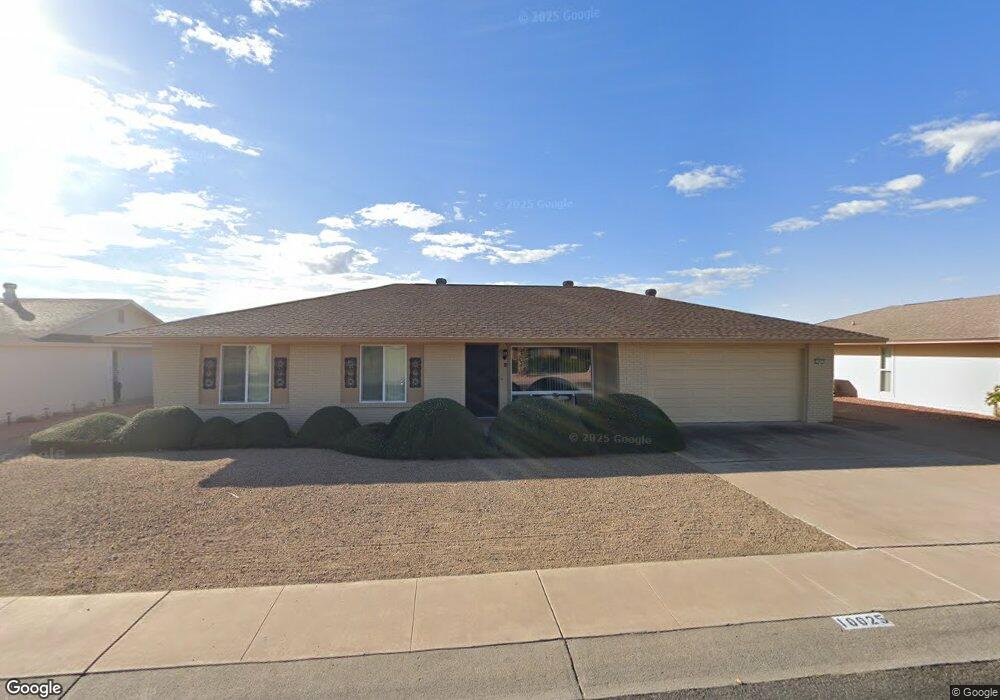
10025 W Desert Rock Dr Sun City, AZ 85351
Estimated Value: $267,994 - $335,000
3
Beds
2
Baths
1,465
Sq Ft
$214/Sq Ft
Est. Value
About This Home
This home is located at 10025 W Desert Rock Dr, Sun City, AZ 85351 and is currently estimated at $313,499, approximately $213 per square foot. 10025 W Desert Rock Dr is a home located in Maricopa County with nearby schools including Sonoran Science Academy-Peoria, Desert Mirage Elementary School, and Black Mountain Science Academy Montessori.
Ownership History
Date
Name
Owned For
Owner Type
Purchase Details
Closed on
Jan 6, 2015
Sold by
Hutchison Lawrence G
Bought by
Hutchison Lawrance G and Hurchison Frances
Current Estimated Value
Purchase Details
Closed on
Jun 11, 2009
Sold by
Astros Phyllis Diane and The Phyllis Diana Astros Revoc
Bought by
Hutchison Lawrence G
Purchase Details
Closed on
Aug 24, 1999
Sold by
Downing Mary E and Mary E Downing Revocable Trust
Bought by
Astros Phyllis Diane and Mielke Constance
Home Financials for this Owner
Home Financials are based on the most recent Mortgage that was taken out on this home.
Original Mortgage
$50,000
Interest Rate
7.77%
Mortgage Type
New Conventional
Create a Home Valuation Report for This Property
The Home Valuation Report is an in-depth analysis detailing your home's value as well as a comparison with similar homes in the area
Home Values in the Area
Average Home Value in this Area
Purchase History
| Date | Buyer | Sale Price | Title Company |
|---|---|---|---|
| Hutchison Lawrance G | -- | None Available | |
| Hutchison Lawrence G | $123,500 | Equity Title Agency Inc | |
| Astros Phyllis Diane | $107,000 | Security Title Agency |
Source: Public Records
Mortgage History
| Date | Status | Borrower | Loan Amount |
|---|---|---|---|
| Previous Owner | Astros Phyllis Diane | $50,000 |
Source: Public Records
Tax History Compared to Growth
Tax History
| Year | Tax Paid | Tax Assessment Tax Assessment Total Assessment is a certain percentage of the fair market value that is determined by local assessors to be the total taxable value of land and additions on the property. | Land | Improvement |
|---|---|---|---|---|
| 2025 | $1,265 | $14,281 | -- | -- |
| 2024 | $1,149 | $13,601 | -- | -- |
| 2023 | $1,149 | $22,970 | $4,590 | $18,380 |
| 2022 | $1,080 | $18,030 | $3,600 | $14,430 |
| 2021 | $1,104 | $16,910 | $3,380 | $13,530 |
| 2020 | $1,076 | $14,950 | $2,990 | $11,960 |
| 2019 | $1,062 | $13,960 | $2,790 | $11,170 |
| 2018 | $1,025 | $12,720 | $2,540 | $10,180 |
| 2017 | $988 | $11,400 | $2,280 | $9,120 |
| 2016 | $565 | $10,730 | $2,140 | $8,590 |
| 2015 | $885 | $9,920 | $1,980 | $7,940 |
Source: Public Records
Map
Nearby Homes
- 10018 W Burns Dr
- 10134 W Desert Rock Dr
- 10009 W Pleasant Valley Rd
- 10019 W Shasta Dr
- 10025 W Shasta Dr
- 10202 W Edgewood Dr
- 10228 W Twin Oaks Dr
- 15406 N Boswell Blvd
- 9915 W Sandstone Dr
- 10313 W Desert Rock Dr
- 9814 W Gulf Hills Dr
- 10210 W Charter Oak Dr
- 10251 W Twin Oaks Dr
- 15602 N Lakeforest Dr
- 9805 W Burns Dr
- 10336 W Kingswood Cir
- 15205 N Desert Rose Dr
- 9921 W Hutton Dr
- 10313 W Burns Dr
- 15462 N Lakeforest Dr
- 10021 W Desert Rock Dr
- 10029 W Desert Rock Dr
- 10026 W Burns Dr
- 10030 W Burns Dr
- 10022 W Burns Dr
- 10017 W Desert Rock Dr
- 10034 W Burns Dr
- 10026 W Desert Rock Dr
- 10022 W Desert Rock Dr Unit 3
- 10030 W Desert Rock Dr
- 10013 W Desert Rock Dr
- 10102 W Burns Dr
- 10021 W Brookside Dr
- 10014 W Burns Dr
- 10010 W Desert Rock Dr
- 10018 W Brookside Dr
- 10102 W Desert Rock Dr
- 10102 W Desert Rock Dr
- 10102 W Desert Rock Dr Unit 1
- 10106 W Burns Dr