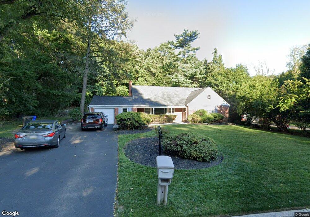
1003 Dell Ln Wyncote, PA 19095
Estimated Value: $434,000 - $620,905
5
Beds
3
Baths
3,079
Sq Ft
$174/Sq Ft
Est. Value
About This Home
This home is located at 1003 Dell Ln, Wyncote, PA 19095 and is currently estimated at $535,976, approximately $174 per square foot. 1003 Dell Ln is a home located in Montgomery County with nearby schools including Wyncote Elementary School, Elkins Park School, and Cedarbrook Middle School.
Ownership History
Date
Name
Owned For
Owner Type
Purchase Details
Closed on
Aug 21, 1998
Sold by
Wilshire Funding Corp
Bought by
Turner Timothy S and Turner Garnet
Current Estimated Value
Purchase Details
Closed on
Apr 1, 1998
Sold by
Citicorp North America Inc
Bought by
Wilshire Funding Corp
Purchase Details
Closed on
Jul 2, 1996
Sold by
Lalley Francis P
Bought by
Bristol Oaks Lp
Create a Home Valuation Report for This Property
The Home Valuation Report is an in-depth analysis detailing your home's value as well as a comparison with similar homes in the area
Home Values in the Area
Average Home Value in this Area
Purchase History
| Date | Buyer | Sale Price | Title Company |
|---|---|---|---|
| Turner Timothy S | $130,625 | -- | |
| Wilshire Funding Corp | $206,480 | -- | |
| Bristol Oaks Lp | $17,012 | -- |
Source: Public Records
Tax History Compared to Growth
Tax History
| Year | Tax Paid | Tax Assessment Tax Assessment Total Assessment is a certain percentage of the fair market value that is determined by local assessors to be the total taxable value of land and additions on the property. | Land | Improvement |
|---|---|---|---|---|
| 2025 | $11,354 | $170,000 | $68,940 | $101,060 |
| 2024 | $11,354 | $170,000 | $68,940 | $101,060 |
| 2023 | $11,226 | $170,000 | $68,940 | $101,060 |
| 2022 | $11,033 | $170,000 | $68,940 | $101,060 |
| 2021 | $10,731 | $170,000 | $68,940 | $101,060 |
| 2020 | $10,422 | $170,000 | $68,940 | $101,060 |
| 2019 | $10,214 | $170,000 | $68,940 | $101,060 |
| 2018 | $3,002 | $170,000 | $68,940 | $101,060 |
| 2017 | $9,751 | $170,000 | $68,940 | $101,060 |
| 2016 | $9,685 | $170,000 | $68,940 | $101,060 |
| 2015 | $9,235 | $170,000 | $68,940 | $101,060 |
| 2014 | $9,235 | $170,000 | $68,940 | $101,060 |
Source: Public Records
Map
Nearby Homes
- 809 Church Rd
- 819 Elkins Ave
- 100 Breyer Dr Unit 3C
- 706 Sural Ln
- 8302 Old York Rd Unit B24
- 209 Greenwood Ave
- 123 Township Line Rd
- 622 Spring Ave
- 116 Township Line Rd
- 7900 Old York Rd Unit 303B
- 7900 Old York Rd Unit 903A
- 7900 Old York Rd Unit 308B
- 7900 Old York Rd Unit 414B
- 7900 Old York Rd
- 7900 Old York Rd Unit 204-A
- 7900 Old York Rd Unit 206A
- 7900 Old York Rd Unit 208B
- 7900 Old York Rd Unit 404-A
- 7900 Old York Rd Unit 414-A
- 7900 Old York Rd Unit 907A