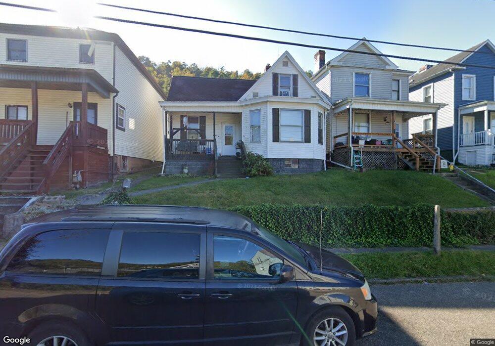
1003 Howard St Bridgeport, OH 43912
Estimated Value: $61,000 - $83,000
3
Beds
1
Bath
1,192
Sq Ft
$64/Sq Ft
Est. Value
About This Home
This home is located at 1003 Howard St, Bridgeport, OH 43912 and is currently estimated at $75,883, approximately $63 per square foot. 1003 Howard St is a home located in Belmont County with nearby schools including Bridgeport Elementary School, Bridgeport Middle School, and Bridgeport High School.
Ownership History
Date
Name
Owned For
Owner Type
Purchase Details
Closed on
Aug 4, 2021
Sold by
Pyle Malinda V and Pyle James
Bought by
Pyle James and Pyle Malinda V
Current Estimated Value
Purchase Details
Closed on
Sep 10, 2018
Bought by
Palmer Barbara G
Purchase Details
Closed on
Dec 3, 2009
Sold by
Hodgson Tammy K
Bought by
Palmer Barbara J and Paler Dominic F
Purchase Details
Closed on
Oct 6, 1992
Bought by
Palmer Domenic F Etal 1
Purchase Details
Closed on
Jan 1, 1986
Sold by
Case Andrew W
Bought by
Case Andrew W
Create a Home Valuation Report for This Property
The Home Valuation Report is an in-depth analysis detailing your home's value as well as a comparison with similar homes in the area
Home Values in the Area
Average Home Value in this Area
Purchase History
| Date | Buyer | Sale Price | Title Company |
|---|---|---|---|
| Pyle James | -- | Costne Law Firm | |
| Pyle Malinda V | $15,600 | Costine Law Firm | |
| Palmer Barbara G | -- | -- | |
| Palmer Barbara J | $3,500 | Attorney | |
| Palmer Domenic F Etal 1 | $21,000 | -- | |
| Case Andrew W | -- | -- |
Source: Public Records
Tax History Compared to Growth
Tax History
| Year | Tax Paid | Tax Assessment Tax Assessment Total Assessment is a certain percentage of the fair market value that is determined by local assessors to be the total taxable value of land and additions on the property. | Land | Improvement |
|---|---|---|---|---|
| 2024 | $970 | $23,370 | $2,020 | $21,350 |
| 2023 | $756 | $16,220 | $2,030 | $14,190 |
| 2022 | $991 | $16,219 | $2,030 | $14,189 |
| 2021 | $946 | $16,219 | $2,030 | $14,189 |
| 2020 | $584 | $13,510 | $1,690 | $11,820 |
| 2019 | $602 | $13,510 | $1,690 | $11,820 |
| 2018 | $585 | $13,510 | $1,690 | $11,820 |
| 2017 | $623 | $13,360 | $2,000 | $11,360 |
| 2016 | $223 | $13,360 | $2,000 | $11,360 |
| 2015 | $222 | $13,360 | $2,000 | $11,360 |
| 2014 | $126 | $11,130 | $1,820 | $9,310 |
| 2013 | $106 | $11,130 | $1,820 | $9,310 |
Source: Public Records
Map
Nearby Homes
- 1049 Buckeye St
- 866 Main St
- 67478 Kirkwood Heights Rd
- 8 Spring St
- 20 Locust Ave
- 902 National Rd
- 16 Patterson Rd
- 67605 Kirkwood Heights Rd
- 67620 Kirkwood Heights Rd
- 67730 Kirkwood Heights Rd
- 56624 Boyd Ave
- 61 Laipple St
- 56316 National Rd
- 56559 Boyd Ave
- 0 Ohio 7
- 116 Ohio St
- 219 S York St
- 217 N Huron St
- 50 Kentucky St
- 301 N Huron St
- 1001 Howard St
- 1005 Howard St
- 1007 Howard St
- 1014 Howard St
- 929 Howard St
- 1009 Howard St
- 1002 Minellen Dr
- 1018 Howard St
- 1011 Howard St
- 927 Howard St
- 927 Howard St
- 934 W Bennett St
- 1008 Minellen Dr
- 928 W Bennett St
- 1010 Minellen Dr
- 921 Howard St
- 921 Howard St
- 922 Howard St
- 922 W Bennett St
- 1015 Howard St