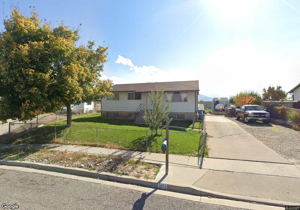
1003 W 550 S Payson, UT 84651
Estimated Value: $396,009 - $439,000
3
Beds
1
Bath
1,066
Sq Ft
$390/Sq Ft
Est. Value
About This Home
This home is located at 1003 W 550 S, Payson, UT 84651 and is currently estimated at $415,252, approximately $389 per square foot. 1003 W 550 S is a home located in Utah County with nearby schools including Wilson Elementary School, Mt. Nebo Junior High School, and Mt. Nebo Middle.
Ownership History
Date
Name
Owned For
Owner Type
Purchase Details
Closed on
Dec 13, 2000
Sold by
Reece Karl W and Reece Katreena
Bought by
Romrell Brian Kent and Romrell Kirsten Marie
Current Estimated Value
Home Financials for this Owner
Home Financials are based on the most recent Mortgage that was taken out on this home.
Original Mortgage
$27,500
Outstanding Balance
$10,112
Interest Rate
7.67%
Estimated Equity
$405,140
Create a Home Valuation Report for This Property
The Home Valuation Report is an in-depth analysis detailing your home's value as well as a comparison with similar homes in the area
Home Values in the Area
Average Home Value in this Area
Purchase History
| Date | Buyer | Sale Price | Title Company |
|---|---|---|---|
| Romrell Brian Kent | -- | Provo Land Title Company |
Source: Public Records
Mortgage History
| Date | Status | Borrower | Loan Amount |
|---|---|---|---|
| Open | Romrell Brian Kent | $27,500 | |
| Closed | Romrell Brian Kent | $85,577 |
Source: Public Records
Tax History Compared to Growth
Tax History
| Year | Tax Paid | Tax Assessment Tax Assessment Total Assessment is a certain percentage of the fair market value that is determined by local assessors to be the total taxable value of land and additions on the property. | Land | Improvement |
|---|---|---|---|---|
| 2025 | $1,762 | $193,765 | $120,800 | $231,500 |
| 2024 | $1,762 | $179,355 | $0 | $0 |
| 2023 | $1,765 | $180,070 | $0 | $0 |
| 2022 | $1,837 | $184,415 | $0 | $0 |
| 2021 | $1,568 | $252,500 | $88,800 | $163,700 |
| 2020 | $1,486 | $234,000 | $80,700 | $153,300 |
| 2019 | $1,332 | $215,000 | $72,300 | $142,700 |
| 2018 | $1,301 | $202,500 | $64,600 | $137,900 |
| 2017 | $1,147 | $96,030 | $0 | $0 |
| 2016 | $1,012 | $84,150 | $0 | $0 |
| 2015 | $904 | $74,635 | $0 | $0 |
| 2014 | $879 | $73,095 | $0 | $0 |
Source: Public Records
Map
Nearby Homes
- 527 S 1000 W
- 528 S 800 W
- 550 700 W
- 533 S 700 W
- 219 S Majestic W
- 513 W 600 S
- 735 W 100 S
- 1192 W 1130 St S Unit 202
- 1546 W 800 S
- 1128 W 1150 S Unit 9
- 1087 S 680 W
- 1172 S 880 W
- 1163 S 730 W
- 1216 S 1150 W Unit 19
- 1287 S 1080 W
- 1161 Utah 198
- 1045 S 1700 W Unit 1533
- 1045 S 1700 W Unit 710
- 1045 S 1700 W Unit 311
- 1045 S 1700 W Unit 133