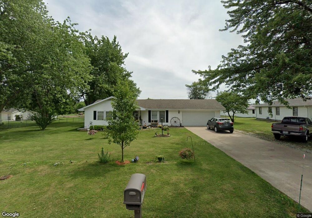
1003 W Shepherd Ave Kirksville, MO 63501
Estimated Value: $158,000 - $199,000
3
Beds
2
Baths
1,120
Sq Ft
$159/Sq Ft
Est. Value
About This Home
This home is located at 1003 W Shepherd Ave, Kirksville, MO 63501 and is currently estimated at $177,955, approximately $158 per square foot. 1003 W Shepherd Ave is a home with nearby schools including Kirksville Primary School, Ray Miller Elementary School, and William Matthew Middle School.
Ownership History
Date
Name
Owned For
Owner Type
Purchase Details
Closed on
Sep 18, 2013
Sold by
Carter Linda and Carter Ricky
Bought by
Holt Darrell and Holt Connie
Current Estimated Value
Home Financials for this Owner
Home Financials are based on the most recent Mortgage that was taken out on this home.
Original Mortgage
$52,500
Outstanding Balance
$26,888
Interest Rate
4.62%
Mortgage Type
New Conventional
Estimated Equity
$151,067
Create a Home Valuation Report for This Property
The Home Valuation Report is an in-depth analysis detailing your home's value as well as a comparison with similar homes in the area
Home Values in the Area
Average Home Value in this Area
Purchase History
| Date | Buyer | Sale Price | Title Company |
|---|---|---|---|
| Holt Darrell | -- | -- |
Source: Public Records
Mortgage History
| Date | Status | Borrower | Loan Amount |
|---|---|---|---|
| Open | Holt Darrell | $52,500 |
Source: Public Records
Tax History Compared to Growth
Tax History
| Year | Tax Paid | Tax Assessment Tax Assessment Total Assessment is a certain percentage of the fair market value that is determined by local assessors to be the total taxable value of land and additions on the property. | Land | Improvement |
|---|---|---|---|---|
| 2024 | $812 | $14,680 | $3,730 | $10,950 |
| 2023 | $808 | $12,140 | $3,730 | $8,410 |
| 2022 | $808 | $12,140 | $3,730 | $8,410 |
| 2021 | $799 | $12,140 | $3,730 | $8,410 |
| 2020 | $762 | $12,390 | $3,730 | $8,660 |
| 2019 | $734 | $12,390 | $3,730 | $8,660 |
| 2018 | $729 | $12,390 | $3,730 | $8,660 |
| 2017 | $609 | $10,390 | $1,860 | $8,530 |
| 2016 | -- | $10,390 | $1,860 | $8,530 |
| 2015 | -- | $10,390 | $1,860 | $8,530 |
| 2011 | -- | $0 | $0 | $0 |
Source: Public Records
Map
Nearby Homes
- 405 W Shepherd Ave
- 3308 S 1st St
- 0 Meadow Ln
- 405 Garrett Dr
- 23358 Rainbow Basin Trail
- 1921 S First St
- 3515 S 1st St
- 1904 S 1st St
- 1902 S 1st St
- 203 W La Harpe St
- 712 W Shelby St
- 2116 S Franklin St
- 23878 Youngstown Trail
- 2700 S Franklin St
- 801 W Hamilton St
- 702 W Hamilton St
- 1601 S Boundary St
- xxx Missouri 11
- 306 Hillcrest Dr
- 2000 E Laharpe St
- 1005 W Shepherd Ave
- 3208 S Adams Dr
- 1001 W Shepherd Ave
- 1004 W Shepherd Ave
- 1006 W Shepherd Ave
- XX W Shepherd Ave
- 0 W Shepherd Ave
- 1007 W Shepherd Ave
- 2907 Breezewood Dr
- 906 W Shepherd Ave
- 2905 Breezewood Dr
- 2903 Breezewood Dr
- 2906 Breezewood Dr
- 901 W Shepherd Ave
- 2904 Breezewood Dr
- 2901 Breezewood Dr
- X S Adams Dr
- 3406 S Adams Dr
- 3207 S Adams Dr
- . Breezewood Dr