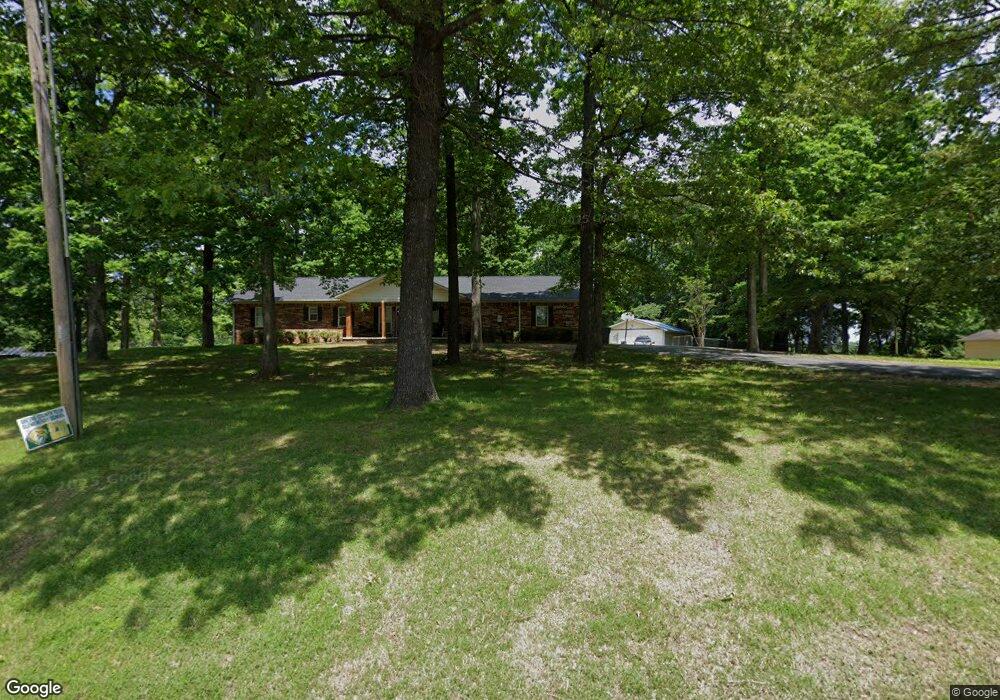
1003 W Unity Rd Paragould, AR 72450
Estimated Value: $308,317 - $342,000
Studio
1
Bath
2,692
Sq Ft
$121/Sq Ft
Est. Value
About This Home
This home is located at 1003 W Unity Rd, Paragould, AR 72450 and is currently estimated at $325,159, approximately $120 per square foot. 1003 W Unity Rd is a home with nearby schools including Paragould High School and St. Mary's Catholic School & Preschool.
Ownership History
Date
Name
Owned For
Owner Type
Purchase Details
Closed on
Oct 2, 2025
Sold by
Ashby Tim and Ashby Judy
Bought by
Bowden Van Allen
Current Estimated Value
Purchase Details
Closed on
Mar 10, 2011
Sold by
Orr Wilma J and Houston B Orr Family Trust
Bought by
Orr Houston William Otto and Orr Koryn Elizabeth
Purchase Details
Closed on
Feb 27, 2004
Bought by
Houston B Orr Fam Trust
Purchase Details
Closed on
Dec 8, 1982
Bought by
Houston B Orr/Wilma J Orr -Tn
Purchase Details
Closed on
Oct 28, 1982
Bought by
Houston B & Wilma J Orr
Purchase Details
Closed on
Apr 16, 1982
Bought by
Houston B & Wilma J Orr
Create a Home Valuation Report for This Property
The Home Valuation Report is an in-depth analysis detailing your home's value as well as a comparison with similar homes in the area
Purchase History
| Date | Buyer | Sale Price | Title Company |
|---|---|---|---|
| Bowden Van Allen | $20,000 | Priority Title | |
| Orr Houston William Otto | $1,333 | None Available | |
| Houston B Orr Fam Trust | -- | -- | |
| Houston B Orr/Wilma J Orr -Tn | -- | -- | |
| Houston B & Wilma J Orr | -- | -- | |
| Houston B & Wilma J Orr | -- | -- |
Source: Public Records
Tax History
| Year | Tax Paid | Tax Assessment Tax Assessment Total Assessment is a certain percentage of the fair market value that is determined by local assessors to be the total taxable value of land and additions on the property. | Land | Improvement |
|---|---|---|---|---|
| 2025 | $1,977 | $55,070 | $4,240 | $50,830 |
| 2024 | $1,898 | $55,070 | $4,240 | $50,830 |
| 2023 | $1,739 | $42,430 | $5,310 | $37,120 |
| 2022 | $1,364 | $42,430 | $5,310 | $37,120 |
| 2021 | $1,285 | $42,430 | $5,310 | $37,120 |
| 2020 | $1,549 | $33,650 | $4,100 | $29,550 |
| 2019 | $1,174 | $33,650 | $4,100 | $29,550 |
| 2018 | $1,199 | $33,650 | $4,100 | $29,550 |
| 2017 | $1,501 | $33,650 | $4,100 | $29,550 |
| 2016 | $1,152 | $33,650 | $4,100 | $29,550 |
| 2015 | $1,061 | $31,610 | $5,400 | $26,210 |
| 2014 | $1,421 | $31,610 | $5,400 | $26,210 |
Source: Public Records
Map
Nearby Homes
- 3613 Purcell Rd
- Tract 4 Greene 726 Rd
- 000 Hwy 412 Byp Everett Dr
- Tract 3 Greene 726 Rd
- Tract 2 Greene 726 Rd
- 714 Thorne Dr
- 0 Hwy 49s Unit 10124883
- 3407 Sweet Gum St
- 0 Acres Highway 49n Unit 10121154
- 3505 Sweet Gum St
- 21 N 8 1 2 St
- 5 Acres Greene 726 Rd Tract 4
- 3503 Sweet Gum St
- 807 Bard
- 4 Lots Sierra Hills Subdivision
- 4800 S Block Highway 49
- 26 Lots Sierra Hills Subdivision
- 3501 Sweet Gum St
- 100 E Unity Rd
- 2802 N 4th St
- W Unity Rd
- 0 W Unity Rd
- 1009 W Unity Rd
- 1001 W Unity Rd
- 905 W Unity Rd
- 901 W Unity Rd
- 1107 W Unity Rd
- 717 W Unity Rd
- 813 W Unity Rd
- 80 W Unity Rd
- 80 acres W Unity Rd
- 807 W Unity Rd
- 904 W Unity Rd
- 1000 W Unity Rd
- 1113 W Unity Rd
- 801 W Unity Rd
- 1008 W Unity Rd
- 1012 W Unity Rd
- 715 W Unity Rd
- 1207 W Unity Rd
Your Personal Tour Guide
Ask me questions while you tour the home.