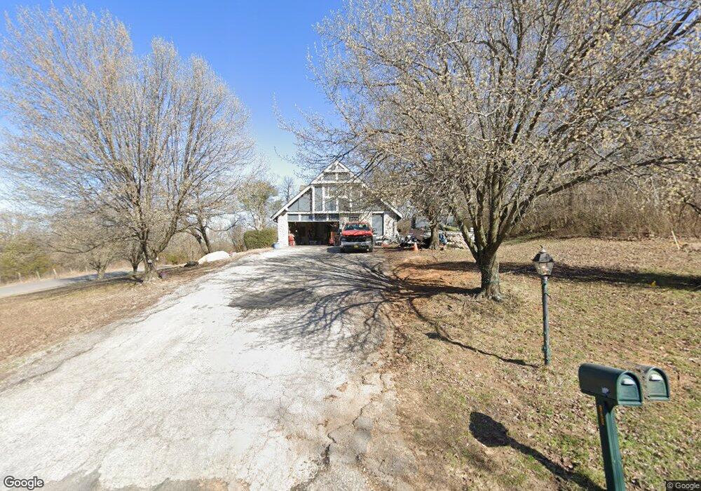
1003 Westland Rd Sapulpa, OK 74066
Estimated Value: $259,000 - $324,000
3
Beds
3
Baths
2,082
Sq Ft
$136/Sq Ft
Est. Value
About This Home
This home is located at 1003 Westland Rd, Sapulpa, OK 74066 and is currently estimated at $283,955, approximately $136 per square foot. 1003 Westland Rd is a home located in Creek County with nearby schools including Sapulpa Middle School, Sapulpa Junior High School, and Sapulpa High School.
Ownership History
Date
Name
Owned For
Owner Type
Purchase Details
Closed on
Jan 11, 2016
Sold by
Whitehouse Regina and Whitehouse Stecen D
Bought by
Whitehouse Regina and Whitehouse Steven D
Current Estimated Value
Home Financials for this Owner
Home Financials are based on the most recent Mortgage that was taken out on this home.
Original Mortgage
$98,000
Outstanding Balance
$77,472
Interest Rate
3.94%
Mortgage Type
New Conventional
Estimated Equity
$206,483
Purchase Details
Closed on
Dec 31, 2003
Sold by
Balthis William Brooks Tr
Bought by
Carlson Joel J and Carlson Regina M
Purchase Details
Closed on
Apr 17, 2001
Sold by
Kelly John and Kelly Vicki
Purchase Details
Closed on
Nov 25, 1992
Sold by
Dale and Joan Wilson
Create a Home Valuation Report for This Property
The Home Valuation Report is an in-depth analysis detailing your home's value as well as a comparison with similar homes in the area
Home Values in the Area
Average Home Value in this Area
Purchase History
| Date | Buyer | Sale Price | Title Company |
|---|---|---|---|
| Whitehouse Regina | -- | American Abstract & Title Co | |
| Carlson Joel J | $110,000 | -- | |
| -- | $129,000 | -- | |
| -- | $108,000 | -- |
Source: Public Records
Mortgage History
| Date | Status | Borrower | Loan Amount |
|---|---|---|---|
| Open | Whitehouse Regina | $98,000 |
Source: Public Records
Tax History Compared to Growth
Tax History
| Year | Tax Paid | Tax Assessment Tax Assessment Total Assessment is a certain percentage of the fair market value that is determined by local assessors to be the total taxable value of land and additions on the property. | Land | Improvement |
|---|---|---|---|---|
| 2025 | $1,818 | $18,954 | $1,920 | $17,034 |
| 2024 | $1,818 | $18,402 | $1,920 | $16,482 |
| 2023 | $1,818 | $17,866 | $1,920 | $15,946 |
| 2022 | $1,627 | $17,346 | $1,920 | $15,426 |
| 2021 | $1,612 | $16,841 | $1,920 | $14,921 |
| 2020 | $1,580 | $16,350 | $1,920 | $14,430 |
| 2019 | $1,561 | $15,874 | $1,920 | $13,954 |
| 2018 | $1,537 | $15,412 | $1,980 | $13,432 |
| 2017 | $1,541 | $15,412 | $1,980 | $13,432 |
| 2016 | $1,435 | $15,412 | $1,980 | $13,432 |
| 2015 | -- | $15,412 | $1,980 | $13,432 |
| 2014 | -- | $15,291 | $1,980 | $13,311 |
Source: Public Records
Map
Nearby Homes
- 2000 W Taft Ave
- 1401 Panther Ln
- 1330 Panther Ln
- 1755 S Stephanie St
- 1776 S Stephanie St
- 1515 Emily Cir
- 1160 W Keeling Ave
- 1120 W Keeling Ave
- 10 Sahoma Lake Rd
- 215 S Hawthorne St
- 21 Johnson Dr
- 1203 Johnson Dr
- 4244 N Spocogee St
- 1522 N Spocogee St
- 3335 N Spocogee St
- 408 S Muskogee St
- 920 S Oklahoma St
- 706 S Oklahoma St
- 909 S Oklahoma St
- 00 Sahoma Lake Rd
- 1009 Westland Rd
- 619 Westland Rd
- 1105 Westland Rd
- 1010 Westland Rd
- 1106 Westland Rd
- 1113 Westland Rd
- 1114 Westland Rd
- 1207 Westland Rd
- 12201 S Shaw Dr
- 1208 Westland Rd
- 1309 Westland Rd
- 1700 W Taft Ave
- 1212 Westland Rd
- 1206 W Taft Ave
- 287 Westland
- 1520 W Taft Ave
- 286 Westland
- 12237 S Shaw Dr
- 0 W 122nd
- 1315 Westland Rd