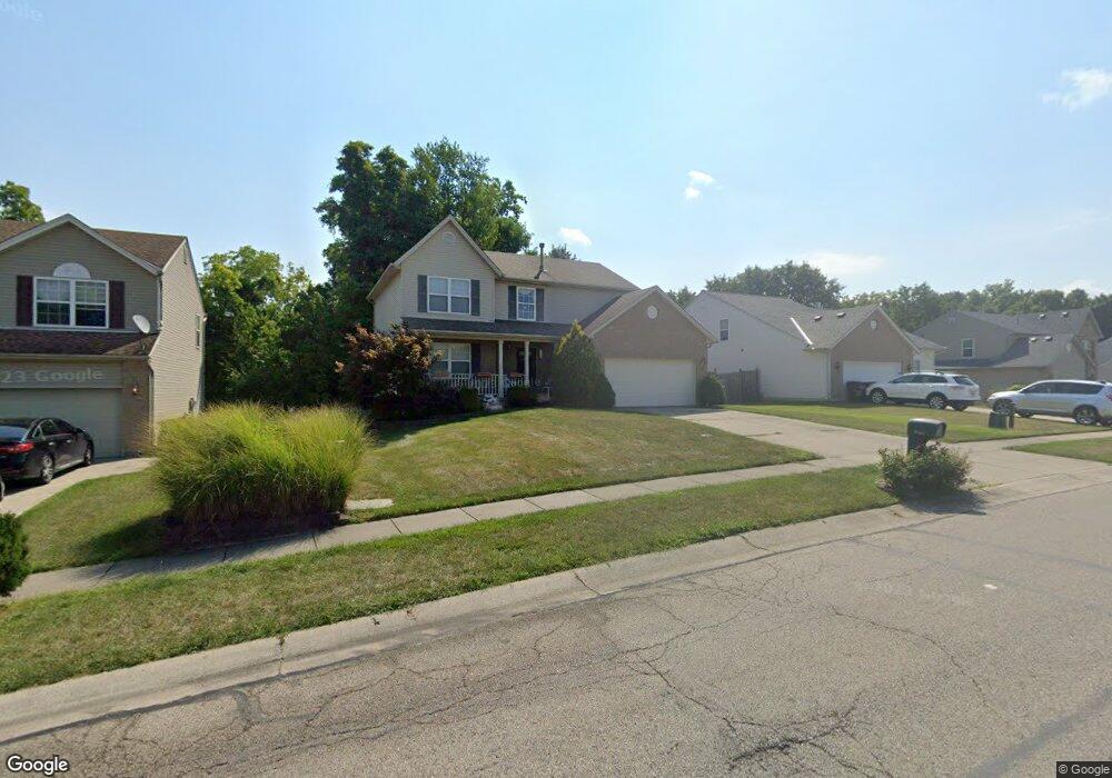
10030 Trapp Ln Cincinnati, OH 45231
New Burlington NeighborhoodEstimated Value: $289,000 - $330,000
3
Beds
3
Baths
1,874
Sq Ft
$163/Sq Ft
Est. Value
About This Home
This home is located at 10030 Trapp Ln, Cincinnati, OH 45231 and is currently estimated at $306,396, approximately $163 per square foot. 10030 Trapp Ln is a home located in Hamilton County with nearby schools including Mt Healthy High School, Hamilton County Mathematics and Science Academy, and Central Montessori Academy.
Ownership History
Date
Name
Owned For
Owner Type
Purchase Details
Closed on
Dec 21, 2001
Sold by
Crossmann Communities Of Ohio Inc
Bought by
Dubois Tonda and Dubois Tycha
Current Estimated Value
Home Financials for this Owner
Home Financials are based on the most recent Mortgage that was taken out on this home.
Original Mortgage
$159,894
Outstanding Balance
$59,527
Interest Rate
6.52%
Estimated Equity
$246,869
Purchase Details
Closed on
Aug 10, 2001
Sold by
Map Research Llc
Bought by
Crossmann Communities Of Ohio Inc
Create a Home Valuation Report for This Property
The Home Valuation Report is an in-depth analysis detailing your home's value as well as a comparison with similar homes in the area
Home Values in the Area
Average Home Value in this Area
Purchase History
| Date | Buyer | Sale Price | Title Company |
|---|---|---|---|
| Dubois Tonda | $168,400 | First Title Agency Inc | |
| Crossmann Communities Of Ohio Inc | $62,000 | -- |
Source: Public Records
Mortgage History
| Date | Status | Borrower | Loan Amount |
|---|---|---|---|
| Open | Dubois Tonda | $159,894 |
Source: Public Records
Tax History
| Year | Tax Paid | Tax Assessment Tax Assessment Total Assessment is a certain percentage of the fair market value that is determined by local assessors to be the total taxable value of land and additions on the property. | Land | Improvement |
|---|---|---|---|---|
| 2025 | $4,982 | $85,712 | $12,366 | $73,346 |
| 2023 | $4,689 | $85,712 | $12,366 | $73,346 |
| 2022 | $4,174 | $54,926 | $12,117 | $42,809 |
| 2021 | $4,063 | $54,926 | $12,117 | $42,809 |
| 2020 | $4,124 | $54,926 | $12,117 | $42,809 |
| 2019 | $4,279 | $53,327 | $11,764 | $41,563 |
| 2018 | $4,303 | $53,327 | $11,764 | $41,563 |
| 2017 | $4,083 | $53,327 | $11,764 | $41,563 |
| 2016 | $4,094 | $52,700 | $11,862 | $40,838 |
| 2015 | $4,125 | $52,700 | $11,862 | $40,838 |
| 2014 | $4,106 | $52,700 | $11,862 | $40,838 |
| 2013 | $4,231 | $55,472 | $12,485 | $42,987 |
Source: Public Records
Map
Nearby Homes
- 9925 Grasscreek Ct
- 2005 Miles Rd
- 9978 Greenriver Dr
- 10228 Springbeauty Ln
- 10073 Pippin Rd
- 2473 Schon Dr
- 2528 Mariposa St
- 2456 Fulbourne Dr
- 2585 Fulbourne Dr
- 2792 Wheatfield Dr
- 2626 Ontario St
- 2497 Ontario St
- 10123 Manistee Way
- 2788 Hazelton Ct
- 1805 Miles Rd
- 9852 Wiscasset Way
- 624 Brightview Dr
- 626 Brightview Dr
- 606 Brightview Dr
- 610 Brightview Dr
Your Personal Tour Guide
Ask me questions while you tour the home.