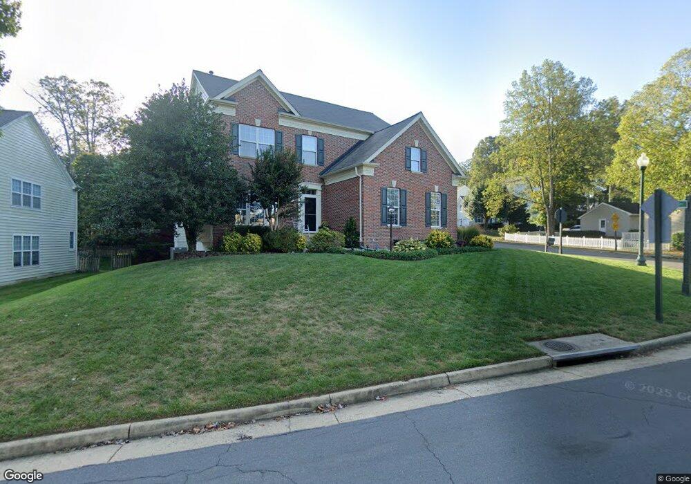
10033 Cairn Mountain Way Bristow, VA 20136
Villages At Saybrooke NeighborhoodEstimated Value: $725,000 - $777,000
4
Beds
3
Baths
2,472
Sq Ft
$305/Sq Ft
Est. Value
About This Home
This home is located at 10033 Cairn Mountain Way, Bristow, VA 20136 and is currently estimated at $754,241, approximately $305 per square foot. 10033 Cairn Mountain Way is a home located in Prince William County with nearby schools including Patriot High School, Cedar Point Elementary School, and E.H. Marsteller Middle School.
Ownership History
Date
Name
Owned For
Owner Type
Purchase Details
Closed on
Jan 11, 2002
Sold by
Echols Mihcael A
Bought by
Parowski R Mark
Current Estimated Value
Home Financials for this Owner
Home Financials are based on the most recent Mortgage that was taken out on this home.
Original Mortgage
$260,900
Outstanding Balance
$106,616
Interest Rate
7.04%
Mortgage Type
New Conventional
Estimated Equity
$647,625
Purchase Details
Closed on
Dec 23, 1998
Sold by
Coscan Washington Inc
Bought by
Echols Michael A
Home Financials for this Owner
Home Financials are based on the most recent Mortgage that was taken out on this home.
Original Mortgage
$195,650
Interest Rate
6.89%
Create a Home Valuation Report for This Property
The Home Valuation Report is an in-depth analysis detailing your home's value as well as a comparison with similar homes in the area
Home Values in the Area
Average Home Value in this Area
Purchase History
| Date | Buyer | Sale Price | Title Company |
|---|---|---|---|
| Parowski R Mark | $289,900 | -- | |
| Echols Michael A | $217,390 | -- |
Source: Public Records
Mortgage History
| Date | Status | Borrower | Loan Amount |
|---|---|---|---|
| Open | Parowski R Mark | $260,900 | |
| Previous Owner | Echols Michael A | $195,650 |
Source: Public Records
Tax History Compared to Growth
Tax History
| Year | Tax Paid | Tax Assessment Tax Assessment Total Assessment is a certain percentage of the fair market value that is determined by local assessors to be the total taxable value of land and additions on the property. | Land | Improvement |
|---|---|---|---|---|
| 2025 | $6,134 | $672,400 | $193,400 | $479,000 |
| 2024 | $6,134 | $616,800 | $184,200 | $432,600 |
| 2023 | $6,096 | $585,900 | $174,700 | $411,200 |
| 2022 | $6,180 | $547,700 | $150,200 | $397,500 |
| 2021 | $5,843 | $478,800 | $132,100 | $346,700 |
| 2020 | $6,698 | $432,100 | $120,200 | $311,900 |
| 2019 | $6,595 | $425,500 | $120,200 | $305,300 |
| 2018 | $5,006 | $414,600 | $114,500 | $300,100 |
| 2017 | $4,959 | $401,900 | $114,500 | $287,400 |
| 2016 | $4,789 | $391,600 | $108,900 | $282,700 |
| 2015 | $4,706 | $393,300 | $108,900 | $284,400 |
| 2014 | $4,706 | $376,500 | $103,800 | $272,700 |
Source: Public Records
Map
Nearby Homes
- 12151 Hayfield Ct
- Hampton II Plan at Parkgate Estates
- 12127 & 12131 Vint Hill Rd
- 12021 Spring Beauty Rd
- 12048 Elliots Oak Place
- 12750 Brewland Way
- 10028 Boreland Ct
- 10512 Blazing Star Loop
- 9656 Bedder Stone Place
- 12054 Nokesville Rd
- 9579 Scales Place
- 10045 Pentland Hills Way
- 10554 Andrew Humphreys Ct
- 9475 Sarah Mill Terrace
- 10423 Rifle Rd
- 9381 Crestview Ridge Dr
- 9293 Crestview Ridge Dr
- 9318 Crestview Ridge Dr
- 9244 Crestview Ridge Dr
- 9478 Merrimont Trace Cir
- 12375 Fife Ness Ct
- 10037 Cairn Mountain Way
- 12391 Burghead Dr
- 12378 Fife Ness Ct
- 10041 Cairn Mountain Way
- 12365 Fife Ness Ct
- 12355 Fife Ness Ct
- 12395 Burghead Dr
- 10025 Cairn Mountain Way
- 10040 Cairn Mountain Way
- 12374 Fife Ness Ct
- 12351 Fife Ness Ct
- 10045 Cairn Mountain Way
- 12370 Fife Ness Ct
- 12399 Burghead Dr
- 10036 Cairn Mountain Way
- 10044 Cairn Mountain Way
- 10021 Cairn Mountain Way
- 12511 Selkirk Cir
- 12347 Fife Ness Ct