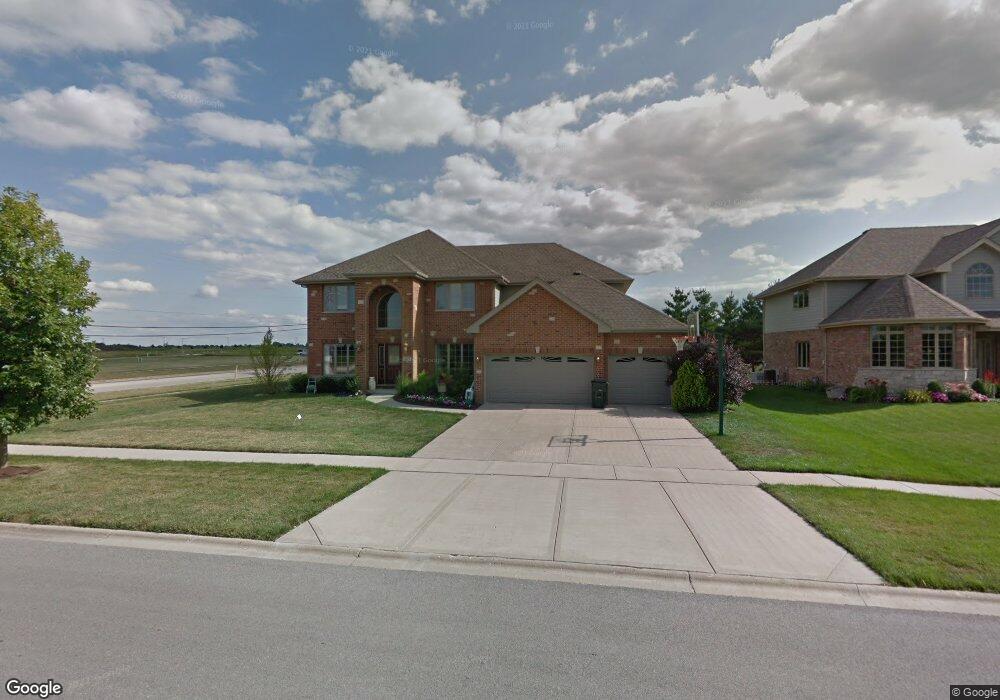
1004 Brooke Ln New Lenox, IL 60451
Estimated Value: $566,000 - $655,000
5
Beds
3
Baths
--
Sq Ft
0.33
Acres
About This Home
This home is located at 1004 Brooke Ln, New Lenox, IL 60451 and is currently estimated at $593,520. 1004 Brooke Ln is a home located in Will County with nearby schools including Nelson Prairie School, Lincoln Way West, and St. Jude School.
Ownership History
Date
Name
Owned For
Owner Type
Purchase Details
Closed on
Jun 29, 2007
Sold by
Rathfarn Builders Inc
Bought by
Flores Eduardo and Flores Nancy
Current Estimated Value
Home Financials for this Owner
Home Financials are based on the most recent Mortgage that was taken out on this home.
Original Mortgage
$46,000
Interest Rate
6.42%
Mortgage Type
Stand Alone Second
Create a Home Valuation Report for This Property
The Home Valuation Report is an in-depth analysis detailing your home's value as well as a comparison with similar homes in the area
Home Values in the Area
Average Home Value in this Area
Purchase History
| Date | Buyer | Sale Price | Title Company |
|---|---|---|---|
| Flores Eduardo | $467,000 | Chicago Title Insurance | |
| Rathfarn Builders Inc | -- | Chicago Title Insurance |
Source: Public Records
Mortgage History
| Date | Status | Borrower | Loan Amount |
|---|---|---|---|
| Closed | Rathfarn Builders Inc | $46,000 | |
| Open | Flores Eduardo | $373,600 |
Source: Public Records
Tax History Compared to Growth
Tax History
| Year | Tax Paid | Tax Assessment Tax Assessment Total Assessment is a certain percentage of the fair market value that is determined by local assessors to be the total taxable value of land and additions on the property. | Land | Improvement |
|---|---|---|---|---|
| 2024 | $13,331 | $172,276 | $37,901 | $134,375 |
| 2023 | $13,331 | $157,043 | $34,550 | $122,493 |
| 2022 | $12,821 | $144,674 | $31,829 | $112,845 |
| 2021 | $11,399 | $136,061 | $29,934 | $106,127 |
| 2020 | $11,079 | $131,206 | $28,866 | $102,340 |
| 2019 | $10,608 | $127,138 | $27,971 | $99,167 |
| 2018 | $10,368 | $122,756 | $27,007 | $95,749 |
| 2017 | $9,855 | $119,227 | $26,231 | $92,996 |
| 2016 | $9,570 | $116,036 | $25,529 | $90,507 |
| 2015 | $9,223 | $112,383 | $24,725 | $87,658 |
| 2014 | $9,223 | $110,996 | $24,420 | $86,576 |
| 2013 | $9,223 | $112,492 | $24,749 | $87,743 |
Source: Public Records
Map
Nearby Homes
- 2763 Foxwood Dr Unit 2763
- 1205 Jennie Dr
- 1108 Yamma Ridge
- 1179 Yamma Ridge
- 2788 Meadow Path
- 1019 James Pass
- 2305 Kerry Winde Dr
- 2206 Daniel Lewis Dr
- 1914 Heatherway Ln Unit 27
- 1801 Stonebridge Dr
- 14620 W Laraway Rd
- 000 W Baker Rd
- 22250 Gougar Rd
- 15551 W Baker Rd
- 2341 Stone Creek Dr
- 2331 Stone Creek Dr
- 2321 Stone Creek Dr
- 2381 Stone Creek Dr
- 2301 Stone Creek Dr
- 2291 Stone Creek Dr
- 1018 Brooke Ln
- 1032 Brooke Ln
- 1025 Stacey Dr
- 1004 Chase Trail
- 1060 Brooke Ln
- 1018 Chase Trail
- 2867 Brett Dr
- 1032 Chase Trail
- 1074 Brooke Ln
- 1077 Brooke Ln
- 1046 Chase Trail
- 2857 Brett Dr
- 2851 Brett Dr
- 915 Stacey Dr
- 2847 Brett Dr
- 1040 Stacey Dr
- 1085 Brooke Ln
- 1088 Brooke Ln
- 1060 Chase Trail
- 2686 Barcoo Bend