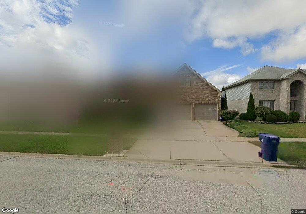
1004 Donnington Dr Matteson, IL 60443
West Matteson NeighborhoodEstimated Value: $442,117 - $491,000
About This Home
This home is located at 1004 Donnington Dr, Matteson, IL 60443 and is currently estimated at $463,529, approximately $142 per square foot. 1004 Donnington Dr is a home located in Cook County with nearby schools including Colin Powell Middle School.
Ownership History
We collect this data history from publicly available records. To have your information removed, we recommend requesting removal directly through your county’s website.
Purchase Details
Purchase Details
Home Financials for this Owner
Home Financials are based on the most recent Mortgage that was taken out on this home.Purchase Details
Purchase Details
Home Financials for this Owner
Home Financials are based on the most recent Mortgage that was taken out on this home.Home Values in the Area
Average Home Value in this Area
Purchase History
We collect this data history from publicly available records. To have your information removed, we recommend requesting removal directly through your county’s website.
| Date | Buyer | Sale Price | Title Company |
|---|---|---|---|
| -- | None Available | ||
| $245,000 | Premier Title | ||
| -- | Premier Title | ||
| $400,500 | Enterprise Land Title Ltd |
Mortgage History
We collect this data history from publicly available records. To have your information removed, we recommend requesting removal directly through your county’s website.
| Date | Status | Borrower | Loan Amount |
|---|---|---|---|
| Previous Owner | $237,986 | ||
| Previous Owner | $320,047 |
Tax History
We collect this data history from publicly available records. To have your information removed, we recommend requesting removal directly through your county’s website.
| Year | Tax Paid | Tax Assessment Tax Assessment Total Assessment is a certain percentage of the fair market value that is determined by local assessors to be the total taxable value of land and additions on the property. | Land | Improvement |
|---|---|---|---|---|
| 2025 | $12,640 | $36,460 | $5,047 | $31,413 |
| 2024 | $12,640 | $36,460 | $5,047 | $31,413 |
| 2023 | $10,574 | $36,460 | $5,047 | $31,413 |
| 2022 | $10,574 | $25,907 | $4,359 | $21,548 |
| 2021 | $10,760 | $25,905 | $4,358 | $21,547 |
| 2020 | $11,390 | $27,395 | $4,358 | $23,037 |
| 2019 | $10,034 | $24,537 | $3,899 | $20,638 |
| 2018 | $11,362 | $24,537 | $3,899 | $20,638 |
| 2017 | $11,079 | $24,537 | $3,899 | $20,638 |
| 2016 | $12,305 | $26,989 | $3,441 | $23,548 |
| 2015 | $12,381 | $26,989 | $3,441 | $23,548 |
| 2014 | $13,035 | $28,937 | $3,441 | $25,496 |
| 2013 | $12,793 | $30,439 | $3,441 | $26,998 |
Map
- 6216 Pond View Dr
- 911 Berry Path Trail Unit 1191
- 21154 Whitney Dr
- 21158 Sophia Dr
- 21143 Gray Hawk Dr Unit 2554
- 6159 Marsh Ln
- 6403 Blue Sky Ln Unit 2532
- 21229 Sophia Dr
- 21223 Alessandra Dr
- 1038 Regent Dr
- 6503 Blue Sky Ln Unit 2502
- 997 Regent Dr
- 0 Ridgeland Ave
- 6500 Pasture Side Trail
- 818 Princeton Ave
- 6508 Fawn Ct
- 6704 Bridle Path Dr
- 6616 Old Plank Blvd
- 5631 Colgate Ln
- 386 Buttercup Ln
- 1008 Donnington Dr
- 1000 Donnington Dr
- 1005 Great Plains Ave
- 1009 Great Plains Ave
- 1001 Great Plains Ave
- 1012 Donnington Dr
- 928 Donnington Dr
- 1013 Great Plains Ave
- 1005 Donnington Dr
- 1009 Donnington Dr
- 921 Great Plains Ave
- 1001 Donnington Dr
- 1013 Donnington Dr
- 1016 Donnington Dr
- 924 Donnington Dr
- 1017 Great Plains Ave
- 927 Donnington Dr
- 917 Great Plains Ave
- 1017 Donnington Dr
- 1004 Berkshire Dr
Ask me questions while you tour the home.