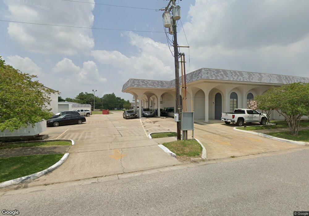
1004 Highway 91 Eunice, LA 70535
Estimated Value: $112,000 - $259,000
Studio
--
Bath
--
Sq Ft
1.92
Acres
About This Home
This home is located at 1004 Highway 91, Eunice, LA 70535 and is currently estimated at $185,071. 1004 Highway 91 is a home located in St. Landry Parish with nearby schools including Eunice Elementary School, Eunice Junior High School, and Central Middle School.
Ownership History
Date
Name
Owned For
Owner Type
Purchase Details
Closed on
Apr 30, 2022
Sold by
Richard Ward Janet Marie
Bought by
Ward Michael Scott
Current Estimated Value
Purchase Details
Closed on
Apr 29, 2022
Sold by
Belfour Investments Llc
Bought by
Ward Janet Marie Richar
Purchase Details
Closed on
Sep 29, 2020
Sold by
Clause Properties Llc
Bought by
Belfour Investments Llc
Home Financials for this Owner
Home Financials are based on the most recent Mortgage that was taken out on this home.
Original Mortgage
$129,323
Interest Rate
2.9%
Mortgage Type
New Conventional
Purchase Details
Closed on
Oct 17, 2017
Sold by
Burnett Jimmy R
Bought by
Talcam Llc
Purchase Details
Closed on
Aug 11, 2015
Bought by
Ray Jimmy
Create a Home Valuation Report for This Property
The Home Valuation Report is an in-depth analysis detailing your home's value as well as a comparison with similar homes in the area
Purchase History
| Date | Buyer | Sale Price | Title Company |
|---|---|---|---|
| Ward Michael Scott | -- | None Listed On Document | |
| Ward Janet Marie Richar | $200,000 | None Listed On Document | |
| Belfour Investments Llc | $160,000 | None Available | |
| Talcam Llc | $155,000 | None Available | |
| Ray Jimmy | -- | -- |
Source: Public Records
Mortgage History
| Date | Status | Borrower | Loan Amount |
|---|---|---|---|
| Previous Owner | Belfour Investments Llc | $129,323 |
Source: Public Records
Tax History
| Year | Tax Paid | Tax Assessment Tax Assessment Total Assessment is a certain percentage of the fair market value that is determined by local assessors to be the total taxable value of land and additions on the property. | Land | Improvement |
|---|---|---|---|---|
| 2024 | $11 | $24,860 | $2,450 | $22,410 |
| 2023 | $1,002 | $12,700 | $2,450 | $10,250 |
| 2022 | $1,002 | $12,700 | $2,450 | $10,250 |
| 2021 | $1,002 | $22,320 | $2,450 | $19,870 |
| 2020 | $1,002 | $22,320 | $2,450 | $19,870 |
| 2019 | $1,070 | $21,940 | $2,450 | $19,490 |
| 2018 | $945 | $19,260 | $2,450 | $16,810 |
| 2017 | $945 | $19,260 | $2,450 | $16,810 |
| 2015 | $915 | $18,870 | $2,450 | $16,420 |
| 2013 | $223 | $4,600 | $2,300 | $2,300 |
Source: Public Records
Map
Nearby Homes
- 1480 W Oak Ave
- 1410 W Elm St
- 1820 Betty St
- 200 Thayer Ave
- 1350 College Rd
- 1311 Bruce Ave
- 1230 Phillip Ave
- 1240 B and B Ave
- 231 Eula St
- 151 Dulles St
- 1750 W Peach Ave
- 1701 W Peach Ave
- 1440 W Peach Ave
- 99 University Place
- 101 University Place
- 130 Jeansonne St
- 0 Savannah Unit SWL25001182
- 0 W Maple Ave
- 1 Rena Rd
- 2 Rena Rd
- 1020 Highway 91
- 129 Jeanne St
- 133 Jeanne St
- TBD Eunice Iota Hwy
- Tract 1 Eunice Iota
- Tract 2 Eunice Iota Hwy
- 135 Jeanne St
- 117 Jeanne St
- 0 Jeanne St
- 137 Jeanne St
- 141 Jeanne St
- 128 Jeanne St
- 128 Jeanne St
- 136 Jeanne St
- 120 Jeanne St
- 153 Jeanne St
- 111 Jeanne St
- 138 Jeanne St
- 116 Jeanne St
- 148 Jeanne St
Your Personal Tour Guide
Ask me questions while you tour the home.