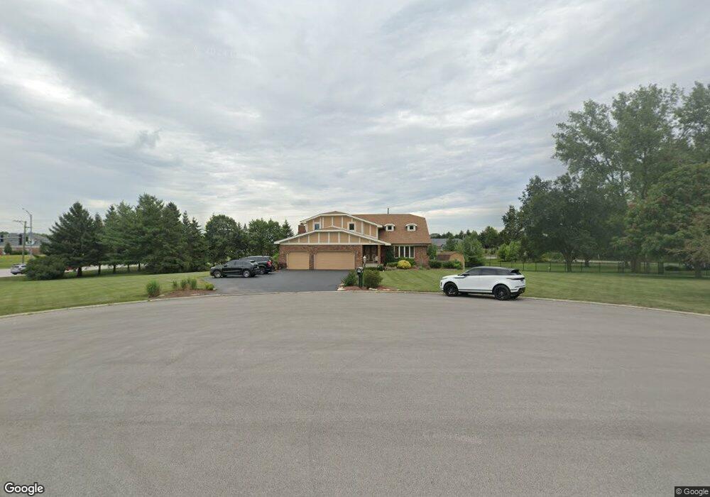
1004 Joey Ct New Lenox, IL 60451
Estimated Value: $658,000 - $840,635
6
Beds
5
Baths
4,792
Sq Ft
$149/Sq Ft
Est. Value
About This Home
This home is located at 1004 Joey Ct, New Lenox, IL 60451 and is currently estimated at $714,159, approximately $149 per square foot. 1004 Joey Ct is a home located in Will County with nearby schools including Spencer Trail, Spencer Pointe, and Spencer Crossing Intermediate School.
Ownership History
Date
Name
Owned For
Owner Type
Purchase Details
Closed on
Dec 7, 2018
Sold by
Miotti Marc A and Miotti Rita J
Bought by
Miotti Jerome and Miotti Marc A
Current Estimated Value
Purchase Details
Closed on
Nov 23, 2001
Sold by
Suburban Bank & Trust Company
Bought by
Miotti Marc A and Miotti Rita J
Home Financials for this Owner
Home Financials are based on the most recent Mortgage that was taken out on this home.
Original Mortgage
$250,000
Outstanding Balance
$92,519
Interest Rate
6%
Estimated Equity
$621,640
Create a Home Valuation Report for This Property
The Home Valuation Report is an in-depth analysis detailing your home's value as well as a comparison with similar homes in the area
Home Values in the Area
Average Home Value in this Area
Purchase History
| Date | Buyer | Sale Price | Title Company |
|---|---|---|---|
| Miotti Jerome | -- | Attorney | |
| Miotti Marc A | $320,000 | Chicago Title Insurance Co |
Source: Public Records
Mortgage History
| Date | Status | Borrower | Loan Amount |
|---|---|---|---|
| Open | Miotti Marc A | $250,000 |
Source: Public Records
Tax History Compared to Growth
Tax History
| Year | Tax Paid | Tax Assessment Tax Assessment Total Assessment is a certain percentage of the fair market value that is determined by local assessors to be the total taxable value of land and additions on the property. | Land | Improvement |
|---|---|---|---|---|
| 2024 | $14,258 | $199,106 | $54,305 | $144,801 |
| 2023 | $14,258 | $181,500 | $49,503 | $131,997 |
| 2022 | $12,972 | $167,204 | $45,604 | $121,600 |
| 2021 | $12,298 | $157,250 | $42,889 | $114,361 |
| 2020 | $13,053 | $151,640 | $41,359 | $110,281 |
| 2019 | $12,511 | $146,938 | $40,077 | $106,861 |
| 2018 | $11,295 | $141,873 | $38,695 | $103,178 |
| 2017 | $10,715 | $137,795 | $37,583 | $100,212 |
| 2016 | $10,399 | $134,107 | $36,577 | $97,530 |
| 2015 | $10,331 | $129,886 | $35,426 | $94,460 |
| 2014 | $10,331 | $128,283 | $34,989 | $93,294 |
| 2013 | $10,331 | $130,013 | $35,461 | $94,552 |
Source: Public Records
Map
Nearby Homes
- 12118 Sarkis Dr
- 2609 Walter Dr
- 12415 Foxborough Dr
- 12417 Lajunta Ct
- 19411 Baron Rd
- 19909 Foxborough Dr
- 501 Bryan Trail
- 11966 Duchess Ave
- 19418 Boulder Ridge Dr
- 11525 Edgewood Dr
- 12526 Surrey Ct
- 19502 115th Ave Unit A
- 11420 Kluth Dr
- 11323 1st St
- 11325 1st St
- 12752 Berkshire Dr
- 19429 114th Ave
- Willowcrest Lot 2 Willowcrest
- 1920 Tessington Ct
- 1931 Tessington Ct
- 1000 Joey Ct
- 1009 Joey Ct
- 1005 Joey Ct
- 19924 S Townline Rd
- 1001 Joey Ct
- 11936 Bryan Ct
- 11924 Bryan Ct
- 11941 Bryan Ct
- 1008 Donald Ct
- 1004 Donald Ct
- 1000 Donald Ct
- 19850 Golden Oak Ln
- 11905 Bryan Ct
- 11929 Bryan Ct
- 11900 Bryan Ct
- 19824 Golden Oak Ln
- 19864 Golden Oak Ln
- 12019 Sarkis Dr
- 12005 Sarkis Dr
- 12033 Sarkis Dr