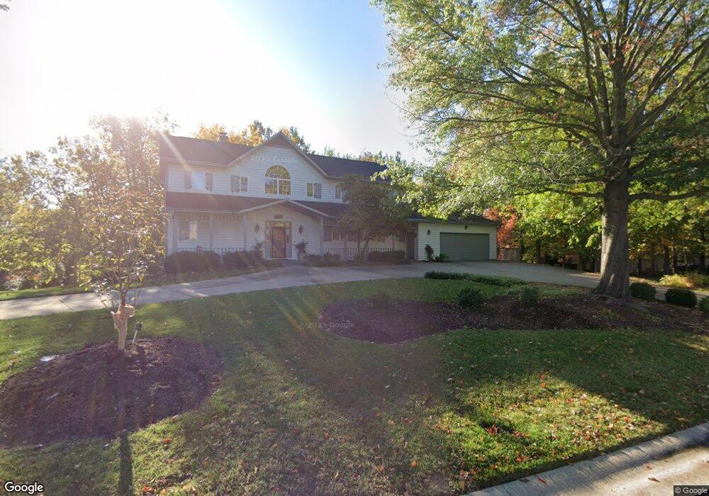
1004 Lagrange Ct Columbia, MO 65203
Old Southwest NeighborhoodEstimated Value: $746,000 - $918,000
4
Beds
5
Baths
4,164
Sq Ft
$195/Sq Ft
Est. Value
About This Home
This home is located at 1004 Lagrange Ct, Columbia, MO 65203 and is currently estimated at $814,012, approximately $195 per square foot. 1004 Lagrange Ct is a home located in Boone County with nearby schools including Grant Elementary School, West Middle School, and David H. Hickman High School.
Ownership History
Date
Name
Owned For
Owner Type
Purchase Details
Closed on
Jan 8, 2015
Sold by
Harper Milton E and Harper Deanna Ward
Bought by
Harper Milton E and Harper Deanna
Current Estimated Value
Purchase Details
Closed on
Jun 2, 2008
Sold by
Harper Milton E and Harper Deanna Ward
Bought by
Harper Milton E and Harper Deanna Ward
Create a Home Valuation Report for This Property
The Home Valuation Report is an in-depth analysis detailing your home's value as well as a comparison with similar homes in the area
Home Values in the Area
Average Home Value in this Area
Purchase History
| Date | Buyer | Sale Price | Title Company |
|---|---|---|---|
| Harper Milton E | -- | None Available | |
| Harper Milton E | -- | None Available | |
| Harper Milton E | -- | None Available |
Source: Public Records
Tax History Compared to Growth
Tax History
| Year | Tax Paid | Tax Assessment Tax Assessment Total Assessment is a certain percentage of the fair market value that is determined by local assessors to be the total taxable value of land and additions on the property. | Land | Improvement |
|---|---|---|---|---|
| 2025 | $6,559 | $111,264 | $14,459 | $96,805 |
| 2024 | $6,555 | $97,166 | $14,459 | $82,707 |
| 2023 | $6,501 | $97,166 | $14,459 | $82,707 |
| 2022 | $6,013 | $89,965 | $14,459 | $75,506 |
| 2021 | $6,024 | $89,965 | $14,459 | $75,506 |
| 2020 | $5,936 | $83,296 | $14,459 | $68,837 |
| 2019 | $5,434 | $76,252 | $14,459 | $61,793 |
| 2018 | $5,067 | $0 | $0 | $0 |
| 2017 | $5,005 | $70,604 | $14,459 | $56,145 |
| 2016 | $5,137 | $70,604 | $14,459 | $56,145 |
| 2015 | $4,739 | $70,604 | $14,459 | $56,145 |
| 2014 | $4,765 | $70,604 | $14,459 | $56,145 |
Source: Public Records
Map
Nearby Homes
- 1109 Lakeshore Dr
- 711 Thilly Ave
- 504 S Glenwood Ave
- 1102 Westwinds Dr
- 303 S Glenwood Ave
- 1020 Prospect St
- 1108 W Stewart Rd
- 812 W Broadway
- 1402 W Rollins Rd
- 208 N Garth Ave
- 1660 Highridge Cir
- 705 Westridge Dr
- 301 Crown Point
- 20 Clinton Dr
- 407 Oak St
- 502 W Worley St
- 401 W Worley St
- 2708 Goldcrest Ct
- 600 N Providence Rd Unit 100
- 602 N Providence Rd Unit 100
- 212 W Ridgeley Rd
- 1008 Lagrange Ct
- LOT 15 Lagrange Ct
- LOT 16 Lagrange Ct
- L15 & L16 Lagrange Ct
- 1020 Lagrange Ct
- 1001 Lagrange Ct
- 1005 Lagrange Ct
- 1009 Lagrange Ct
- 208 W Ridgeley Rd
- 923 Lagrange Rd
- 1016 Lagrange Ct
- 209 W Brandon Rd
- 1013 Lagrange Ct
- 1024 Lagrange Ct
- 211 W Ridgeley Rd
- 322 W Burnam Rd
- 320 W Burnam Rd
- 200 W Ridgeley Rd
- 207 W Brandon Rd