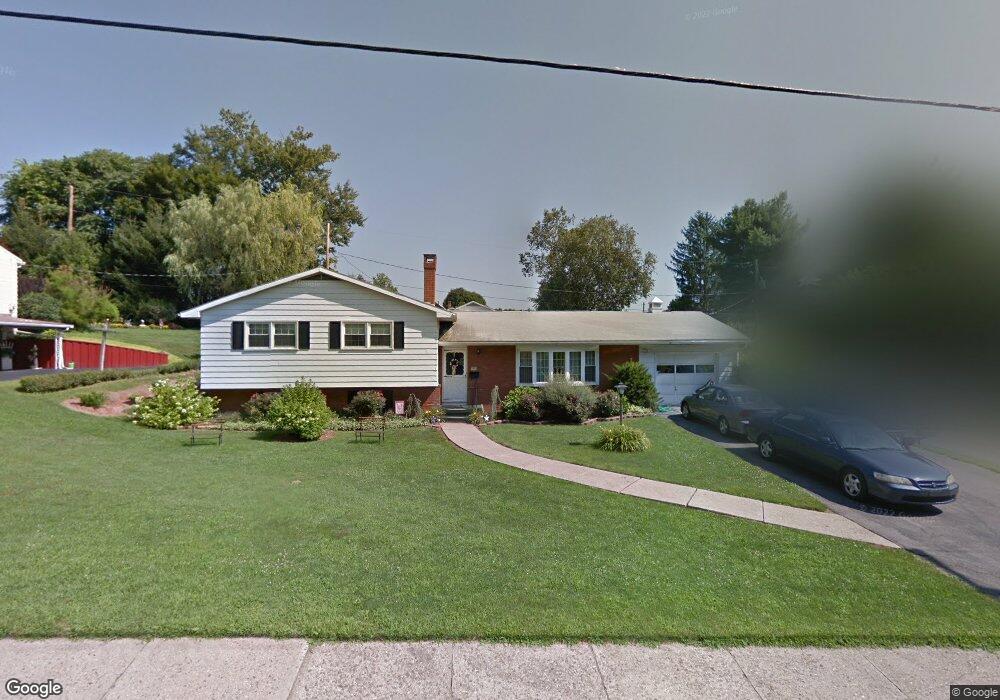
1004 Locust St Jersey Shore, PA 17740
Estimated Value: $158,000 - $212,367
3
Beds
1
Bath
2,184
Sq Ft
$83/Sq Ft
Est. Value
About This Home
This home is located at 1004 Locust St, Jersey Shore, PA 17740 and is currently estimated at $182,342, approximately $83 per square foot. 1004 Locust St is a home located in Lycoming County with nearby schools including Jersey Shore Area Senior High School and Walnut Street Christian School.
Ownership History
Date
Name
Owned For
Owner Type
Purchase Details
Closed on
Jul 18, 2011
Sold by
Vanemon Michael A and Vanemon Laura L
Bought by
Snyder Robert C and Snyder Jean Ann
Current Estimated Value
Home Financials for this Owner
Home Financials are based on the most recent Mortgage that was taken out on this home.
Original Mortgage
$145,000
Outstanding Balance
$103,167
Interest Rate
5.25%
Mortgage Type
Adjustable Rate Mortgage/ARM
Estimated Equity
$79,175
Purchase Details
Closed on
Jan 17, 2006
Sold by
Alouisa James A
Bought by
Vanemon Michael A
Create a Home Valuation Report for This Property
The Home Valuation Report is an in-depth analysis detailing your home's value as well as a comparison with similar homes in the area
Home Values in the Area
Average Home Value in this Area
Purchase History
| Date | Buyer | Sale Price | Title Company |
|---|---|---|---|
| Snyder Robert C | $145,000 | None Available | |
| Vanemon Michael A | -- | None Available |
Source: Public Records
Mortgage History
| Date | Status | Borrower | Loan Amount |
|---|---|---|---|
| Open | Snyder Robert C | $145,000 |
Source: Public Records
Tax History Compared to Growth
Tax History
| Year | Tax Paid | Tax Assessment Tax Assessment Total Assessment is a certain percentage of the fair market value that is determined by local assessors to be the total taxable value of land and additions on the property. | Land | Improvement |
|---|---|---|---|---|
| 2025 | $3,433 | $97,230 | $18,000 | $79,230 |
| 2024 | $3,376 | $97,230 | $18,000 | $79,230 |
| 2023 | $3,351 | $97,230 | $18,000 | $79,230 |
| 2022 | $3,338 | $97,230 | $18,000 | $79,230 |
| 2021 | $3,321 | $97,230 | $18,000 | $79,230 |
| 2020 | $3,318 | $97,230 | $18,000 | $79,230 |
| 2019 | $3,169 | $97,230 | $18,000 | $79,230 |
| 2018 | $3,132 | $97,230 | $18,000 | $79,230 |
| 2017 | $3,001 | $97,230 | $18,000 | $79,230 |
| 2016 | $2,827 | $97,230 | $18,000 | $79,230 |
| 2015 | $2,827 | $97,230 | $18,000 | $79,230 |
Source: Public Records
Map
Nearby Homes
- 117 Kendall Ave
- 1126 Allegheny St
- 10 Shaffer Ln
- 1236 & 1240 Allegheny St
- 315 Glover St
- 333 Glover St
- 1308 Allegheny St
- 1236 - 1318 Allegheny St Unit 19 UNITS
- 121 Fountain St
- 310 S Lincoln Ave
- 1427 Walnut St
- 1435 Locust St
- 124 Pine St
- 9595 Route 220 Hwy
- 421 Wilson St
- 219 Maple St
- 150 Pine Creek Ave
- 240 Smith St
- 509 Burke St
- 323 N Lincoln Ave
- 1008 Locust St
- 216 Kerr Ave
- 910 Locust St
- 1010 Locust St
- 214 Kerr Ave
- 1012 Michael St
- 1012 Locust St
- 218 Kendall Ave
- 214 Kendall Ave
- 210 Kerr Ave
- 1020 Michael St
- 1009 Thompson St
- 1024 Michael St
- 907 Thompson St
- 1014 Locust St
- 1015 Thompson St
- 1007 Thompson St
- 210 Kendall Ave
- 905 Thompson St
- 205 Howard St