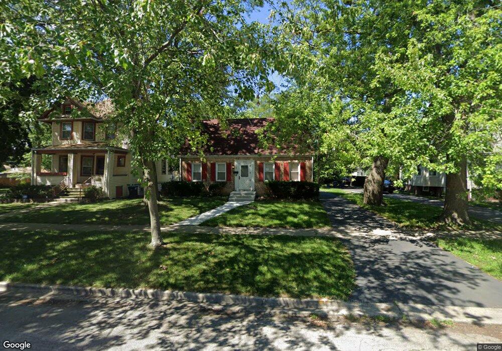
1004 N 4th Ave Maywood, IL 60153
North Maywood NeighborhoodEstimated Value: $291,000 - $352,000
4
Beds
3
Baths
1,589
Sq Ft
$204/Sq Ft
Est. Value
About This Home
This home is located at 1004 N 4th Ave, Maywood, IL 60153 and is currently estimated at $324,874, approximately $204 per square foot. 1004 N 4th Ave is a home located in Cook County with nearby schools including Lincoln Elementary School, Stevenson Middle School, and Proviso East High School.
Ownership History
Date
Name
Owned For
Owner Type
Purchase Details
Closed on
Sep 20, 1996
Sold by
Thoelke Mark and Thoelke Teresa J
Bought by
Eaton Michael A
Current Estimated Value
Home Financials for this Owner
Home Financials are based on the most recent Mortgage that was taken out on this home.
Original Mortgage
$123,300
Outstanding Balance
$10,335
Interest Rate
7.93%
Mortgage Type
VA
Estimated Equity
$314,539
Purchase Details
Closed on
Feb 25, 1994
Sold by
Kaeppel Alphonse H and Kaeppel Gertrude B
Bought by
Thoelke Mark and Thoelle Teresa J
Home Financials for this Owner
Home Financials are based on the most recent Mortgage that was taken out on this home.
Original Mortgage
$89,600
Interest Rate
7.1%
Create a Home Valuation Report for This Property
The Home Valuation Report is an in-depth analysis detailing your home's value as well as a comparison with similar homes in the area
Home Values in the Area
Average Home Value in this Area
Purchase History
| Date | Buyer | Sale Price | Title Company |
|---|---|---|---|
| Eaton Michael A | $120,000 | -- | |
| Thoelke Mark | $74,666 | Land Title Group |
Source: Public Records
Mortgage History
| Date | Status | Borrower | Loan Amount |
|---|---|---|---|
| Open | Eaton Michael A | $123,300 | |
| Previous Owner | Thoelke Mark | $89,600 |
Source: Public Records
Tax History Compared to Growth
Tax History
| Year | Tax Paid | Tax Assessment Tax Assessment Total Assessment is a certain percentage of the fair market value that is determined by local assessors to be the total taxable value of land and additions on the property. | Land | Improvement |
|---|---|---|---|---|
| 2024 | $10,204 | $27,000 | $3,680 | $23,320 |
| 2023 | $9,596 | $27,000 | $3,680 | $23,320 |
| 2022 | $9,596 | $20,465 | $3,178 | $17,287 |
| 2021 | $9,685 | $20,464 | $3,178 | $17,286 |
| 2020 | $9,569 | $20,464 | $3,178 | $17,286 |
| 2019 | $8,474 | $16,841 | $2,843 | $13,998 |
| 2018 | $8,240 | $16,841 | $2,843 | $13,998 |
| 2017 | $7,999 | $16,841 | $2,843 | $13,998 |
| 2016 | $8,051 | $15,462 | $2,509 | $12,953 |
| 2015 | $7,432 | $15,462 | $2,509 | $12,953 |
| 2014 | $6,826 | $15,462 | $2,509 | $12,953 |
| 2013 | $7,649 | $18,443 | $2,509 | $15,934 |
Source: Public Records
Map
Nearby Homes
- 1118 N 6th Ave
- 1401 N 5th Ave
- 291 Division St
- 619 N 4th Ave
- 613 Huron St
- 1114 N 11th Ave
- 1200 N 11th Ave
- 407 N 2nd Ave
- 1303 Rice St
- 1209 Helen Dr
- 918 Park Dr
- 1202 Elsie Dr
- 1616 N 12th Ave
- 105 N 12th Ave
- 1700 Riverwoods Dr Unit 517
- 1700 Riverwoods Dr Unit 314
- 1650 Riverwoods Dr Unit 503
- 1650 Riverwoods Dr Unit 205
- 1630 N 15th Ave
- 500 Auvergne Place