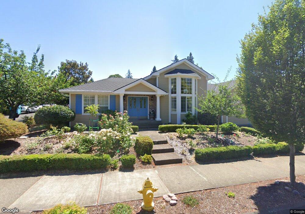
1004 NW Silverado Dr Beaverton, OR 97006
Five Oaks NeighborhoodEstimated Value: $804,200 - $908,000
4
Beds
3
Baths
2,716
Sq Ft
$308/Sq Ft
Est. Value
About This Home
This home is located at 1004 NW Silverado Dr, Beaverton, OR 97006 and is currently estimated at $837,300, approximately $308 per square foot. 1004 NW Silverado Dr is a home located in Washington County with nearby schools including Elmonica Elementary School, Five Oaks Middle School, and Westview High School.
Ownership History
Date
Name
Owned For
Owner Type
Purchase Details
Closed on
Nov 16, 2015
Sold by
Mistic Barbara J and Weatherford Barbara J
Bought by
An Chen Revocable Trust
Current Estimated Value
Purchase Details
Closed on
Jan 6, 1998
Sold by
Power Tech Fcu
Bought by
Weatherford M Craig and Weatherford Barbara J
Home Financials for this Owner
Home Financials are based on the most recent Mortgage that was taken out on this home.
Original Mortgage
$245,000
Interest Rate
7.16%
Mortgage Type
Seller Take Back
Purchase Details
Closed on
Dec 10, 1996
Sold by
Cahill Charles and Cahill Pamela
Bought by
Power Tech Fcu
Create a Home Valuation Report for This Property
The Home Valuation Report is an in-depth analysis detailing your home's value as well as a comparison with similar homes in the area
Home Values in the Area
Average Home Value in this Area
Purchase History
| Date | Buyer | Sale Price | Title Company |
|---|---|---|---|
| An Chen Revocable Trust | $461,000 | Ticor Title | |
| Weatherford M Craig | $255,000 | First American Title Ins Co | |
| Power Tech Fcu | -- | Chicago Title |
Source: Public Records
Mortgage History
| Date | Status | Borrower | Loan Amount |
|---|---|---|---|
| Previous Owner | Weatherford M Craig | $245,000 |
Source: Public Records
Tax History Compared to Growth
Tax History
| Year | Tax Paid | Tax Assessment Tax Assessment Total Assessment is a certain percentage of the fair market value that is determined by local assessors to be the total taxable value of land and additions on the property. | Land | Improvement |
|---|---|---|---|---|
| 2026 | $10,956 | $534,870 | -- | -- |
| 2025 | $10,956 | $519,300 | -- | -- |
| 2024 | $10,345 | $504,180 | -- | -- |
| 2023 | $10,345 | $489,500 | $0 | $0 |
| 2022 | $9,901 | $489,500 | $0 | $0 |
| 2021 | $9,554 | $461,410 | $0 | $0 |
| 2020 | $9,264 | $447,980 | $0 | $0 |
| 2019 | $8,970 | $434,940 | $0 | $0 |
| 2018 | $8,684 | $422,280 | $0 | $0 |
| 2017 | $8,360 | $409,990 | $0 | $0 |
| 2016 | $7,939 | $398,050 | $0 | $0 |
| 2015 | $7,551 | $386,460 | $0 | $0 |
| 2014 | $7,460 | $375,210 | $0 | $0 |
Source: Public Records
Map
Nearby Homes
- 16223 NW Ashfield Dr
- 2195 NW 160th Ave
- 15705 NW Barkton St
- 122 NW 152nd Ave
- 1630 NW Eastbrook Ct Unit 439
- 17525 NW Shorewood Dr Unit 487
- 2474 NW 168th Place
- 17555 NW Shorewood Dr Unit 497
- 17570 NW Shorewood Dr
- 16590 NW Avondale Dr
- 1551 NW Tanasbrook Ct
- 17756 NW Lakeway Ct Unit 294
- 2453 NW Rogue Valley Terrace
- 1696 NW Rolling Hill Dr Unit 348C
- 17629 NW Shady Fir Loop
- 17822 NW Lakeway Ct
- 17621 NW Shady Fir Loop Unit 65
- 2525 NW Rogue Valley Terrace
- 415 NW Kotrik Place
- 17760 NW Rolling Hill Ln Unit 399
- 986 NW Silverado Dr
- 965 NW 161st Terrace
- 990 NW 161st Terrace
- 966 NW 162nd Terrace
- 1035 NW 161st Place
- 966 NW 162 Terrace
- 970 NW 161st Terrace
- 945 NW 161st Terrace
- 962 NW Silverado Dr
- 1030 NW 161st Place
- 948 NW 162nd Terrace
- 950 NW 161st Terrace
- 973 NW Silverado Dr
- 1065 NW 161st Place
- 925 NW 161st Terrace
- 971 NW 162nd Terrace
- 1060 NW 161st Place
- 1070 NW Katsules Place
- 930 NW 162nd Terrace
- 930 NW 161st Terrace