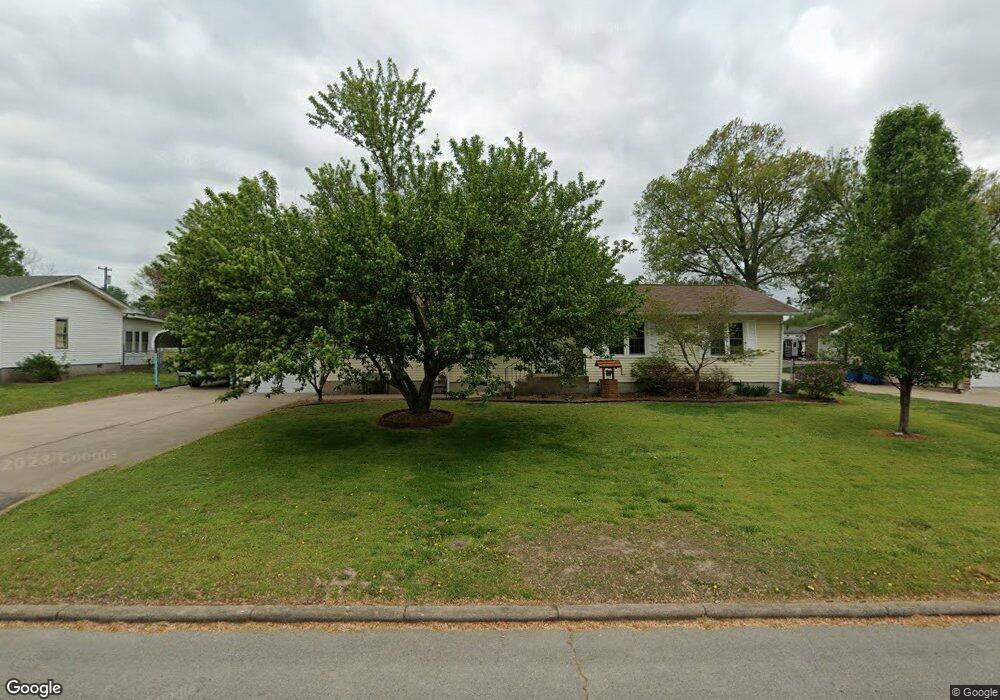
1004 Ridgecrest Ave Unit 1 Carthage, MO 64836
Estimated Value: $189,000 - $230,000
3
Beds
2
Baths
1,500
Sq Ft
$137/Sq Ft
Est. Value
About This Home
This home is located at 1004 Ridgecrest Ave Unit 1, Carthage, MO 64836 and is currently estimated at $205,000, approximately $136 per square foot. 1004 Ridgecrest Ave Unit 1 is a home located in Jasper County with nearby schools including Carthage High School, St. Ann's Catholic School, and Victory Academy.
Ownership History
Date
Name
Owned For
Owner Type
Purchase Details
Closed on
Oct 17, 2007
Sold by
Sloniker Marian Virginia
Bought by
Jacks Ruth E
Current Estimated Value
Home Financials for this Owner
Home Financials are based on the most recent Mortgage that was taken out on this home.
Original Mortgage
$29,000
Outstanding Balance
$18,266
Interest Rate
6.47%
Mortgage Type
Purchase Money Mortgage
Estimated Equity
$186,734
Create a Home Valuation Report for This Property
The Home Valuation Report is an in-depth analysis detailing your home's value as well as a comparison with similar homes in the area
Home Values in the Area
Average Home Value in this Area
Purchase History
| Date | Buyer | Sale Price | Title Company |
|---|---|---|---|
| Jacks Ruth E | -- | Abbey |
Source: Public Records
Mortgage History
| Date | Status | Borrower | Loan Amount |
|---|---|---|---|
| Open | Jacks Ruth E | $29,000 |
Source: Public Records
Tax History Compared to Growth
Tax History
| Year | Tax Paid | Tax Assessment Tax Assessment Total Assessment is a certain percentage of the fair market value that is determined by local assessors to be the total taxable value of land and additions on the property. | Land | Improvement |
|---|---|---|---|---|
| 2025 | $1,012 | $21,740 | $4,410 | $17,330 |
| 2024 | $1,013 | $19,670 | $4,410 | $15,260 |
| 2023 | $1,013 | $19,670 | $4,410 | $15,260 |
| 2022 | $992 | $19,330 | $4,410 | $14,920 |
| 2021 | $981 | $19,330 | $4,410 | $14,920 |
| 2020 | $801 | $15,120 | $4,410 | $10,710 |
| 2019 | $802 | $15,120 | $4,410 | $10,710 |
| 2018 | $774 | $14,620 | $0 | $0 |
| 2017 | $776 | $14,620 | $0 | $0 |
| 2016 | $773 | $14,620 | $0 | $0 |
| 2015 | $773 | $14,620 | $0 | $0 |
| 2014 | $773 | $14,620 | $0 | $0 |
Source: Public Records
Map
Nearby Homes
- 2141 Carrie St
- 925 Gene Taylor Dr
- 1922 Southwood Ln
- 909 Durward Hall Dr
- 837 Modern Way
- 1106 Southern Hills
- 2032 Alison St
- 1910 Wynwood Dr
- 1314 Patrick Place
- 1211 E Airport Dr
- NE COR Airport Dr & River
- 1743 S River St
- 739 Sheridan St
- 1131 Belle Air Place
- 1814 Buena Vista Ave
- 1012 Euclid Blvd
- 2206 Benjamin Dr
- 1647 Glenwood Place
- 824 Euclid Blvd
- TBD Lexie Ln
- 1004 Ridgecrest Ave
- 1014 Ridgecrest Ave
- 952 Ridgecrest Ave
- 1005 Lillie Dr
- 942 Ridgecrest Ave
- 1011 Lillie Dr
- 947 Lillie Dr
- 947 Lillie Dr Unit 1
- 1005 Ridgecrest Ave
- 943 Ridgecrest Ave
- 1100 Ridgecrest Ave
- 1024 Ridgecrest Ave
- 951 Ridgecrest Ave Unit 1
- 951 Ridgecrest Ave
- 1013 Ridgecrest Ave
- 943 Lillie Dr
- 1025 Lillie Dr
- 1104 Ridgecrest Ave
- 1027 Ridgecrest Ave
- 930 Ridgecrest Ave