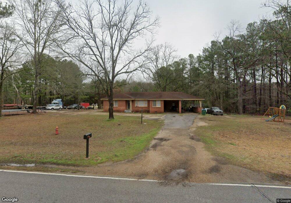
1004 S Main St Newton, MS 39345
Estimated Value: $151,054 - $376,000
Studio
2
Baths
2,462
Sq Ft
$91/Sq Ft
Est. Value
About This Home
This home is located at 1004 S Main St, Newton, MS 39345 and is currently estimated at $223,014, approximately $90 per square foot. 1004 S Main St is a home located in Newton County with nearby schools including Newton Elementary School, N.H. Pilate Middle School, and Newton High School.
Ownership History
Date
Name
Owned For
Owner Type
Purchase Details
Closed on
Jun 29, 2012
Sold by
Shimfessel Donald G and Shimfessel Shelly R
Bought by
Nicholson Shannon R and Nicholson Monickala E
Current Estimated Value
Home Financials for this Owner
Home Financials are based on the most recent Mortgage that was taken out on this home.
Original Mortgage
$103,098
Outstanding Balance
$70,961
Interest Rate
3.76%
Mortgage Type
New Conventional
Estimated Equity
$152,053
Create a Home Valuation Report for This Property
The Home Valuation Report is an in-depth analysis detailing your home's value as well as a comparison with similar homes in the area
Home Values in the Area
Average Home Value in this Area
Purchase History
We collect this data history from publicly available records. To have your information removed, we recommend requesting removal directly through your county’s website.
| Date | Buyer | Sale Price | Title Company |
|---|---|---|---|
| Nicholson Shannon R | -- | -- |
Source: Public Records
Mortgage History
We collect this data history from publicly available records. To have your information removed, we recommend requesting removal directly through your county’s website.
| Date | Status | Borrower | Loan Amount |
|---|---|---|---|
| Open | Nicholson Shannon R | $103,098 |
Source: Public Records
Tax History
| Year | Tax Paid | Tax Assessment Tax Assessment Total Assessment is a certain percentage of the fair market value that is determined by local assessors to be the total taxable value of land and additions on the property. | Land | Improvement |
|---|---|---|---|---|
| 2025 | $1,555 | $12,029 | $0 | $0 |
| 2024 | $1,593 | $12,029 | $0 | $0 |
| 2023 | $1,590 | $12,029 | $0 | $0 |
| 2022 | $1,590 | $12,029 | $0 | $0 |
| 2021 | $1,381 | $10,937 | $0 | $0 |
| 2020 | $1,382 | $10,937 | $0 | $0 |
| 2019 | $1,395 | $10,937 | $0 | $0 |
| 2018 | $1,386 | $10,937 | $0 | $0 |
| 2017 | $1,290 | $10,352 | $0 | $0 |
| 2016 | $1,285 | $10,352 | $0 | $0 |
| 2015 | -- | $10,352 | $0 | $0 |
| 2014 | -- | $10,352 | $0 | $0 |
Source: Public Records
Map
Nearby Homes
- 0 Hwy 15 Wickware Rd Unit 26-48
- 0 1st Ave
- 304 S Main St
- 106 Stennis St
- 402 E Church St
- 500 Oak St
- 501 W Church St
- 508 W Church St
- 1704 Pecan Rd
- 103 Old Hickory Rd
- 710 Decatur St
- 906 W Church St
- 0 Clyde Evans Rd
- 1116 Old Hickory Rd
- 3989 Cedar Grove Rd
- 4016 Cedar Grove Rd
- 107 Adeline Ln
- 0 Eastside Dr
- 487 Grennie Morrow Rd
- 000 Mississippi 505
Your Personal Tour Guide
Ask me questions while you tour the home.