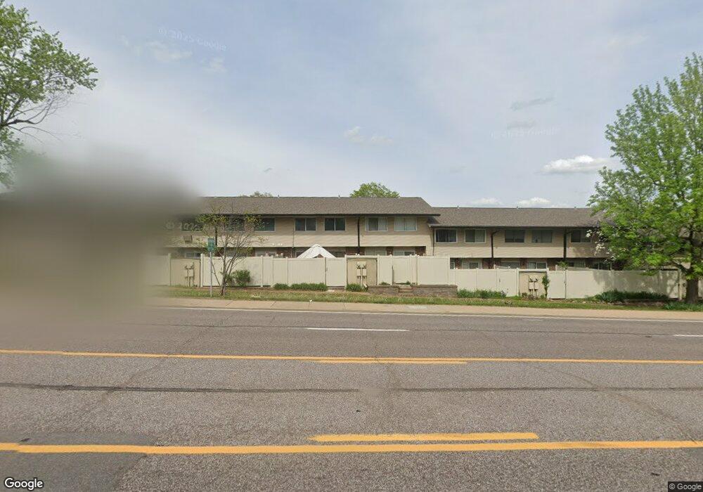
10040 Bunker Hill Dr Unit 222 Saint Louis, MO 63123
Estimated Value: $129,000 - $148,000
3
Beds
2
Baths
1,254
Sq Ft
$112/Sq Ft
Est. Value
About This Home
This home is located at 10040 Bunker Hill Dr Unit 222, Saint Louis, MO 63123 and is currently estimated at $140,404, approximately $111 per square foot. 10040 Bunker Hill Dr Unit 222 is a home located in St. Louis County with nearby schools including Bierbaum Elementary School, Margaret Buerkle Middle School, and Mehlville High School.
Ownership History
Date
Name
Owned For
Owner Type
Purchase Details
Closed on
Dec 2, 2021
Sold by
Ann Boston Melissa and Ann Steven
Bought by
Winckowski Rachel
Current Estimated Value
Home Financials for this Owner
Home Financials are based on the most recent Mortgage that was taken out on this home.
Original Mortgage
$65,625
Outstanding Balance
$60,258
Interest Rate
3.14%
Mortgage Type
New Conventional
Estimated Equity
$80,146
Purchase Details
Closed on
Feb 14, 2020
Sold by
Boston Melissa Ann and Lambert Melissa A
Bought by
Boston Melissa Ann and Boston Steven
Home Financials for this Owner
Home Financials are based on the most recent Mortgage that was taken out on this home.
Original Mortgage
$73,500
Interest Rate
3.6%
Mortgage Type
New Conventional
Purchase Details
Closed on
May 23, 2007
Sold by
Soest Cynthia J
Bought by
Lambert Melissa A
Home Financials for this Owner
Home Financials are based on the most recent Mortgage that was taken out on this home.
Original Mortgage
$82,400
Interest Rate
6.17%
Mortgage Type
Purchase Money Mortgage
Purchase Details
Closed on
Jun 7, 2002
Sold by
Soest Cynthia J and Soest Paul
Bought by
Soest Cynthia J
Home Financials for this Owner
Home Financials are based on the most recent Mortgage that was taken out on this home.
Original Mortgage
$89,000
Interest Rate
5.9%
Purchase Details
Closed on
Feb 27, 2001
Sold by
Burgic and Nermina
Bought by
Soest Cynthia J
Home Financials for this Owner
Home Financials are based on the most recent Mortgage that was taken out on this home.
Original Mortgage
$75,050
Interest Rate
6.97%
Purchase Details
Closed on
Oct 26, 1998
Sold by
Ann Poore Laura and Ann Laura Ann
Bought by
Burgic Ismet and Burgic Nermina
Home Financials for this Owner
Home Financials are based on the most recent Mortgage that was taken out on this home.
Original Mortgage
$46,750
Interest Rate
6.61%
Create a Home Valuation Report for This Property
The Home Valuation Report is an in-depth analysis detailing your home's value as well as a comparison with similar homes in the area
Home Values in the Area
Average Home Value in this Area
Purchase History
| Date | Buyer | Sale Price | Title Company |
|---|---|---|---|
| Winckowski Rachel | $87,281 | Title Partners | |
| Winckowski Rachel | -- | Title Partners | |
| Boston Melissa Ann | -- | Us Title Des Peres | |
| Lambert Melissa A | $103,000 | Clt | |
| Soest Cynthia J | -- | Nations Title Agency Inc | |
| Soest Cynthia J | $81,000 | -- | |
| Soest Cynthia J | -- | -- | |
| Burgic Ismet | $55,000 | -- |
Source: Public Records
Mortgage History
| Date | Status | Borrower | Loan Amount |
|---|---|---|---|
| Open | Winckowski Rachel | $65,625 | |
| Closed | Winckowski Rachel | $65,625 | |
| Previous Owner | Boston Melissa Ann | $73,500 | |
| Previous Owner | Lambert Melissa A | $82,400 | |
| Previous Owner | Soest Cynthia J | $89,000 | |
| Previous Owner | Soest Cynthia J | $75,050 | |
| Previous Owner | Burgic Ismet | $46,750 |
Source: Public Records
Tax History Compared to Growth
Tax History
| Year | Tax Paid | Tax Assessment Tax Assessment Total Assessment is a certain percentage of the fair market value that is determined by local assessors to be the total taxable value of land and additions on the property. | Land | Improvement |
|---|---|---|---|---|
| 2025 | $1,713 | $26,780 | $5,970 | $20,810 |
| 2024 | $1,713 | $23,580 | $3,820 | $19,760 |
| 2023 | $1,713 | $23,580 | $3,820 | $19,760 |
| 2022 | $1,424 | $18,620 | $4,290 | $14,330 |
| 2021 | $1,294 | $18,620 | $4,290 | $14,330 |
| 2020 | $1,139 | $15,440 | $4,290 | $11,150 |
| 2019 | $1,136 | $15,440 | $4,290 | $11,150 |
| 2018 | $1,044 | $12,710 | $2,510 | $10,200 |
| 2017 | $1,036 | $12,710 | $2,510 | $10,200 |
| 2016 | $946 | $11,480 | $2,260 | $9,220 |
| 2015 | $891 | $11,480 | $2,260 | $9,220 |
| 2014 | $785 | $10,020 | $3,290 | $6,730 |
Source: Public Records
Map
Nearby Homes
- 10018 Bunker Hill Dr Unit G
- 9925 Bunker Hill Dr Unit F
- 10077 N Bunker Hill Dr Unit F
- 9925 Bunker Hill Dr Unit G
- 9117 Villaridge Ct Unit E
- 9197 Villaridge Ct
- 9070 Villaridge Ct Unit 38
- 9920 Bunker Hill Dr Unit E
- 9030 Villaridge Ct Unit 53
- 4828 Reavis Barracks Rd
- 9837 Huntingdon Ln
- 1918 Union Rd
- 1908 Union Rd Unit 1908
- 10158 Chancery Ln
- 4259 Burnett Walk Unit 4259
- 10212 Highbury Ln
- 1905 Mansard Dr Unit 1905
- 1871 Mansard Dr Unit 1917
- 9118 Radiom Dr
- 4127 Burnett Ave
- 10036 Bunker Hill Dr
- 10038 Bunker Hill Dr
- 10042 Bunker Hill Dr Unit 221
- 10044 Bunker Hill Dr Unit 220
- 10046 Bunker Hill Dr
- 10034 Bunker Hill Dr
- 10032 Bunker Hill Dr Unit 226
- 10048 Bunker Hill Dr
- 10030 Bunker Hill Dr Unit 227
- 10050 Bunker Hill Dr
- 4712 Reavis Barracks Rd
- 4716 Reavis Barracks Rd
- 4708 Reavis Barracks Rd
- 4700 Reavis Barracks Rd
- 10010 Bunker Hill Dr Unit D
- 10018 Bunker Hill Dr Unit A
- 10010 Bunker Hill Dr Unit C
- 10010 Bunker Hill Dr Unit H
- 10018 Bunker Hill Dr Unit C
- 10010 Bunker Hill Dr Unit B