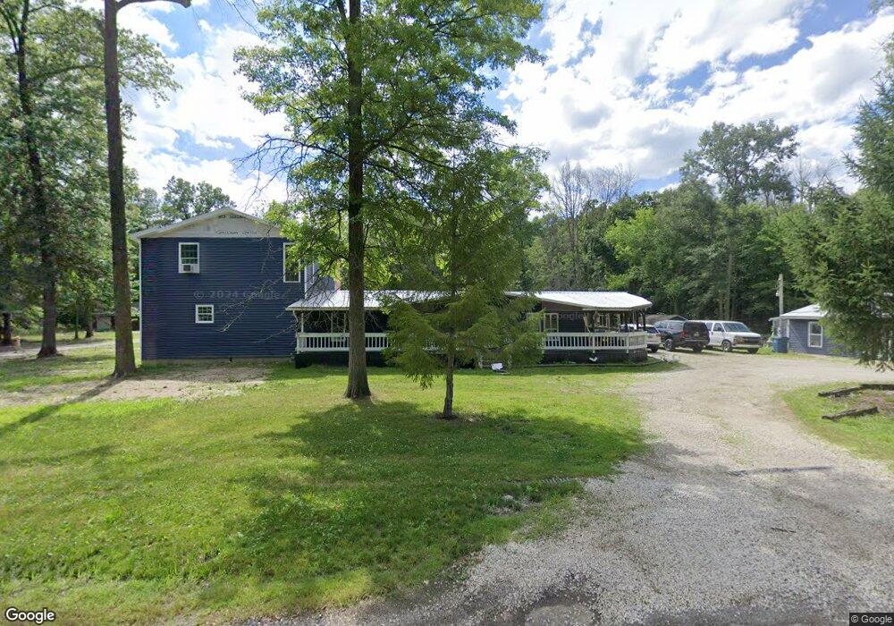
10040 Oyster Rd Alliance, OH 44601
Estimated Value: $13,000 - $246,000
2
Beds
4
Baths
1,296
Sq Ft
$100/Sq Ft
Est. Value
About This Home
This home is located at 10040 Oyster Rd, Alliance, OH 44601 and is currently estimated at $129,500, approximately $99 per square foot. 10040 Oyster Rd is a home with nearby schools including West Branch Middle School, West Branch Early Learning Center, and West Branch High School.
Ownership History
Date
Name
Owned For
Owner Type
Purchase Details
Closed on
Dec 23, 2021
Bought by
Alan White
Current Estimated Value
Home Financials for this Owner
Home Financials are based on the most recent Mortgage that was taken out on this home.
Interest Rate
3.05%
Purchase Details
Closed on
Sep 7, 2021
Sold by
Puett Edward J
Bought by
White Alan and Porter Barbara
Purchase Details
Closed on
Jun 25, 2010
Sold by
Puett Edward J
Bought by
Hershey Troy
Home Financials for this Owner
Home Financials are based on the most recent Mortgage that was taken out on this home.
Original Mortgage
$103,000
Interest Rate
4.86%
Mortgage Type
Seller Take Back
Purchase Details
Closed on
May 10, 2009
Sold by
Scott Janice May
Bought by
Puett Edward J
Purchase Details
Closed on
May 13, 1999
Sold by
J J Detweiler Enterprises Inc
Bought by
Carmany Sandra L
Purchase Details
Closed on
Sep 30, 1991
Bought by
J J Detweiler Enterprises
Create a Home Valuation Report for This Property
The Home Valuation Report is an in-depth analysis detailing your home's value as well as a comparison with similar homes in the area
Home Values in the Area
Average Home Value in this Area
Purchase History
| Date | Buyer | Sale Price | Title Company |
|---|---|---|---|
| Alan White | $37,035 | -- | |
| White Alan | $10,000 | None Available | |
| Hershey Troy | $113,000 | Attorney | |
| Puett Edward J | $27,500 | None Available | |
| Carmany Sandra L | $11,900 | -- | |
| J J Detweiler Enterprises | -- | -- |
Source: Public Records
Mortgage History
| Date | Status | Borrower | Loan Amount |
|---|---|---|---|
| Closed | Alan White | -- | |
| Previous Owner | Hershey Troy | $103,000 | |
| Closed | Carmany Sandra L | $0 |
Source: Public Records
Tax History Compared to Growth
Tax History
| Year | Tax Paid | Tax Assessment Tax Assessment Total Assessment is a certain percentage of the fair market value that is determined by local assessors to be the total taxable value of land and additions on the property. | Land | Improvement |
|---|---|---|---|---|
| 2024 | $782 | $19,720 | $7,190 | $12,530 |
| 2023 | $768 | $19,720 | $7,190 | $12,530 |
| 2022 | $735 | $17,260 | $5,750 | $11,510 |
| 2021 | $701 | $17,260 | $5,750 | $11,510 |
| 2020 | $704 | $17,260 | $5,750 | $11,510 |
| 2019 | $660 | $15,340 | $5,750 | $9,590 |
| 2018 | $676 | $15,340 | $5,750 | $9,590 |
| 2017 | $641 | $15,340 | $5,750 | $9,590 |
| 2016 | $363 | $8,690 | $6,500 | $2,190 |
| 2015 | $352 | $8,690 | $6,500 | $2,190 |
| 2014 | $354 | $8,690 | $6,500 | $2,190 |
| 2013 | $350 | $8,690 | $6,500 | $2,190 |
Source: Public Records
Map
Nearby Homes
- 15789 Coalbank St NE
- 20871 N Benton Rd W
- 0 Knoll St NE
- 15520 Coalbank St NE
- 10985 Johnson Rd
- 15995 Elbrook St NE
- 15832 Waverly St NE
- 11310 Webb Ave NE
- 11344 Walnut Ave NE
- 7374 Virginia Rd
- 14723 Bolton St NE
- 9663 Berlin Heights Dr
- 652 N Webb Ave
- 14422 Sturbridge Rd NE
- 0 Homestead Ave NE
- 0 Johnson Ave NE Unit 5142926
- 11030 12th St
- 124 E Wayne St
- 0 Meadowbrook Ave
- 263 Franklin Ave
- 10175 Oyster Rd
- 10140 Oyster Rd
- 9920 Oyster Rd
- 9880 Oyster Rd
- 10375 Oyster Rd
- 9999 Oyster Rd
- 22475 N Benton West Rd
- 22615 N Benton West Rd
- 22645 N Benton West Rd
- 22251 N Benton Rd W
- 22498 N Benton West Rd
- 22251 N Benton West Rd
- Lot 6 N Benton Rd W
- 9590 Oyster Rd
- 22498 N Benton Rd W
- 22578 N Benton West Rd
- V/L N Benton Rd W
- 0 Benton W Unit 3068392
- 0 N Benton Rd W Unit 3398943
- 0 N Benton Rd W Unit 4399035