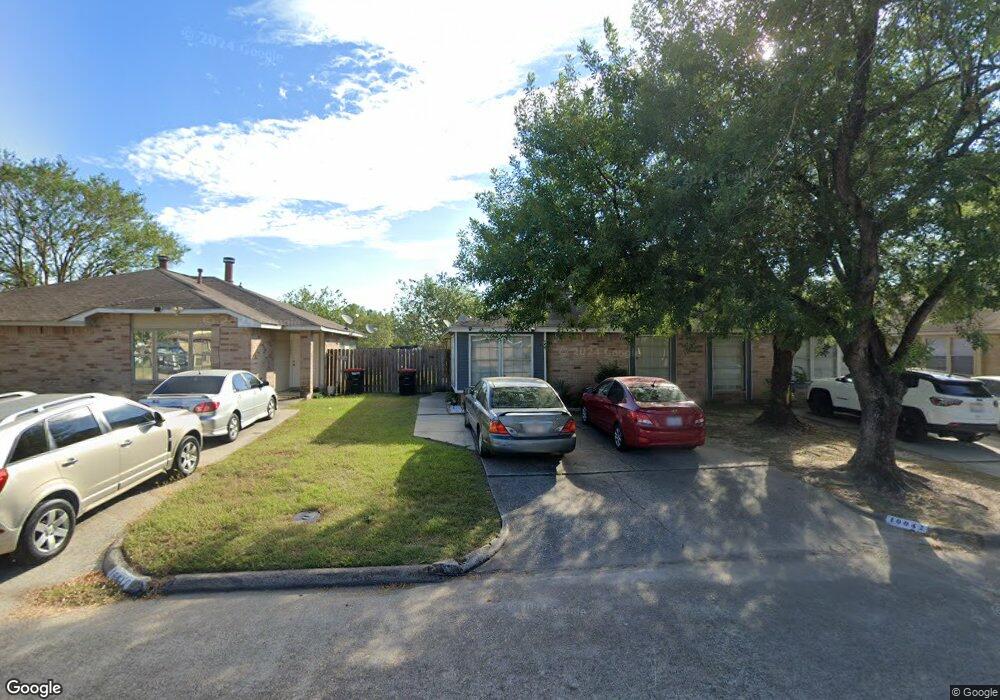
10042 Rosbrook Dr Houston, TX 77038
North Houston NeighborhoodEstimated Value: $119,000 - $143,000
2
Beds
1
Bath
855
Sq Ft
$154/Sq Ft
Est. Value
About This Home
This home is located at 10042 Rosbrook Dr, Houston, TX 77038 and is currently estimated at $132,081, approximately $154 per square foot. 10042 Rosbrook Dr is a home located in Harris County with nearby schools including Jerry Keeble Ec/Pre-K, Gray Elementary School, and Aldine Ninth Grade School.
Ownership History
Date
Name
Owned For
Owner Type
Purchase Details
Closed on
Aug 8, 2000
Sold by
Morgan Roddie C
Bought by
Morgan Roddie C and Morgan Carrie Brown
Current Estimated Value
Home Financials for this Owner
Home Financials are based on the most recent Mortgage that was taken out on this home.
Original Mortgage
$36,700
Interest Rate
8.16%
Mortgage Type
Credit Line Revolving
Create a Home Valuation Report for This Property
The Home Valuation Report is an in-depth analysis detailing your home's value as well as a comparison with similar homes in the area
Home Values in the Area
Average Home Value in this Area
Purchase History
| Date | Buyer | Sale Price | Title Company |
|---|---|---|---|
| Morgan Roddie C | -- | -- |
Source: Public Records
Mortgage History
| Date | Status | Borrower | Loan Amount |
|---|---|---|---|
| Closed | Morgan Roddie C | $36,700 |
Source: Public Records
Tax History Compared to Growth
Tax History
| Year | Tax Paid | Tax Assessment Tax Assessment Total Assessment is a certain percentage of the fair market value that is determined by local assessors to be the total taxable value of land and additions on the property. | Land | Improvement |
|---|---|---|---|---|
| 2025 | $2,297 | $127,822 | $27,489 | $100,333 |
| 2024 | $2,297 | $118,700 | $23,858 | $94,842 |
| 2023 | $2,297 | $117,491 | $23,858 | $93,633 |
| 2022 | $1,946 | $84,539 | $10,373 | $74,166 |
| 2021 | $2,030 | $84,539 | $10,373 | $74,166 |
| 2020 | $2,027 | $79,303 | $10,373 | $68,930 |
| 2019 | $1,422 | $53,464 | $10,373 | $43,091 |
| 2018 | $641 | $44,609 | $10,373 | $34,236 |
| 2017 | $1,149 | $44,609 | $10,373 | $34,236 |
| 2016 | $1,149 | $44,609 | $10,373 | $34,236 |
| 2015 | $867 | $44,609 | $10,373 | $34,236 |
| 2014 | $867 | $33,596 | $10,373 | $23,223 |
Source: Public Records
Map
Nearby Homes
- 10026 Lasaber Ct
- 10134 Lasaber Ct
- 1006 Fruitvale Dr
- 1010 Francitas Dr
- 10226 Ella Falls Blvd
- 1022 Progreso Dr
- 9710 Debbie Ln
- 1138 Cherry Spring Dr
- 939 Point Blank Dr
- 1506 Wilshire Park Dr
- 1219 Pilot Point Dr
- 1019 Castolan Dr
- 1327 Fallbrook Dr
- 00 Fallbrook Dr
- 10519 Pleasanton Dr
- 0 W Mt Houston Rd Unit 90464120
- 0 Veterans Memorial Rd Unit 43555293
- 10558 Pleasanton Dr
- 2115 Havencrest Dr
- 2203 Chalet Rd
- 10044 Rosbrook Dr
- 10040 Rosbrook Dr
- 10038 Rosbrook Dr
- 10036 Rosbrook Dr
- 10034 Rosbrook Dr
- 10106 Rosbrook Ct
- 10045 Rosbrook Dr
- 10047 Rosbrook Dr
- 10043 Rosbrook Dr
- 10032 Rosbrook Dr
- 10049 Rosbrook Dr
- 10041 Rosbrook Dr
- 10102 Rosbrook Dr
- 10051 Rosbrook Dr
- 10039 Rosbrook Dr
- 10030 Rosbrook Dr
- 10037 Rosbrook Dr
- 10028 Rosbrook Dr
- 10035 Rosbrook Dr
- 10106 Rosbrook Dr