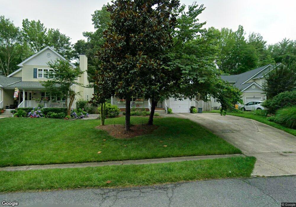
1005 Biltmore Ave West River, MD 20778
Estimated Value: $460,000 - $559,000
Studio
3
Baths
2,218
Sq Ft
$236/Sq Ft
Est. Value
About This Home
This home is located at 1005 Biltmore Ave, West River, MD 20778 and is currently estimated at $522,579, approximately $235 per square foot. 1005 Biltmore Ave is a home located in Anne Arundel County with nearby schools including Deale Elementary School, Southern Middle School, and Southern High School.
Ownership History
Date
Name
Owned For
Owner Type
Purchase Details
Closed on
Dec 7, 2000
Sold by
Grice Sean R
Bought by
Rinaldi Mary C
Current Estimated Value
Purchase Details
Closed on
Sep 30, 1998
Sold by
Grice Sean R
Bought by
Grice Sean R and Grice Elisabeth R
Purchase Details
Closed on
Sep 20, 1994
Sold by
Chalk Point Inc
Bought by
Grice Sean R
Home Financials for this Owner
Home Financials are based on the most recent Mortgage that was taken out on this home.
Original Mortgage
$151,050
Interest Rate
8.38%
Create a Home Valuation Report for This Property
The Home Valuation Report is an in-depth analysis detailing your home's value as well as a comparison with similar homes in the area
Home Values in the Area
Average Home Value in this Area
Purchase History
| Date | Buyer | Sale Price | Title Company |
|---|---|---|---|
| Rinaldi Mary C | $185,500 | -- | |
| Grice Sean R | -- | -- | |
| Grice Sean R | $151,927 | -- |
Source: Public Records
Mortgage History
| Date | Status | Borrower | Loan Amount |
|---|---|---|---|
| Previous Owner | Grice Sean R | $151,050 | |
| Closed | Rinaldi Mary C | -- |
Source: Public Records
Tax History
| Year | Tax Paid | Tax Assessment Tax Assessment Total Assessment is a certain percentage of the fair market value that is determined by local assessors to be the total taxable value of land and additions on the property. | Land | Improvement |
|---|---|---|---|---|
| 2025 | $3,436 | $388,967 | -- | -- |
| 2024 | $3,436 | $374,333 | $0 | $0 |
| 2023 | $3,334 | $359,700 | $147,400 | $212,300 |
| 2022 | $3,124 | $357,333 | $0 | $0 |
| 2020 | $2,989 | $352,600 | $152,400 | $200,200 |
| 2019 | $2,935 | $340,967 | $0 | $0 |
| 2018 | $3,339 | $329,333 | $0 | $0 |
| 2017 | $2,759 | $317,700 | $0 | $0 |
| 2016 | -- | $303,167 | $0 | $0 |
| 2015 | -- | $288,633 | $0 | $0 |
| 2014 | -- | $274,100 | $0 | $0 |
Source: Public Records
Map
Nearby Homes
- 1006 Allen Ave
- 5277 Cedar St
- 4937 Aspen St
- 4907 Quince St
- 4951 Dogwood St
- 1209 Johnson Dr
- 1161 Steamboat Rd
- 4908 Aspen St
- 5771 Shady Side Rd
- 0 Riverside Dr Unit C4 MDAA2119968
- 1330 Jordan Dr
- 1302 Spruce St
- 1225 Juniper St
- 1241 Steamboat Rd
- 5218 Nick Rd
- Lot 2 Benning Rd
- 5375 Deale Churchton Rd
- 0 Shady Side Rd Unit MDAA2113156
- 0 Shady Side Rd Unit MDAA2113166
- 946 Benning Rd
- 1007 Biltmore Ave
- 1003 Biltmore Ave
- 1009 Biltmore Ave
- 1001 Biltmore Ave
- 1008 Allen Ave
- 1010 Allen Ave
- 1011 Biltmore Ave
- 1004 Allen Ave
- 1012 Allen Ave
- 1002 Allen Ave
- 1002 Biltmore Ave
- 1004 Biltmore Ave
- 1000 Biltmore Ave
- 1013 Biltmore Ave
- 1014 Allen Ave
- 1006 Biltmore Ave
- 1000 Allen Ave
- 1008 Biltmore Ave
- 1016 Allen Ave
- 1015 Biltmore Ave
Your Personal Tour Guide
Ask me questions while you tour the home.