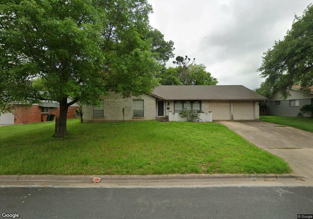
1005 Bob White Dr Austin, TX 78758
North Austin NeighborhoodEstimated Value: $428,592 - $545,000
4
Beds
2
Baths
1,596
Sq Ft
$294/Sq Ft
Est. Value
About This Home
This home is located at 1005 Bob White Dr, Austin, TX 78758 and is currently estimated at $469,148, approximately $293 per square foot. 1005 Bob White Dr is a home located in Travis County with nearby schools including Wooldridge Elementary School, Burnet Middle School, and Navarro Early College High School.
Ownership History
Date
Name
Owned For
Owner Type
Purchase Details
Closed on
Sep 12, 2003
Sold by
Alonzo Victor and Alonzo Margarei
Bought by
Fisher Felicia G
Current Estimated Value
Home Financials for this Owner
Home Financials are based on the most recent Mortgage that was taken out on this home.
Original Mortgage
$114,400
Outstanding Balance
$53,326
Interest Rate
6.31%
Mortgage Type
New Conventional
Estimated Equity
$415,822
Create a Home Valuation Report for This Property
The Home Valuation Report is an in-depth analysis detailing your home's value as well as a comparison with similar homes in the area
Home Values in the Area
Average Home Value in this Area
Purchase History
| Date | Buyer | Sale Price | Title Company |
|---|---|---|---|
| Fisher Felicia G | -- | -- |
Source: Public Records
Mortgage History
| Date | Status | Borrower | Loan Amount |
|---|---|---|---|
| Open | Fisher Felicia G | $114,400 | |
| Closed | Fisher Felicia G | $21,450 |
Source: Public Records
Tax History Compared to Growth
Tax History
| Year | Tax Paid | Tax Assessment Tax Assessment Total Assessment is a certain percentage of the fair market value that is determined by local assessors to be the total taxable value of land and additions on the property. | Land | Improvement |
|---|---|---|---|---|
| 2025 | $5,296 | $382,946 | -- | -- |
| 2023 | $4,323 | $316,485 | $0 | $0 |
| 2022 | $5,682 | $287,714 | $0 | $0 |
| 2021 | $5,693 | $261,558 | $125,000 | $227,873 |
| 2020 | $5,100 | $237,780 | $125,000 | $193,817 |
| 2018 | $4,351 | $196,513 | $125,000 | $170,505 |
| 2017 | $3,984 | $178,648 | $75,000 | $181,977 |
| 2016 | $3,622 | $162,407 | $60,000 | $158,816 |
| 2015 | $2,850 | $147,643 | $20,000 | $169,252 |
| 2014 | $2,850 | $134,221 | $0 | $0 |
Source: Public Records
Map
Nearby Homes
- 8909 Laurel Grove Dr
- 9010 Laurel Grove Dr
- 9007 Quail Valley Dr
- 8906 Parkfield Dr Unit C
- 8520 Bradford Dr
- 1107 Chesapeake Dr
- 9303 Quail Field Dr
- 8906 Trone Cir Unit A
- 1010 W Rundberg Ln Unit 13
- 1010 W Rundberg Ln Unit 24
- 9100 Shepard Dr
- 1207 W Rundberg Ln
- 8706 Brookfield Dr
- 8801 Redfield Ln
- 9104 Glenn Ln
- 8524 Dryfield Dr
- 9215 Hunters Trace E
- 9504 Quail Village Ln
- 9214 Hunters Trace E
- 8424 Jamestown Dr
- 1007 Bob White Dr
- 1003 Bob White Dr
- 1009 Bob White Dr
- 9001 Blue Quail Dr
- 1001 Bob White Dr
- 9000 Blue Quail Dr
- 9000 Quail Creek Dr
- 9003 Blue Quail Dr
- 1011 Bob White Dr
- 9002 Blue Quail Dr
- 9001 Collinfield Dr
- 9005 Blue Quail Dr
- 8927 Quail Creek Dr
- 8929 Quail Creek Dr
- 9003 Collinfield Dr
- 9004 Blue Quail Dr
- 9001 Quail Creek Dr
- 913 Kirschner Place
- 9004 Quail Creek Dr