Estimated Value: $654,000 - $710,000
4
Beds
4
Baths
3,250
Sq Ft
$212/Sq Ft
Est. Value
About This Home
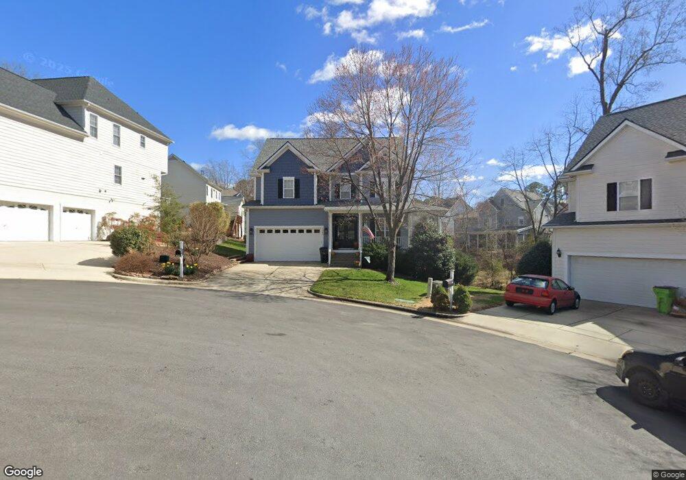
This home is located at 1005 Cherokee Sunset Rd, Apex, NC 27502 and is currently estimated at $689,219, approximately $212 per square foot. 1005 Cherokee Sunset Rd is a home located in Wake County with nearby schools including Scotts Ridge Elementary School, Apex Middle, and Apex High School.
Ownership History
Date
Name
Owned For
Owner Type
Purchase Details
Closed on
Jan 31, 2014
Sold by
Bush Kevin M
Bought by
Bush Christine M
Current Estimated Value
Home Financials for this Owner
Home Financials are based on the most recent Mortgage that was taken out on this home.
Original Mortgage
$238,850
Outstanding Balance
$181,947
Interest Rate
4.55%
Mortgage Type
New Conventional
Estimated Equity
$507,272
Purchase Details
Closed on
Mar 31, 2005
Sold by
Empire Constractors Inc
Bought by
Bush Kevin M and Bush Christine M
Home Financials for this Owner
Home Financials are based on the most recent Mortgage that was taken out on this home.
Original Mortgage
$252,000
Interest Rate
5.57%
Mortgage Type
Fannie Mae Freddie Mac
Purchase Details
Closed on
Oct 31, 2001
Sold by
Billsco Inc
Bought by
Young Austin Construction Company Inc
Create a Home Valuation Report for This Property
The Home Valuation Report is an in-depth analysis detailing your home's value as well as a comparison with similar homes in the area
Purchase History
| Date | Buyer | Sale Price | Title Company |
|---|---|---|---|
| Bush Christine M | -- | None Available | |
| Bush Kevin M | $315,000 | -- | |
| Young Austin Construction Company Inc | $42,000 | -- |
Source: Public Records
Mortgage History
| Date | Status | Borrower | Loan Amount |
|---|---|---|---|
| Open | Bush Christine M | $238,850 | |
| Closed | Bush Kevin M | $252,000 |
Source: Public Records
Tax History
| Year | Tax Paid | Tax Assessment Tax Assessment Total Assessment is a certain percentage of the fair market value that is determined by local assessors to be the total taxable value of land and additions on the property. | Land | Improvement |
|---|---|---|---|---|
| 2025 | $5,653 | $645,137 | $190,000 | $455,137 |
| 2024 | $5,526 | $645,137 | $190,000 | $455,137 |
Source: Public Records
Map
Nearby Homes
- 1224 Tartarian Trail
- 809 Town Side Dr
- 1210 Evian Ct
- 3013 White Cloud Cir
- 3021 White Cloud Cir
- 101 Rocklyn Ln
- 517 Village Loop Dr
- 0 Jb Morgan Rd Unit 10051948
- 400 Village Loop Dr
- 710 Mid Summer Ln
- 1305 Olde Walker Mill Rd
- 105 Garden Side Way
- 100 Henson Place
- 440 Oak Pine Dr
- 1202 Fairfax Woods Dr
- 1200 Fairfax Woods Dr
- 101 Graystar Rd
- 1400 Applethorn Dr
- 113 Curley Maple Ct
- 1209 Haywards Heath Ln
- 1003 Cherokee Sunset Rd
- 1007 Cherokee Sunset Rd
- 1104 Red Sunset Dr
- 1212 Dalgarven Dr
- 1216 Dalgarven Dr
- 1208 Dalgarven Dr
- 1220 Dalgarven Dr
- 1100 Red Sunset Dr
- 1001 Cherokee Sunset Rd
- 1106 Red Sunset Dr
- 1008 Cherokee Sunset Rd
- 1204 Dalgarven Dr
- 1224 Dalgarven Dr
- 1004 Cherokee Sunset Rd
- 1228 Dalgarven Dr
- 1200 Dalgarven Dr
- 1217 Dalgarven Dr
- 1209 Dalgarven Dr
- 1002 Cherokee Sunset Rd
- 1107 Red Sunset Dr
Your Personal Tour Guide
Ask me questions while you tour the home.