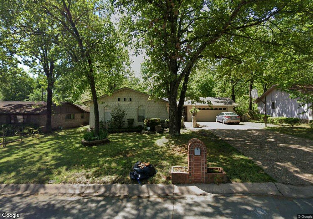
1005 Dyson Dr Sherwood, AR 72120
Estimated Value: $171,553 - $219,000
--
Bed
2
Baths
1,630
Sq Ft
$124/Sq Ft
Est. Value
About This Home
This home is located at 1005 Dyson Dr, Sherwood, AR 72120 and is currently estimated at $201,388, approximately $123 per square foot. 1005 Dyson Dr is a home located in Pulaski County with nearby schools including Sherwood Elementary School, Sylvan Hills Middle School, and Sylvan Hills High School.
Ownership History
Date
Name
Owned For
Owner Type
Purchase Details
Closed on
Jun 30, 1999
Sold by
Tacker Deborah Ann Bruning and Tacker Michael
Bought by
Almazan Gerardo
Current Estimated Value
Home Financials for this Owner
Home Financials are based on the most recent Mortgage that was taken out on this home.
Original Mortgage
$90,725
Outstanding Balance
$24,599
Interest Rate
7.39%
Mortgage Type
Purchase Money Mortgage
Estimated Equity
$176,789
Create a Home Valuation Report for This Property
The Home Valuation Report is an in-depth analysis detailing your home's value as well as a comparison with similar homes in the area
Home Values in the Area
Average Home Value in this Area
Purchase History
| Date | Buyer | Sale Price | Title Company |
|---|---|---|---|
| Almazan Gerardo | $96,000 | American Abstract & Title Co |
Source: Public Records
Mortgage History
| Date | Status | Borrower | Loan Amount |
|---|---|---|---|
| Open | Almazan Gerardo | $90,725 |
Source: Public Records
Tax History Compared to Growth
Tax History
| Year | Tax Paid | Tax Assessment Tax Assessment Total Assessment is a certain percentage of the fair market value that is determined by local assessors to be the total taxable value of land and additions on the property. | Land | Improvement |
|---|---|---|---|---|
| 2025 | $1,522 | $29,782 | $4,200 | $25,582 |
| 2024 | $1,395 | $29,782 | $4,200 | $25,582 |
| 2023 | $1,395 | $29,782 | $4,200 | $25,582 |
| 2022 | $1,495 | $29,782 | $4,200 | $25,582 |
| 2021 | $1,386 | $24,330 | $5,800 | $18,530 |
| 2020 | $1,005 | $24,330 | $5,800 | $18,530 |
| 2019 | $1,005 | $24,330 | $5,800 | $18,530 |
| 2018 | $1,030 | $24,330 | $5,800 | $18,530 |
| 2017 | $1,027 | $24,330 | $5,800 | $18,530 |
| 2016 | $1,020 | $24,190 | $4,600 | $19,590 |
| 2015 | $1,211 | $23,846 | $4,600 | $19,246 |
| 2014 | $1,211 | $21,866 | $4,600 | $17,266 |
Source: Public Records
Map
Nearby Homes
- 8 Beaconsfield Ct
- 901 Coulter Rd
- 604 Beverly Ave E
- 926 Karla Cir
- 614 Beaconsfield Rd
- 304 Verona Ave
- 503 Brent Dr
- 1003 Silver Creek Dr
- 1503 Hawkwood Rd
- 300 Burntwood Rd
- 10 Campden Hill Rd
- 3305 Seminole Trail
- 205 Spring River Rd
- 405 Fork River Rd
- 400 Fork River Rd
- 5101 Burrow Dr
- 5201 Fairway Dr
- 5317 Fairway Ave
- 5009 Burrow Dr
- 4524 Dawson Dr