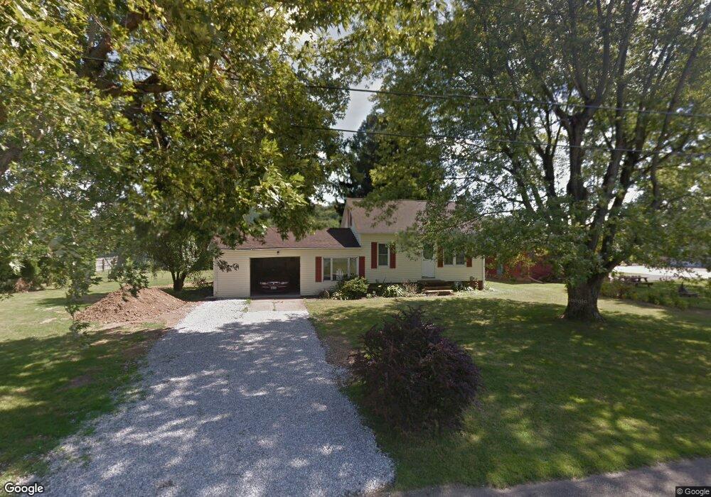
1005 E 1st St Minerva, OH 44657
Estimated Value: $126,538 - $135,000
2
Beds
1
Bath
1,034
Sq Ft
$125/Sq Ft
Est. Value
About This Home
This home is located at 1005 E 1st St, Minerva, OH 44657 and is currently estimated at $129,635, approximately $125 per square foot. 1005 E 1st St is a home located in Stark County with nearby schools including Minerva Elementary School, Minerva Middle School, and Minerva High School.
Ownership History
Date
Name
Owned For
Owner Type
Purchase Details
Closed on
Jan 7, 1999
Sold by
Tabellion Wilma Jean and Rose Wilma Jean
Bought by
Rose Gerald M
Current Estimated Value
Home Financials for this Owner
Home Financials are based on the most recent Mortgage that was taken out on this home.
Original Mortgage
$53,400
Interest Rate
6.79%
Mortgage Type
Balloon
Purchase Details
Closed on
May 3, 1994
Purchase Details
Closed on
Jan 6, 1994
Purchase Details
Closed on
Jul 7, 1993
Purchase Details
Closed on
Jun 9, 1992
Create a Home Valuation Report for This Property
The Home Valuation Report is an in-depth analysis detailing your home's value as well as a comparison with similar homes in the area
Home Values in the Area
Average Home Value in this Area
Purchase History
| Date | Buyer | Sale Price | Title Company |
|---|---|---|---|
| Rose Gerald M | -- | -- | |
| -- | $52,900 | -- | |
| -- | -- | -- | |
| -- | -- | -- | |
| -- | -- | -- |
Source: Public Records
Mortgage History
| Date | Status | Borrower | Loan Amount |
|---|---|---|---|
| Closed | Rose Gerald M | $53,400 |
Source: Public Records
Tax History Compared to Growth
Tax History
| Year | Tax Paid | Tax Assessment Tax Assessment Total Assessment is a certain percentage of the fair market value that is determined by local assessors to be the total taxable value of land and additions on the property. | Land | Improvement |
|---|---|---|---|---|
| 2025 | -- | $32,830 | $12,390 | $20,440 |
| 2024 | -- | $32,830 | $12,390 | $20,440 |
| 2023 | $1,179 | $27,200 | $8,330 | $18,870 |
| 2022 | $1,189 | $27,200 | $8,330 | $18,870 |
| 2021 | $1,218 | $27,200 | $8,330 | $18,870 |
| 2020 | $1,169 | $24,400 | $7,530 | $16,870 |
| 2019 | $1,011 | $24,400 | $7,530 | $16,870 |
| 2018 | $1,074 | $24,400 | $7,530 | $16,870 |
| 2017 | $950 | $20,720 | $7,070 | $13,650 |
| 2016 | $1,142 | $24,260 | $7,070 | $17,190 |
| 2015 | $1,212 | $24,260 | $7,070 | $17,190 |
| 2014 | $1,065 | $21,530 | $6,270 | $15,260 |
| 2013 | $538 | $21,530 | $6,270 | $15,260 |
Source: Public Records
Map
Nearby Homes
- 22141 Mcdaniel St
- 817 Hillview Ave
- 710 E Lincolnway
- 0 Lynnwood Dr
- 208 Ridgewood Blvd
- 102 Murray Ave Unit 10A
- 0 Stonehedge Dr
- 518 King St
- 401 Prospect St
- 503 Murray Ave Unit 19
- 110 S Liberty St Unit 10
- 0 Lincoln St SE
- 106 N Hilltop Dr
- 802 Elizabeth St
- 617 Valley St Unit 6A
- 604 Valley St Unit 6
- 10514 Harry June Cir
- 11583 Bower Rd
- 10294 Manor Rd NE
- 0 Sr 30 Hwy
- 311 Park St
- 1000 E Lincolnway
- 1017 E 1st St
- 1012 E Lincolnway
- 956 E Lincolnway
- 326 Park St
- 1000 E 1st St
- 1020 E Lincolnway
- 400 Park St
- 1012 E 1st St
- 948 E Lincolnway
- 1005 E Lincolnway
- 1024 E 1st St
- 935 E 1st St
- 957 Stafford St
- 1025 E Lincolnway
- 933 E 1st St
- 1032 E 1st St
- 1004 Stafford St
- 1032 E Lincolnway