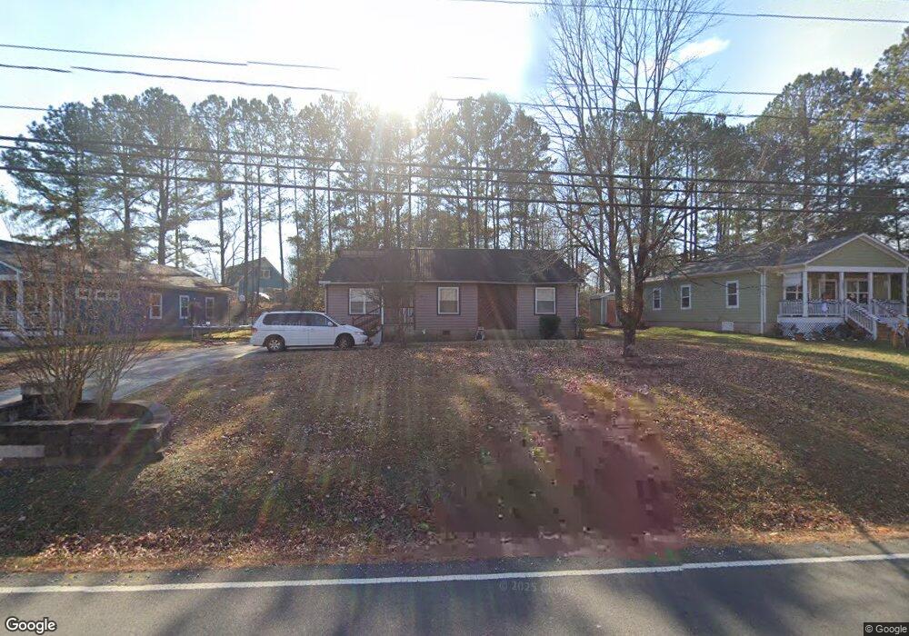
1005 Horton Rd Durham, NC 27704
Duke Homestead NeighborhoodEstimated Value: $337,622 - $357,000
About This Home
This home is located at 1005 Horton Rd, Durham, NC 27704 and is currently estimated at $348,906, approximately $196 per square foot. 1005 Horton Rd is a home located in Durham County with nearby schools including Holt Elementary, George L Carrington Middle, and Northern High School.
Ownership History
We collect this data history from publicly available records. To have your information removed, we recommend requesting removal directly through your county’s website.
Purchase Details
Purchase Details
Home Financials for this Owner
Home Financials are based on the most recent Mortgage that was taken out on this home.Home Values in the Area
Average Home Value in this Area
Purchase History
We collect this data history from publicly available records. To have your information removed, we recommend requesting removal directly through your county’s website.
| Date | Buyer | Sale Price | Title Company |
|---|---|---|---|
| -- | None Available | ||
| $136,000 | -- |
Mortgage History
We collect this data history from publicly available records. To have your information removed, we recommend requesting removal directly through your county’s website.
| Date | Status | Borrower | Loan Amount |
|---|---|---|---|
| Previous Owner | $50,000 |
Tax History
We collect this data history from publicly available records. To have your information removed, we recommend requesting removal directly through your county’s website.
| Year | Tax Paid | Tax Assessment Tax Assessment Total Assessment is a certain percentage of the fair market value that is determined by local assessors to be the total taxable value of land and additions on the property. | Land | Improvement |
|---|---|---|---|---|
| 2025 | $3,483 | $351,357 | $110,700 | $240,657 |
| 2024 | $2,740 | $196,456 | $36,870 | $159,586 |
| 2023 | $2,573 | $196,456 | $36,870 | $159,586 |
| 2022 | $2,514 | $196,456 | $36,870 | $159,586 |
| 2021 | $2,503 | $196,456 | $36,870 | $159,586 |
| 2020 | $2,444 | $196,456 | $36,870 | $159,586 |
| 2019 | $2,444 | $196,456 | $36,870 | $159,586 |
| 2018 | $2,018 | $148,757 | $24,580 | $124,177 |
| 2017 | $2,003 | $148,757 | $24,580 | $124,177 |
| 2016 | $1,935 | $148,757 | $24,580 | $124,177 |
| 2015 | $2,624 | $189,535 | $18,256 | $171,279 |
| 2014 | $2,624 | $189,535 | $18,256 | $171,279 |
Map
- 1004 Horton Rd
- 8 Bair Cir
- 1010 Wyldewood Rd
- 4105 Toroella St
- 811 Sanderson Dr
- 812 Sanderson Dr
- 1206A River Rock Dr
- 1206B River Rock Dr
- 11 Sweetbay Ct
- 812 Chalk Level Rd
- 4207 Holston Dr
- 4215 Holston Dr
- 35 Stonewall Way
- 2808 Maple Ridge Dr
- 30 Stonewall Way
- 108 Parsons Green Ct
- 708 Woodgreen Dr
- 12 Patriot Cir
- 4206 Delbert Ave
- 808 Woodside Park Ln
- 1200 Horton Rd
- 1200 Horton Rd Unit parcel
- 1007 Horton Rd
- 1009 Horton Rd
- 1008 Horton Rd
- 1003 Horton Rd
- 1006 Horton Rd
- 1012 Horton Rd
- 4008 Wheaton Rd
- 1013 Horton Rd
- 5 Porter Cir
- 1001 Horton Rd
- 1014 Horton Rd
- 4004 Wheaton Rd
- 1015 Horton Rd
- 4009 Wheaton Rd
- 8 Porter Cir
- 917 Horton Rd
- 1002 Horton Rd
- 3 Porter Cir
Ask me questions while you tour the home.