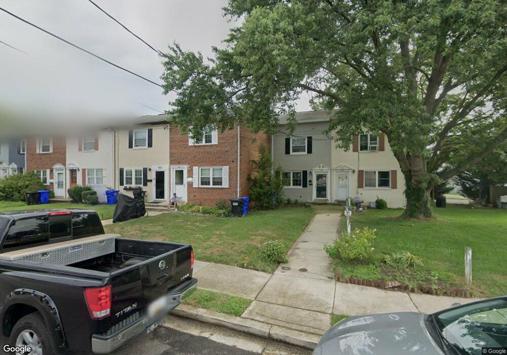
1005 Philip Powers Dr Laurel, MD 20707
Estimated Value: $268,139 - $324,000
2
Beds
1
Bath
1,000
Sq Ft
$304/Sq Ft
Est. Value
About This Home
This home is located at 1005 Philip Powers Dr, Laurel, MD 20707 and is currently estimated at $304,285, approximately $304 per square foot. 1005 Philip Powers Dr is a home located in Prince George's County with nearby schools including Laurel Elementary School, Laurel High School, and Julia Brown Montessori Schools.
Ownership History
Date
Name
Owned For
Owner Type
Purchase Details
Closed on
Nov 18, 1999
Sold by
U S Bank National Association
Bought by
Haynes Diana L
Current Estimated Value
Purchase Details
Closed on
Jun 18, 1999
Sold by
Briscoe Deborah M
Bought by
U S Bank National Association and Equicredit Corp Of America
Purchase Details
Closed on
Jul 14, 1997
Sold by
Briscoe Agnes M
Bought by
Briscoe Deborah M
Create a Home Valuation Report for This Property
The Home Valuation Report is an in-depth analysis detailing your home's value as well as a comparison with similar homes in the area
Home Values in the Area
Average Home Value in this Area
Purchase History
| Date | Buyer | Sale Price | Title Company |
|---|---|---|---|
| Haynes Diana L | $66,900 | -- | |
| U S Bank National Association | $75,000 | -- | |
| Briscoe Deborah M | -- | -- |
Source: Public Records
Tax History Compared to Growth
Tax History
| Year | Tax Paid | Tax Assessment Tax Assessment Total Assessment is a certain percentage of the fair market value that is determined by local assessors to be the total taxable value of land and additions on the property. | Land | Improvement |
|---|---|---|---|---|
| 2025 | $3,381 | $238,000 | $90,000 | $148,000 |
| 2024 | $3,381 | $224,000 | $0 | $0 |
| 2023 | $3,196 | $210,000 | $0 | $0 |
| 2022 | $2,987 | $196,000 | $75,000 | $121,000 |
| 2021 | $2,831 | $186,467 | $0 | $0 |
| 2020 | $2,727 | $176,933 | $0 | $0 |
| 2019 | $2,619 | $167,400 | $75,000 | $92,400 |
| 2018 | $2,533 | $161,133 | $0 | $0 |
| 2017 | $2,459 | $154,867 | $0 | $0 |
| 2016 | -- | $148,600 | $0 | $0 |
| 2015 | $2,047 | $144,733 | $0 | $0 |
| 2014 | $2,047 | $140,867 | $0 | $0 |
Source: Public Records
Map
Nearby Homes
- 1106 Snowden Place
- 1210 Westview Terrace
- 1103 Montgomery St
- 200 1/2 11th St
- 1002 West Ct
- 612 9th St
- 211 Patuxent Rd
- 9422 Fairview Ave
- 1003 Ward St
- 9420 Fairview Ave
- 1004 Marton St
- 610 Main St Unit 413
- 9401 Riverbrink Ct
- 1000 8th St
- 410 Carroll Ave
- 7709 Brooklyn Bridge Rd
- 1002 7th St
- 15443 Arbory Way
- 16035 Dorset Rd
- 19 Post Office Ave Unit 203
- 1007 Philip Powers Dr
- 1003 Philip Powers Dr
- 1009 Philip Powers Dr
- 1011 Philip Powers Dr
- 1001 Philip Powers Dr
- 1013 Philip Powers Dr
- 1015 Philip Powers Dr
- 933 Park Ave
- 1017 Philip Powers Dr
- 310 Grace Way
- 1019 Philip Powers Dr
- 308 Grace Way
- 1021 Philip Powers Dr
- 312 Grace Way
- 1023 Philip Powers Dr
- 920 Philip Powers Dr
- 314 Grace Way
- 1025 Philip Powers Dr
- 918 Philip Powers Dr
- 1014 Philip Powers Dr