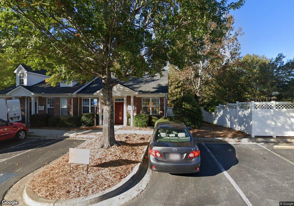
1005 Powers Place Alpharetta, GA 30009
Estimated Value: $482,923
--
Bed
--
Bath
1,134
Sq Ft
$426/Sq Ft
Est. Value
About This Home
This home is located at 1005 Powers Place, Alpharetta, GA 30009 and is currently estimated at $482,923, approximately $425 per square foot. 1005 Powers Place is a home located in Fulton County with nearby schools including Alpharetta Elementary School, Hopewell Middle School, and Cambridge High School.
Ownership History
Date
Name
Owned For
Owner Type
Purchase Details
Closed on
Nov 29, 2022
Sold by
Lee Angela D
Bought by
Main Street Commons Holding Llc
Current Estimated Value
Home Financials for this Owner
Home Financials are based on the most recent Mortgage that was taken out on this home.
Original Mortgage
$310,250
Outstanding Balance
$245,095
Interest Rate
6.95%
Mortgage Type
New Conventional
Estimated Equity
$237,828
Purchase Details
Closed on
May 24, 2013
Sold by
Martarella Roy
Bought by
Lee Angela D
Home Financials for this Owner
Home Financials are based on the most recent Mortgage that was taken out on this home.
Original Mortgage
$99,000
Interest Rate
3.43%
Mortgage Type
Commercial
Purchase Details
Closed on
Aug 26, 2011
Sold by
Phillips Nancy E
Bought by
Martarella Roy
Purchase Details
Closed on
Sep 30, 2004
Sold by
Maia Llc
Bought by
Dangar Pam and Phillips Nancy
Home Financials for this Owner
Home Financials are based on the most recent Mortgage that was taken out on this home.
Original Mortgage
$135,000
Interest Rate
5.64%
Mortgage Type
Commercial
Create a Home Valuation Report for This Property
The Home Valuation Report is an in-depth analysis detailing your home's value as well as a comparison with similar homes in the area
Home Values in the Area
Average Home Value in this Area
Purchase History
| Date | Buyer | Sale Price | Title Company |
|---|---|---|---|
| Main Street Commons Holding Llc | $365,000 | -- | |
| Lee Angela D | $110,000 | -- | |
| Martarella Roy | -- | -- | |
| Dangar Pam | $139,000 | -- |
Source: Public Records
Mortgage History
| Date | Status | Borrower | Loan Amount |
|---|---|---|---|
| Open | Main Street Commons Holding Llc | $310,250 | |
| Previous Owner | Lee Angela D | $99,000 | |
| Previous Owner | Dangar Pam | $135,000 |
Source: Public Records
Tax History Compared to Growth
Tax History
| Year | Tax Paid | Tax Assessment Tax Assessment Total Assessment is a certain percentage of the fair market value that is determined by local assessors to be the total taxable value of land and additions on the property. | Land | Improvement |
|---|---|---|---|---|
| 2025 | $1,069 | $185,840 | $10,720 | $175,120 |
| 2023 | $3,996 | $141,560 | $10,720 | $130,840 |
| 2022 | $2,008 | $76,320 | $10,720 | $65,600 |
| 2021 | $1,947 | $59,200 | $10,720 | $48,480 |
| 2020 | $1,476 | $43,988 | $9,908 | $34,080 |
| 2019 | $253 | $43,988 | $9,908 | $34,080 |
| 2018 | $1,242 | $43,988 | $9,908 | $34,080 |
| 2017 | $1,283 | $43,988 | $9,908 | $34,080 |
| 2016 | $1,284 | $43,990 | $9,910 | $34,080 |
| 2015 | $1,542 | $43,990 | $9,910 | $34,080 |
| 2014 | $1,348 | $43,990 | $9,910 | $34,080 |
Source: Public Records
Map
Nearby Homes
- 120 N Main St Unit 302
- 120 N Main St Unit 2A
- 136 Canton St
- 410 Anglin Walk
- 535 Rose Garden Ln
- 225 Anglin Walk
- 171 Upshaw Dr
- 254 N Main St
- 730 Tannery Common
- 264 N Main St
- 50 Canton St Unit 307
- 50 Canton St Unit 202
- 105 Cumming St
- 181 Brooke Dr
- Lot 7 Plan at 1858 Downtown
- Lot 9 Plan at 1858 Downtown
- 355 Cricket Ln
- 105 Martin Run
- 1020 Powers Place
- 0 Main St Commons Unit 3248928
- 1125 Powers Place Unit 1125
- 1060 Powers Place
- 1080 Powers Place
- 1090 Powers Place
- 1085 Powers Place
- 1085 Powers Place Unit B
- 1085 Powers Place Unit A
- 1085 Powers Place Unit A
- 0 State Hwy 9 Unit 8201269
- 0 State Hwy 9 Unit 5859300
- 124 Christine Dr
- 175 N Main St
- 159 N Main St
- 134 N Main St
- 193 N Main St
- 145 N Main St
- 126 B N Main St Unit 302
- 126 N Main St