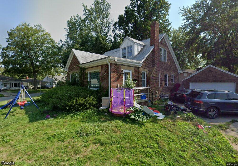
1005 S 21st St Decatur, IL 62521
Saint Mary's NeighborhoodEstimated Value: $88,000 - $112,000
3
Beds
2
Baths
3,018
Sq Ft
$34/Sq Ft
Est. Value
About This Home
This home is located at 1005 S 21st St, Decatur, IL 62521 and is currently estimated at $101,247, approximately $33 per square foot. 1005 S 21st St is a home located in Macon County with nearby schools including Muffley Elementary School, Stephen Decatur Middle School, and Robertson Charter School.
Ownership History
Date
Name
Owned For
Owner Type
Purchase Details
Closed on
Jul 11, 2022
Sold by
Ross Chelsi R
Bought by
Lyles Lindsey
Current Estimated Value
Home Financials for this Owner
Home Financials are based on the most recent Mortgage that was taken out on this home.
Original Mortgage
$89,900
Outstanding Balance
$85,916
Interest Rate
5.63%
Mortgage Type
New Conventional
Estimated Equity
$15,331
Purchase Details
Closed on
Feb 13, 2013
Sold by
Prairie State Bank & Trust
Bought by
Ross Chelsi R
Home Financials for this Owner
Home Financials are based on the most recent Mortgage that was taken out on this home.
Original Mortgage
$61,600
Interest Rate
3.38%
Mortgage Type
New Conventional
Purchase Details
Closed on
May 8, 2010
Purchase Details
Closed on
Jul 17, 2007
Sold by
Myers Donald G
Bought by
Myers Donald G
Create a Home Valuation Report for This Property
The Home Valuation Report is an in-depth analysis detailing your home's value as well as a comparison with similar homes in the area
Home Values in the Area
Average Home Value in this Area
Purchase History
| Date | Buyer | Sale Price | Title Company |
|---|---|---|---|
| Lyles Lindsey | $90,000 | Chiligiris Andrew P | |
| Lyles Lindsey | $90,000 | Chiligiris Andrew P | |
| Ross Chelsi R | $80,000 | Macon County Title Llc | |
| -- | -- | -- | |
| Myers Donald G | -- | None Available |
Source: Public Records
Mortgage History
| Date | Status | Borrower | Loan Amount |
|---|---|---|---|
| Open | Lyles Lindsey | $89,900 | |
| Closed | Lyles Lindsey | $89,900 | |
| Previous Owner | Ross Chelsi R | $61,600 |
Source: Public Records
Tax History Compared to Growth
Tax History
| Year | Tax Paid | Tax Assessment Tax Assessment Total Assessment is a certain percentage of the fair market value that is determined by local assessors to be the total taxable value of land and additions on the property. | Land | Improvement |
|---|---|---|---|---|
| 2024 | -- | $20,027 | $1,502 | $18,525 |
| 2023 | -- | $19,318 | $1,449 | $17,869 |
| 2022 | $1,181 | $17,552 | $1,341 | $16,211 |
| 2021 | $1,069 | $16,392 | $1,252 | $15,140 |
| 2020 | $1,060 | $15,632 | $1,194 | $14,438 |
| 2019 | $1,060 | $15,632 | $1,194 | $14,438 |
| 2018 | $1,047 | $14,607 | $1,685 | $12,922 |
| 2017 | $1,044 | $14,997 | $1,730 | $13,267 |
| 2016 | $1,053 | $15,150 | $1,748 | $13,402 |
| 2015 | $1,018 | $14,882 | $1,717 | $13,165 |
| 2014 | $955 | $14,735 | $1,700 | $13,035 |
| 2013 | $951 | $15,289 | $1,764 | $13,525 |
Source: Public Records
Map
Nearby Homes
- 1136 S 21st St
- 1127 S 21st St
- 1155 S 20th St
- 1952 Florida Ct
- 2039 E Whitmer St
- 729 S 22nd St
- 2104 E Whitmer St
- 632 S 17th St
- 2152 E Decatur St
- 1764 E Johns Ave
- 1263 E Dickinson Ave
- 1753 E Clay St
- 245 S 20th St
- 1408 E Buena Vista Ave
- 22 Eastmoreland Ln
- 2111 E Wood St
- 1605 E Clay St
- 1645 E Wood St
- 1656 E Wood St
- 1104 E Moore St
- 965 S 21st St
- 1025 S 21st St
- 1006 S 21st St
- 2052 E Dickinson Ave
- 955 S 21st St
- 1029 S 21st St
- 1014 S 21st St
- 2035 E Dickinson Ave
- 2025 E Dickinson Ave
- 945 S 21st St
- 2035 E Cleveland Ave
- 1022 S 21st St
- 1049 S 21st St
- 2028 E Dickinson Ave
- 2027 E Cleveland Ave
- 1030 S 21st St
- 1020 S 20th St
- 2024 E Dickinson Ave
- 2020 E Dickinson Ave
- 2126 E Dickinson Ave