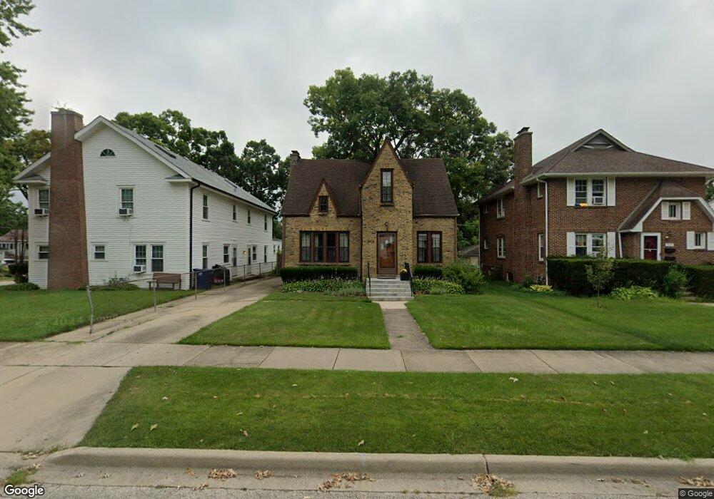
1005 W Keith Ave Waukegan, IL 60085
Marquette Highlands NeighborhoodEstimated Value: $230,000 - $258,000
2
Beds
1
Bath
1,504
Sq Ft
$160/Sq Ft
Est. Value
About This Home
This home is located at 1005 W Keith Ave, Waukegan, IL 60085 and is currently estimated at $239,934, approximately $159 per square foot. 1005 W Keith Ave is a home located in Lake County with nearby schools including Glen Flora Elementary School, Edith M Smith Middle School, and Waukegan High School.
Ownership History
Date
Name
Owned For
Owner Type
Purchase Details
Closed on
Apr 30, 1999
Sold by
Lang Rebecca A
Bought by
Larson Brian K and Larson Rosario
Current Estimated Value
Home Financials for this Owner
Home Financials are based on the most recent Mortgage that was taken out on this home.
Original Mortgage
$98,000
Outstanding Balance
$25,321
Interest Rate
7.04%
Estimated Equity
$214,613
Create a Home Valuation Report for This Property
The Home Valuation Report is an in-depth analysis detailing your home's value as well as a comparison with similar homes in the area
Home Values in the Area
Average Home Value in this Area
Purchase History
| Date | Buyer | Sale Price | Title Company |
|---|---|---|---|
| Larson Brian K | $113,000 | Chicago Title Insurance Co |
Source: Public Records
Mortgage History
| Date | Status | Borrower | Loan Amount |
|---|---|---|---|
| Open | Larson Brian K | $98,000 |
Source: Public Records
Tax History Compared to Growth
Tax History
| Year | Tax Paid | Tax Assessment Tax Assessment Total Assessment is a certain percentage of the fair market value that is determined by local assessors to be the total taxable value of land and additions on the property. | Land | Improvement |
|---|---|---|---|---|
| 2024 | $4,513 | $61,942 | $8,980 | $52,962 |
| 2023 | $4,349 | $55,864 | $8,099 | $47,765 |
| 2022 | $4,349 | $50,488 | $6,741 | $43,747 |
| 2021 | $4,077 | $45,103 | $6,013 | $39,090 |
| 2020 | $4,083 | $42,019 | $5,602 | $36,417 |
| 2019 | $4,056 | $38,503 | $5,133 | $33,370 |
| 2018 | $3,620 | $34,382 | $7,264 | $27,118 |
| 2017 | $3,474 | $30,419 | $6,427 | $23,992 |
| 2016 | $3,158 | $26,433 | $5,585 | $20,848 |
| 2015 | $2,983 | $23,658 | $4,999 | $18,659 |
| 2014 | $3,373 | $25,474 | $5,585 | $19,889 |
| 2012 | $4,400 | $27,597 | $6,050 | $21,547 |
Source: Public Records
Map
Nearby Homes
- 1018 W Atlantic Ave
- 616 W Keith Ave
- 1905 Linden Ave
- 1335 Chestnut St
- 1336 N Ash St
- 1312 N Linden Ave
- 1105 Woodlawn Cir
- 1504 W Glen Flora Ave
- 1110 N Ash St
- 1117 Judge Ave
- 1000 Pine St
- 917 N Linden Ave
- 918 N Ash St
- 2232 Walnut St
- 1109 Massena Ave
- 1038 Indiana Ave
- 415 W Ridgeland Ave
- 2008 Harding Ave
- 1023 N Elmwood Ave
- 2009 Harding Ave
- 1009 W Keith Ave
- 1620 Walnut St
- 1013 W Keith Ave
- 1000 W Atlantic Ave
- 1017 W Keith Ave
- 1600 Walnut St
- 1623 Walnut St
- 1010 W Atlantic Ave
- 1621 N Linden Ave
- 1006 W Keith Ave
- 917 W Keith Ave
- 1702 Walnut St
- 1603 Walnut St
- 1014 W Keith Ave
- 1022 W Atlantic Ave
- 1018 W Keith Ave
- 913 W Keith Ave
- 1705 Walnut St
- 918 W Atlantic Ave
- 1705 N Linden Ave