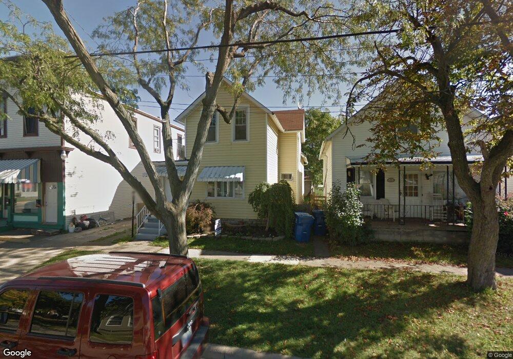
1006 Clinton St Sandusky, OH 44870
Estimated Value: $130,000 - $177,000
5
Beds
1
Bath
1,932
Sq Ft
$79/Sq Ft
Est. Value
About This Home
This home is located at 1006 Clinton St, Sandusky, OH 44870 and is currently estimated at $153,500, approximately $79 per square foot. 1006 Clinton St is a home located in Erie County with nearby schools including Sandusky High School, Monroe Preparatory Academy, and Sandusky Central Catholic School.
Ownership History
Date
Name
Owned For
Owner Type
Purchase Details
Closed on
Dec 20, 2023
Sold by
Erie County Land Reutilization Corporati
Bought by
A & R Chapman Rentals Llc
Current Estimated Value
Purchase Details
Closed on
Sep 12, 2019
Sold by
Db & B Propety Holdings Llc
Bought by
Erie County Land Reutilization Corp
Purchase Details
Closed on
Sep 1, 2017
Sold by
Olrick Ronald E
Bought by
Db & B Property Holdings Llc
Home Financials for this Owner
Home Financials are based on the most recent Mortgage that was taken out on this home.
Original Mortgage
$140,000
Interest Rate
3.96%
Mortgage Type
Commercial
Purchase Details
Closed on
May 10, 2010
Sold by
Warren Mark A
Bought by
Olrick Ronald E and Olrick Becky W
Purchase Details
Closed on
Oct 26, 2009
Sold by
Warren Mark A
Bought by
Olrick Ronald E and Olrick Becky W
Create a Home Valuation Report for This Property
The Home Valuation Report is an in-depth analysis detailing your home's value as well as a comparison with similar homes in the area
Home Values in the Area
Average Home Value in this Area
Purchase History
| Date | Buyer | Sale Price | Title Company |
|---|---|---|---|
| A & R Chapman Rentals Llc | -- | None Listed On Document | |
| Erie County Land Reutilization Corp | -- | Southern Title Of Ohio Ltd | |
| Db & B Property Holdings Llc | $12,500 | None Available | |
| Olrick Ronald E | $30,000 | None Available | |
| Olrick Ronald E | $30,000 | Attorney |
Source: Public Records
Mortgage History
| Date | Status | Borrower | Loan Amount |
|---|---|---|---|
| Previous Owner | Db & B Property Holdings Llc | $140,000 |
Source: Public Records
Tax History Compared to Growth
Tax History
| Year | Tax Paid | Tax Assessment Tax Assessment Total Assessment is a certain percentage of the fair market value that is determined by local assessors to be the total taxable value of land and additions on the property. | Land | Improvement |
|---|---|---|---|---|
| 2024 | $301 | $2,821 | $2,821 | $0 |
| 2023 | $301 | $2,257 | $2,257 | $0 |
| 2022 | $0 | $2,257 | $2,257 | $0 |
| 2021 | $0 | $2,260 | $2,260 | $0 |
| 2020 | $0 | $2,260 | $2,260 | $0 |
| 2019 | $0 | $6,080 | $2,260 | $3,820 |
| 2018 | $882 | $15,400 | $2,260 | $13,140 |
| 2017 | $1,273 | $22,150 | $2,430 | $19,720 |
| 2016 | $1,272 | $22,150 | $2,430 | $19,720 |
| 2015 | $1,153 | $22,150 | $2,430 | $19,720 |
| 2014 | $1,361 | $24,340 | $2,430 | $21,910 |
| 2013 | $1,352 | $24,340 | $2,430 | $21,910 |
Source: Public Records
Map
Nearby Homes
- 1017 Putnam St
- 1813 Sandusky St
- 1329 Carr St
- 1318 Mills St
- 1413 Seneca St
- 1204 W Monroe St
- 1225 Polk St
- 1530 Camp St
- 1319 Tiffin Ave
- 1207 Central Ave
- 912 Central Ave
- 934 W Washington St Unit 2B
- 934 W Washington St Unit 1A
- 1311 Filmore St
- 1618 Mcdonough St
- 1805 Mills St
- 1417 Pierce St
- 1604 Central Ave
- 823 Decatur St
- 831 Decatur St
- 1004 Clinton St
- 1008 Clinton St
- 1606 W Monroe St
- 1010 Clinton St
- 1014 Clinton St
- 1602 W Monroe St
- 1003 Clinton St
- 1018 Clinton St
- 1005 Clinton St
- 1007 Clinton St
- 1009 Clinton St
- 1020 Clinton St
- 1706 W Monroe St
- 635 Clinton St
- 1601 W Monroe St
- 1511 W Monroe St
- 1013 Pearl St
- 1509 W Monroe St
- 1013 Clinton St
- 626 Clinton St