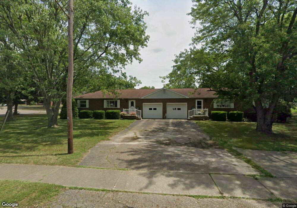
1006 Constitution Ave Louisville, OH 44641
Estimated Value: $216,000 - $220,721
4
Beds
2
Baths
1,800
Sq Ft
$121/Sq Ft
Est. Value
About This Home
This home is located at 1006 Constitution Ave, Louisville, OH 44641 and is currently estimated at $217,680, approximately $120 per square foot. 1006 Constitution Ave is a home located in Stark County with nearby schools including Louisville High School and St. Thomas Aquinas High School & Middle School.
Ownership History
Date
Name
Owned For
Owner Type
Purchase Details
Closed on
Sep 10, 2002
Sold by
Strouble Thomas W and Strouble Sue Ann
Bought by
Maiorana James A and Maiorana Terri L
Current Estimated Value
Home Financials for this Owner
Home Financials are based on the most recent Mortgage that was taken out on this home.
Original Mortgage
$142,500
Outstanding Balance
$60,829
Interest Rate
6.54%
Mortgage Type
Purchase Money Mortgage
Estimated Equity
$156,851
Create a Home Valuation Report for This Property
The Home Valuation Report is an in-depth analysis detailing your home's value as well as a comparison with similar homes in the area
Home Values in the Area
Average Home Value in this Area
Purchase History
| Date | Buyer | Sale Price | Title Company |
|---|---|---|---|
| Maiorana James A | $150,000 | -- |
Source: Public Records
Mortgage History
| Date | Status | Borrower | Loan Amount |
|---|---|---|---|
| Open | Maiorana James A | $142,500 |
Source: Public Records
Tax History Compared to Growth
Tax History
| Year | Tax Paid | Tax Assessment Tax Assessment Total Assessment is a certain percentage of the fair market value that is determined by local assessors to be the total taxable value of land and additions on the property. | Land | Improvement |
|---|---|---|---|---|
| 2025 | -- | $61,570 | $12,920 | $48,650 |
| 2024 | -- | $61,570 | $12,920 | $48,650 |
| 2023 | $2,074 | $47,110 | $9,100 | $38,010 |
| 2022 | $2,079 | $47,110 | $9,100 | $38,010 |
| 2021 | $2,085 | $47,110 | $9,100 | $38,010 |
| 2020 | $1,862 | $45,540 | $8,190 | $37,350 |
| 2019 | $1,871 | $42,210 | $11,130 | $31,080 |
| 2018 | $1,728 | $42,210 | $11,130 | $31,080 |
| 2017 | $1,576 | $37,140 | $9,380 | $27,760 |
| 2016 | $1,609 | $37,140 | $9,380 | $27,760 |
| 2015 | $1,613 | $37,140 | $9,380 | $27,760 |
| 2014 | $1,676 | $35,880 | $9,070 | $26,810 |
| 2013 | $842 | $35,880 | $9,070 | $26,810 |
Source: Public Records
Map
Nearby Homes
- 300 Kennedy St
- 428 Honeycrisp Dr NE
- 3047 Mcintosh Dr NE
- 432 Honeycrisp Dr NE
- 2962 Mcintosh Dr NE
- 2963 Mcintosh Dr NE
- 430 Honeycrisp Dr NE
- 2957 Mcintosh Dr NE
- 325 Lincoln Ave
- 614 Reno Dr
- 524 Glenbar St
- 1149 Sturbridge Dr
- 1175 Sturbridge Dr
- 316 E Reno Dr
- 0 Glenbar St
- 910 Crosswyck Cir
- 0 Brookridge Ave
- 1170 Winding Ridge Ave
- 5474 Ravenna Ave
- 107 E Broad St
- 170 Frana Clara St
- 906 Constitution Ave
- 413 Woodard Ave
- 409 Woodard Ave
- 1015 Constitution Ave Unit 7
- 1015 Constitution Ave Unit 1,2
- 1015 Constitution Ave Unit 4
- 1015 Constitution Ave Unit N
- 1015 Constitution Ave
- 419 Woodard Ave
- 171 Frana Clara St
- 171 Frana Clara St Unit 6
- 913 Constitution Ave Unit 4
- 913 Constitution Ave
- 913 Constitution Ave Unit 5
- 913 Constitution Ave Unit 2
- 913 Constitution Ave Unit 8
- 913 Constitution Ave Unit 6
- 913 Constitution Ave Unit 3
- 913 Constitution Ave Unit N