Estimated Value: $248,356 - $277,000
3
Beds
1
Bath
1,411
Sq Ft
$182/Sq Ft
Est. Value
About This Home
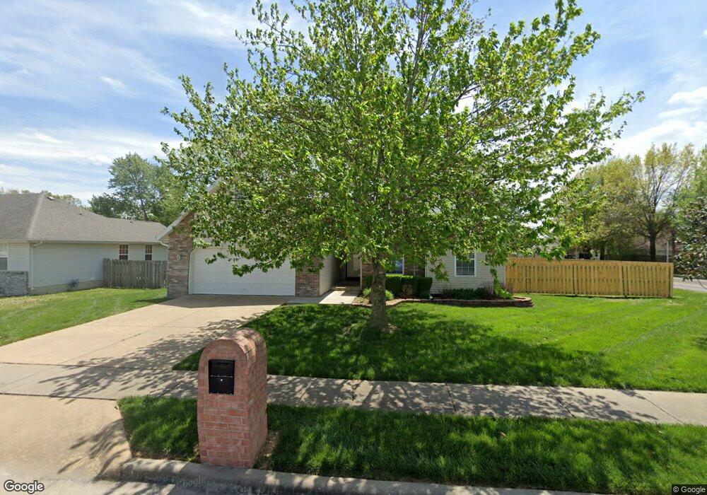
This home is located at 1006 Dustin Ln, Nixa, MO 65714 and is currently estimated at $256,839, approximately $182 per square foot. 1006 Dustin Ln is a home with nearby schools including P.S. 40 Samuel Huntington, Espy Elementary School, and Queens Gateway to Health Sciences Secondary School.
Ownership History
Date
Name
Owned For
Owner Type
Purchase Details
Closed on
Jul 17, 2006
Sold by
Vermont Matthew S and Vermont Amy A
Bought by
Miller Mark Allen
Current Estimated Value
Home Financials for this Owner
Home Financials are based on the most recent Mortgage that was taken out on this home.
Original Mortgage
$100,320
Outstanding Balance
$59,459
Interest Rate
6.62%
Mortgage Type
New Conventional
Estimated Equity
$197,380
Create a Home Valuation Report for This Property
The Home Valuation Report is an in-depth analysis detailing your home's value as well as a comparison with similar homes in the area
Home Values in the Area
Average Home Value in this Area
Purchase History
| Date | Buyer | Sale Price | Title Company |
|---|---|---|---|
| Miller Mark Allen | -- | None Available |
Source: Public Records
Mortgage History
| Date | Status | Borrower | Loan Amount |
|---|---|---|---|
| Open | Miller Mark Allen | $100,320 |
Source: Public Records
Tax History Compared to Growth
Tax History
| Year | Tax Paid | Tax Assessment Tax Assessment Total Assessment is a certain percentage of the fair market value that is determined by local assessors to be the total taxable value of land and additions on the property. | Land | Improvement |
|---|---|---|---|---|
| 2024 | $1,425 | $22,860 | -- | -- |
| 2023 | $1,425 | $22,860 | $0 | $0 |
| 2022 | $1,325 | $21,240 | $0 | $0 |
| 2021 | $1,326 | $21,240 | $0 | $0 |
| 2020 | $1,198 | $18,320 | $0 | $0 |
| 2019 | $1,198 | $18,320 | $0 | $0 |
| 2018 | $1,116 | $18,320 | $0 | $0 |
| 2017 | $1,116 | $18,320 | $0 | $0 |
| 2016 | $1,099 | $18,320 | $0 | $0 |
| 2015 | $1,101 | $18,320 | $18,320 | $0 |
| 2014 | $1,071 | $18,280 | $0 | $0 |
| 2013 | $1,073 | $18,280 | $0 | $0 |
| 2011 | -- | $36,820 | $0 | $0 |
Source: Public Records
Map
Nearby Homes
- 601 S Gregg Rd
- 1216 W Verna Ln
- 1334 W Mount Vernon St
- Tract 3c S Gregg Rd
- 403 S Bryant St
- 412 S Bryant St
- 985 W Pembrook Ave
- 304 N Bonda Way
- 305 Meadow St
- 886 W Paddington Dr
- 502 Osage Dr
- 000 S Nicholas Rd
- 848 S Somerset Dr
- 701 S Cedarwood Ct
- 1209 W Belwood Ct
- 144 Cedar Heights Dr
- 931 W Butterfield Dr
- 415 N Lewis Ct
- 1222 W Butterfield Dr
- 000 West St