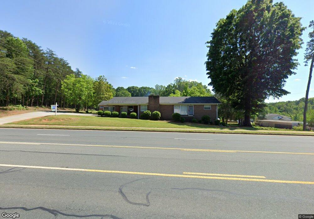
1006 Main St E Locust, NC 28097
Estimated Value: $322,000 - $377,000
3
Beds
2
Baths
1,946
Sq Ft
$181/Sq Ft
Est. Value
About This Home
This home is located at 1006 Main St E, Locust, NC 28097 and is currently estimated at $352,564, approximately $181 per square foot. 1006 Main St E is a home located in Stanly County with nearby schools including Locust Elementary School, West Stanly Middle School, and West Stanly High School.
Ownership History
Date
Name
Owned For
Owner Type
Purchase Details
Closed on
Apr 18, 2023
Sold by
Little C Delanie C and Little Rosa B
Bought by
Delanie Little C and Delanie Little C
Current Estimated Value
Purchase Details
Closed on
Jun 25, 2008
Sold by
Little Rosa B
Bought by
Little Rosa B
Home Financials for this Owner
Home Financials are based on the most recent Mortgage that was taken out on this home.
Original Mortgage
$64,000
Interest Rate
5.96%
Mortgage Type
Purchase Money Mortgage
Purchase Details
Closed on
Sep 6, 2007
Sold by
Little Rosa B and Little Delanie
Bought by
Doby Henry C
Create a Home Valuation Report for This Property
The Home Valuation Report is an in-depth analysis detailing your home's value as well as a comparison with similar homes in the area
Home Values in the Area
Average Home Value in this Area
Purchase History
| Date | Buyer | Sale Price | Title Company |
|---|---|---|---|
| Delanie Little C | -- | None Listed On Document | |
| Delanie Little C | -- | None Listed On Document | |
| Delanie Little C | -- | None Listed On Document | |
| Delanie Little C | -- | None Listed On Document | |
| Little Rosa B | $96,000 | None Available | |
| Doby Henry C | -- | None Available |
Source: Public Records
Mortgage History
| Date | Status | Borrower | Loan Amount |
|---|---|---|---|
| Previous Owner | Little Rosa B | $64,000 |
Source: Public Records
Tax History
| Year | Tax Paid | Tax Assessment Tax Assessment Total Assessment is a certain percentage of the fair market value that is determined by local assessors to be the total taxable value of land and additions on the property. | Land | Improvement |
|---|---|---|---|---|
| 2025 | $2,411 | $262,056 | $40,155 | $221,901 |
| 2024 | $1,880 | $172,518 | $23,728 | $148,790 |
| 2023 | $1,894 | $173,790 | $23,728 | $150,062 |
| 2022 | $1,997 | $173,790 | $23,728 | $150,062 |
| 2021 | $1,980 | $173,790 | $23,728 | $150,062 |
| 2020 | $1,486 | $122,207 | $20,807 | $101,400 |
| 2019 | $1,501 | $122,207 | $20,807 | $101,400 |
| 2018 | $1,381 | $122,207 | $20,807 | $101,400 |
| 2017 | $1,381 | $122,207 | $20,807 | $101,400 |
| 2016 | $1,282 | $113,407 | $19,347 | $94,060 |
| 2015 | $1,398 | $113,407 | $19,347 | $94,060 |
| 2014 | $1,243 | $113,407 | $19,347 | $94,060 |
Source: Public Records
Map
Nearby Homes
- 201 N Beverly Dr
- 106 Marlwood Dr
- 142 Flame Azalea Ct
- 700 Elm St
- 206 Delancy St
- 213 Vanderbilt Blvd
- 213 Delancy St
- 319 N Central Ave
- 288 Harrison Ln
- 135 Water Oak Ln
- 117 Danita Dr
- 211 Amber Glen Dr
- 117 Battery Dr
- 417 Kiser Ln
- 617 Ardsley Dr
- 105 Berea Baptist Church Rd
- 219 Kerri Dawn Ln
- 166 Battery Dr
- 103 Berea Baptist Church Rd
- 402 Church St
- 1002 Main St E
- 103 S Beverly Dr
- 115 S Beverly Dr
- 1010 Main St E
- 102 N Beverly Dr
- 21 Kings Dr Unit Lot 21
- 22 Kings Dr Unit Lot 22
- 002 S Beverly Dr
- 001 S Beverly Dr
- 000 S Beverly Dr
- 109 Kings Dr
- 102 Kings Dr
- 902 Main St E
- 104 N Beverly Dr
- 111 Kings Dr
- 106 N Beverly Dr
- 108 Kings Dr
- 110 Kings Dr
- 113 Kings Dr Unit 22
- 108 N Beverly Dr
Your Personal Tour Guide
Ask me questions while you tour the home.