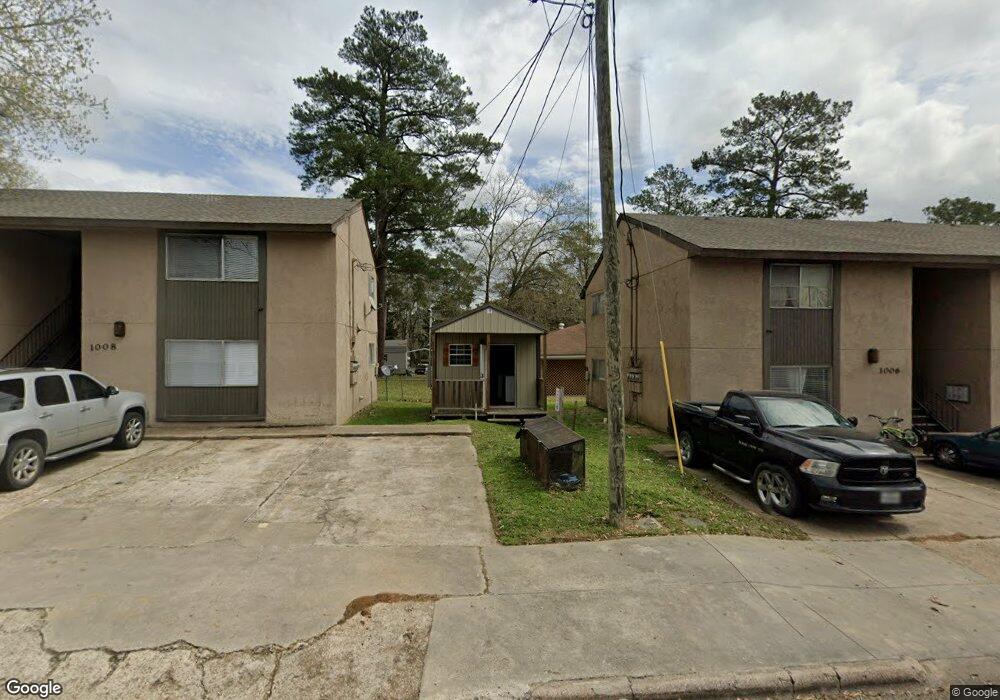
1006 N Houston Ave Unit 2 Livingston, TX 77351
Estimated Value: $183,000 - $486,000
2
Beds
1
Bath
850
Sq Ft
$419/Sq Ft
Est. Value
About This Home
This home is located at 1006 N Houston Ave Unit 2, Livingston, TX 77351 and is currently estimated at $356,403, approximately $419 per square foot. 1006 N Houston Ave Unit 2 is a home located in Polk County with nearby schools including Pine Ridge Elementary School, Livingston High School, and Burke Rd Children's Center.
Ownership History
Date
Name
Owned For
Owner Type
Purchase Details
Closed on
Aug 13, 2024
Sold by
Aadp Properties 4 Llc
Bought by
Aadp Management Llc
Current Estimated Value
Purchase Details
Closed on
Feb 20, 2018
Sold by
Woods Directional Drilling Llc
Bought by
Aadp Properties 4 Llc
Home Financials for this Owner
Home Financials are based on the most recent Mortgage that was taken out on this home.
Original Mortgage
$289,032
Interest Rate
3.99%
Mortgage Type
New Conventional
Create a Home Valuation Report for This Property
The Home Valuation Report is an in-depth analysis detailing your home's value as well as a comparison with similar homes in the area
Home Values in the Area
Average Home Value in this Area
Purchase History
| Date | Buyer | Sale Price | Title Company |
|---|---|---|---|
| Aadp Management Llc | -- | None Listed On Document | |
| Aadp Management Llc | -- | None Listed On Document | |
| Aadp Properties 4 Llc | -- | None Available |
Source: Public Records
Mortgage History
| Date | Status | Borrower | Loan Amount |
|---|---|---|---|
| Previous Owner | Aadp Properties 4 Llc | $289,032 |
Source: Public Records
Tax History Compared to Growth
Tax History
| Year | Tax Paid | Tax Assessment Tax Assessment Total Assessment is a certain percentage of the fair market value that is determined by local assessors to be the total taxable value of land and additions on the property. | Land | Improvement |
|---|---|---|---|---|
| 2025 | $3,999 | $207,622 | $4,535 | $203,087 |
| 2024 | $3,999 | $415,245 | $9,067 | $406,178 |
| 2023 | $3,270 | $217,773 | $7,884 | $209,889 |
| 2022 | $3,162 | $181,499 | $7,884 | $173,615 |
| 2021 | $3,472 | $177,509 | $7,884 | $169,625 |
| 2020 | $3,470 | $176,179 | $7,884 | $168,295 |
| 2019 | $3,587 | $176,179 | $7,884 | $168,295 |
| 2018 | -- | $150,542 | $3,942 | $146,600 |
| 2017 | $3,065 | $150,542 | $3,942 | $146,600 |
| 2016 | $3,065 | $150,542 | $3,942 | $146,600 |
| 2015 | -- | $151,867 | $3,942 | $147,925 |
| 2014 | -- | $151,105 | $3,180 | $147,925 |
Source: Public Records
Map
Nearby Homes
- 210 E North St
- 213 E Feagin St
- 5454 Fm 350 N
- 901 N Washington Ave
- 701 N Beatty Ave
- 405 W Milam St
- 1121 Timberglen Dr
- 00 Autumn
- 1231 Westridge
- 1733 Fm 3277
- 482 Rolling
- TBD Meridian
- 0 Vintage Unit 70196470
- 225 Vintage
- TBD Reveille Rd
- 0 Conway Rd Unit 85028531
- 1345 Fm 3227
- 000 N Washington Ave
- 1128 Timberglen Dr
- 12 Timberglen
- 1006 N Houston Ave Unit 1
- 1006 N Houston Ave
- 307 E North St
- 1008 N Houston Ave Unit 3
- 1008 N Houston Ave Unit 4
- 1008 N Houston Ave
- 1008 N Houston Ave
- TBD 2 E North St
- TBD E North St
- 213 E North St
- 315 E North St
- 1013 N East Ave
- 1016 N Houston Ave
- 207 E North St
- 308 E Pine Hill Dr
- 214 E North St
- 214 E North St
- 1015 N Houston St
- 1015 N Houston St Unit 106
- 1015 N Houston Ave