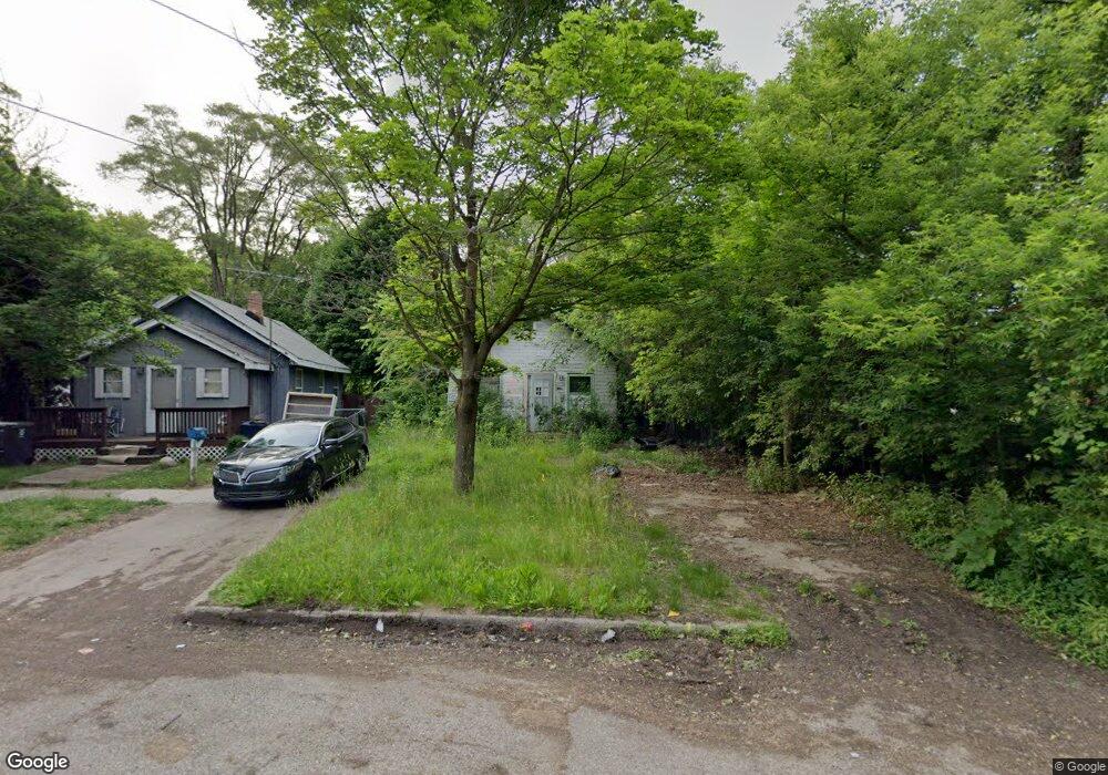
1006 Nelson St Flint, MI 48503
Eastside NeighborhoodEstimated Value: $44,000 - $54,000
2
Beds
1
Bath
520
Sq Ft
$94/Sq Ft
Est. Value
About This Home
This home is located at 1006 Nelson St, Flint, MI 48503 and is currently estimated at $49,000, approximately $94 per square foot. 1006 Nelson St is a home located in Genesee County with nearby schools including Doyle/Ryder School, Flint Cultural Center Academy, and WAY Academy of Flint.
Ownership History
Date
Name
Owned For
Owner Type
Purchase Details
Closed on
Dec 21, 2021
Sold by
Genesee County Treasurer
Bought by
Genesee County Land Bank Authority
Current Estimated Value
Purchase Details
Closed on
Oct 6, 2014
Sold by
Drake Carol Ann
Bought by
Honea Robert
Purchase Details
Closed on
Apr 5, 2005
Sold by
Colmus Michael L
Bought by
Drake Carol Ann
Purchase Details
Closed on
Mar 29, 2004
Sold by
Colmus Alvin F and Colmus Alvin F
Bought by
Colmus Michael L
Create a Home Valuation Report for This Property
The Home Valuation Report is an in-depth analysis detailing your home's value as well as a comparison with similar homes in the area
Home Values in the Area
Average Home Value in this Area
Purchase History
| Date | Buyer | Sale Price | Title Company |
|---|---|---|---|
| Genesee County Land Bank Authority | -- | None Listed On Document | |
| Honea Robert | $8,725 | None Available | |
| Drake Carol Ann | $3,000 | -- | |
| Colmus Michael L | -- | Stewart Title Guaranty Compa |
Source: Public Records
Mortgage History
| Date | Status | Borrower | Loan Amount |
|---|---|---|---|
| Closed | Honea Robert | $0 |
Source: Public Records
Tax History
| Year | Tax Paid | Tax Assessment Tax Assessment Total Assessment is a certain percentage of the fair market value that is determined by local assessors to be the total taxable value of land and additions on the property. | Land | Improvement |
|---|---|---|---|---|
| 2025 | -- | $0 | $0 | $0 |
| 2024 | -- | $0 | $0 | $0 |
| 2023 | -- | $0 | $0 | $0 |
| 2022 | $0 | $0 | $0 | $0 |
| 2021 | $500 | $3,200 | $0 | $0 |
| 2020 | $510 | $3,700 | $0 | $0 |
| 2019 | $1,560 | $5,200 | $0 | $0 |
| 2018 | $516 | $5,400 | $0 | $0 |
| 2017 | $832 | $0 | $0 | $0 |
| 2016 | $504 | $0 | $0 | $0 |
| 2015 | -- | $0 | $0 | $0 |
| 2014 | -- | $0 | $0 | $0 |
| 2012 | -- | $1,600 | $0 | $0 |
Source: Public Records
Map
Nearby Homes
- 1706 Wilberforce Cir
- 1273 Broadway Blvd
- 1710 Wilberforce Cir
- 1379 Washington Ave
- 1540 Illinois Ave
- 1529 Broadway Blvd
- 1214 Root St
- 1609 Ohio Ave
- 1303 Root St
- 1513 Jane Ave
- 429 Page St
- 1216 Minnesota Ave
- 1454 Delaware Ave
- 621 Pierson St
- 1445 Maryland Ave
- 1318 Cronk Ave
- 1016 Garland St
- 710 Pierson St
- 1629 New York Ave
- 915 E Court #206 St Unit 206
- 1010 Nelson St
- 1014 Nelson St
- 1016 Nelson St
- 1026 Nelson St
- 1005 Nelson St
- 1009 Nelson St
- 1013 Nelson St
- 1028 Nelson St
- 1019 Nelson St
- 1025 Nelson St
- 1010 E Boulevard Dr
- 1014 E Boulevard Dr
- 1029 Nelson St
- 1038 Nelson St
- 1033 Nelson St
- 1037 Nelson St
- 1045 Nelson St
- 1102 Nelson St
- 1106 Nelson St
- 1101 Nelson St
Your Personal Tour Guide
Ask me questions while you tour the home.